|
|
|
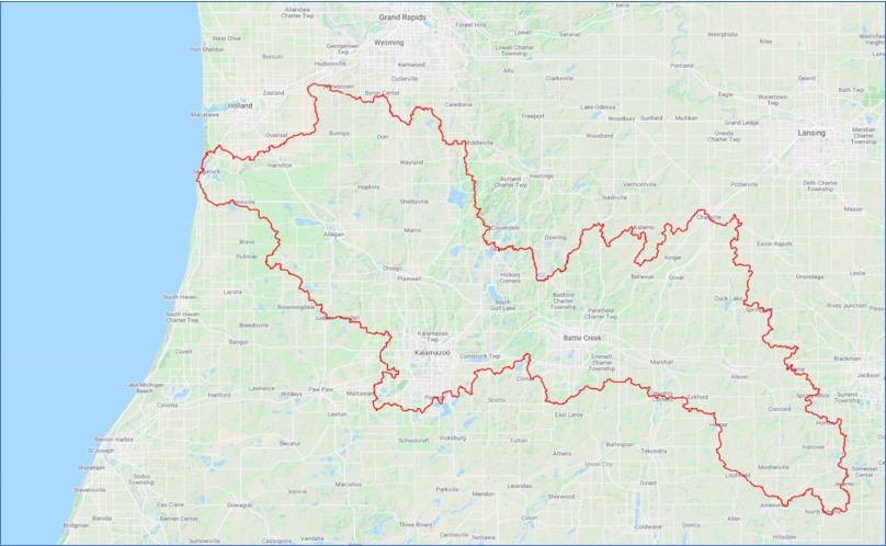
Modeling Groundwater Flow in the Kalamazoo Watershed
The Kalamazoo River watershed is known for its richness in biodiversity, ecosystem services and recreational opportunities, as it consists of many lakes, headwater streams, wetlands, and flood plains which benefit from substantial groundwater contributions.
However, there is growing pressure from development, urbanization, and agricultural operations that extract groundwater in the watershed as their water supply. You are to develop a groundwater flow model of the Kalamazoo watershed using MAGNET to characterize the system dynamics (flow patterns and interactions with surface water bodies), evaluate data worth, and identify management implications - taking advantage of pre-processed BIG DATA to represent the spatial hydrogeologic framework network and parameterize groundwater-surface water interactions.
(Data Needs and Big Data- 2)
|
|
|
|
Big Data Controlling Natural, Prevailing Groundwater Patterns
Ongoing advancements in geospatial data collection has drastically increased the amount of hydrologic/environmental data available. Parallel development of Geographic Information Systems (GIS) and web-based data acquisition from big data repositories provides modelers with an unprecedented opportunity to integrate data collected from various sources (e.g., traditional hydrogeological field studies, remote sensing products, etc.) within a common spatial framework. se MAGNET to explore and experiment. For a specific watershed, or site determine what is the most important dataset that controls prevailing patterns of natural groundwater systems.
(Data Needs and Big Data- 2)
|
|
|
|