StormNET Product Features
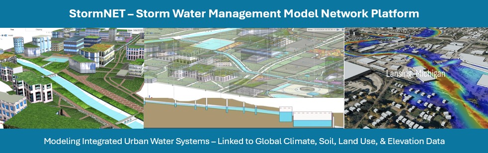
-
Modeling Capabilities
-
Precipitation Modeling
-
| Historical Events |
✔ |
✔ |
| Future Events |
✔ |
✔ |
| Design Storms |
✔ |
✔ |
| Auto-generation of Design Storms - Uniform Events, SCS Type 1,23, and General Time Series |
>1% of total grids |
User selected |
| Snowmelt |
✔ |
✔ |
-
Evaporation Modeling
-
| Evaporation Modeling of Standing / Ponded Water |
✔ |
✔ |
-
Interception Modeling
-
| Interception Modeling Based on Land Cover/Vegetation |
✔ |
✔ |
-
Infiltration Modeling
-
| Horton Methods |
✔ |
✔ |
| Green-Ampt Methods |
✔ |
✔ |
| SCS Curve Number Method |
✔ |
✔ |
-
Runoff Modeling
-
| Ponding Water Balance and Effective Subcatchment Outflow |
✔ |
✔ |
| Max. Number of Vertices in Subcatchments |
3 |
Unlimited |
-
Groundwater Modeling
-
| Groundwater Inflows to Nodes |
-- |
✔ |
-
External Inflows
-
| Sanitary flow, Rainfall-dependent Infiltration |
✔ |
✔ |
-
Stormwater Conduit Modeling
-
| Storm Drainage Modeling Through Conduits |
✔ |
✔ |
| Predefined Regular Cross-sections, Circular, Force Main, Rectangular, etc. |
✔ |
✔ |
| User-defined, Tabular Entries of Cross-section Geometry |
✔ |
✔ |
-
Water Distribution Network Modeling
-
| Network Modeling of Reservoirs, Pressurized Pipes, Regulators and Valves, Pumping Systems, and as Storage Structures |
✔ |
✔ |
-
Sanitary Sewer Network Modeling
-
| Sanitary and Combined Sewer Systems Modeling |
-- |
✔ |
-
Hydraulic Control Structures
-
| Culverts |
✔ |
✔ |
| Weirs/Spillways |
✔ |
✔ |
| Risers |
✔ |
✔ |
| Bridges |
✔ |
✔ |
| Pumps |
✔ |
✔ |
| Orifices/Gates |
✔ |
✔ |
| Spatially Explicit Inlets and Outlets in Ponds |
✔ |
✔ |
-
Storage Units
-
| Surface Water Reservoir |
✔ |
✔ |
| Well Reservoir |
✔ |
✔ |
| Functional/Custom |
✔ |
✔ |
| Pre-defined |
✔ |
✔ |
| Water Tower - Spherical Tank |
✔ |
✔ |
| Water Tower - Cylindrical Tank |
✔ |
✔ |
| Underground Storage Tank |
✔ |
✔ |
| Aboveground Rain Barrel |
✔ |
✔ |
| Underground Detention System - Tanks |
✔ |
✔ |
| Underground Detention System - Pipes |
✔ |
✔ |
| Underground Detention System - Horizontal Vaults |
✔ |
✔ |
| Irregular Storage Unit |
✔ |
✔ |
| Max. Number of Irreg. SU Contours |
3 |
Unlimited |
-
Dynamic Control Rules
-
| Nodebased Condition/Actoin Rules |
✔ |
✔ |
| Link based Condition/Action Rules |
✔ |
✔ |
| Pump based Condition/Action Rules |
✔ |
✔ |
| Control Structure based Condition/Action Rules |
✔ |
✔ |
| Simulation based Condition/Action Rules |
✔ |
✔ |
-
Conveyance System Solvers
-
| Kinematic Wave Approximation |
✔ |
✔ |
| Full Dynamic Wave Routing |
✔ |
✔ |
-
Water Quality Modeling
-
| Dry-weather Polluatant Buildup Over Different Land uses |
✔ |
✔ |
| Reduction in Dry-weather Buildup due to Street Cleaning |
✔ |
✔ |
| Rainfall Desposition |
✔ |
✔ |
| Reduction Due to Wash-off Load due to BMPs |
✔ |
✔ |
| Entry of Sanitary Flows |
✔ |
✔ |
| Routing of Water Quality Consituents Through the Drainage System |
✔ |
✔ |
|
Reduction in Constituent Concentration Through Treatment in Storage Units or by Natural Processes in Pipes and Channels
|
✔ |
✔ |
-
Green Infrastructure Modeling
-
| Bioretention cells |
✔ |
✔ |
| Permeable Pavement |
✔ |
✔ |
| Rain Gardens |
✔ |
✔ |
| Green Roofs |
✔ |
✔ |
| Infiltration Trenches |
✔ |
✔ |
| Rain Barrels & Cisterns |
✔ |
✔ |
| Vegetative swales |
✔ |
✔ |
| Rooftop disconnection |
✔ |
✔ |
-
River System Modeling
-
| River Dynamics Modeling |
✔ |
✔ |
| Kinematic Wave Approximation |
✔ |
✔ |
| Dynamic Wave Equation |
✔ |
✔ |
| Steady Routing |
✔ |
✔ |
| Uniform Channels |
✔ |
✔ |
| Predefined Cross-Sections |
✔ |
✔ |
| Tabular Irregular Cross-sections |
✔ |
✔ |
| DEM-based cross sections with automated sampling & automated interpolation of cross section, automated discretization of irregular rivers |
✔ |
✔ |
| Max. Number of Points on Transect |
5 |
Unlimited |
-
Simulation Settings
-
| Total Number of Model Objects |
5 |
-- |
| Number of Time Steps |
25 |
-- |
-
Server File Management
-
| Same Model file to Local Computer |
✔ |
✔ |
| Saved models on server |
1 (last model) |
100 |
| Max. Number of Uploaded files |
5 |
-- |
| Max. User Folder Size Limit - |
100 MB |
-- |
-
Visualization Capabilities
-
Mapping of Spatial Data
-
| Mapping of DEM, Soil, Land Cover, and Derived Soil and Land Cover properties |
✔ |
✔ |
| Map Data Display NX*NY |
100 |
Unlimited |
-
Map-based Visualization of Model Outputs
-
| Map based Model Visualization Inputs and Outputs, Links, and Nodes, Different Time-steps, etc. |
✔ |
✔ |
| Flood Inundation Mapping |
-- |
✔ |
-
Water Balance Visualization
-
| System based Water Balance |
✔ |
✔ |
| LID based Water Balance |
✔ |
✔ |
| Conveyance System based Water Balance |
✔ |
✔ |
| Subcatchment based Water Balance |
✔ |
✔ |
-
Time-Series Visualization
-
| Node based Time-series Charts - Head, Total Inflow, Depth, etc. |
✔ |
✔ |
| Link based Time-series Charts - Flow rate, velocity, etc. |
✔ |
✔ |
-
Vertical Profile Visualization
-
| Static Profile Visualization (Design Mode) |
✔ |
✔ |
| Dynamic Profile Visualization (Time-dependent Water Dynamics included) |
✔ |
✔ |
| Number of objects along profile |
5 |
Unlimited |
| Flow Cross-section Visualization |
✔ |
✔ |
| Number of Cross-sections |
5 |
Unlimited |
-
Immersive 3D CAD Visualization
-
| Pre-Simulation 3D CAD Digital Twin based on model Inputs (no Water Dynamics) |
-- |
✔ |
| Post-Simulation 3D CAD Digital Tiwn Based on Model Inputs (with Water Dynamics) |
-- |
✔ |
| Max. Number of Time Steps |
-- |
Unlimited |
| Subcatchment Textures - Buildings, Roads, Grassfields, etc. |
✔ |
✔ |
-
Data Capabilities
-
Background Maps
-
| OpenStreetMap Roadmap, Terrain, and Satellite Imagery, ArcGIS World Topographic Map |
✔ |
✔ |
| Image Overlay Tool |
✔ |
✔ |
-
Model Georeferencing
-
| Model Objects linked to Real-world Geographic Coordinates |
✔ |
✔ |
-
Mapping Data Extraction
-
| Extraction of DEM, Land use, Soil, and Derived Properties for Mapping |
✔ |
✔ |
-
Direct Model-Data Linkages
-
| Auto-calculation of Link Lengths Based on Map Dimensions |
✔ |
✔ |
| Auto-calculation of Subcatchment Area Based on Map Dimensions |
✔ |
✔ |
| Auto-generation of Node Elevations from Digital Elevation Model |
✔ |
✔ |
| Extraction of DEM along River Transects (River Systems Modeling) |
✔ |
✔ |
| Auto-generation of Infiltration Parameters from Soil and Land Use/Cover Data |
✔ |
✔ |
| Recipitation Data Extraction |
✔ |
✔ |
| Temperature Data Exraction |
✔ |
✔ |
| Wind Speed Data Extraction |
✔ |
✔ |
-
Reporting Capabilities
-
Model Objects (Model Setup)
-
| Summary Statistics Table(Number of Links; Number of Junctions; Numbers of Subcatchments, Infiltration Method, …) |
✔ |
✔ |
| Detailed Statistics Table (Full Details on Model Objects, Time Series,..) |
✔ |
✔ |
-
Simulation Status
-
| Summary Status Report - Complete Printout of Model Setup, Analysis Options, Simulation Settings, Flow and Water Quality Results, etc. |
✔ |
✔ |
| CAD 3D Generation Log |
✔ |
✔ |
-
Result Summaries
-
| Result Summary by Objects (one or more Model Outputs for Single Model Object) |
✔ |
✔ |
| Result Summary by Parameter (same Model Output across Mulitple Objects) |
✔ |
✔ |
| Result Summary by Categories (all Results for all Objects of the same type) |
✔ |
✔ |
-
AI Capabilities (free)
-
AI Powered Analytics, Insights, Reporting and Publication (coming soon)
-
| AI-generated Reports and Presentation Model Summaries, Detailed Descriptionns, Captioned figures |
✔ |
✔ |
| Automated Model Parameter Table Generation |
-- |
✔ |
| Instantly Publish models, reports, and/or data, etc to Global Model Network (see below) |
-- |
✔ |
-
AI Powered Water Sustainability Learning Center (coming soon)
-
| Stormwater Science AI-Assistant (AI Chat) Trained to Engineering and Scientific Theory, Case Studies, Open-source Textbooks, etc. |
-- |
✔ |
| Case Study Gallery Real-world Implementations & Applications of StormNET |
✔ |
✔ |
| Stormnet Modeling Problems and Exercises |
✔ |
✔ |
| StormNET Capstone Projects |
✔ |
✔ |
-
AI Powered Water Sustainability Observatory Network (Coming soon)
-
| Map Interface of Published Cyber-enabled Observatories (CEOs) - StormNET Models, Input/Output Data, Reports, Graphics, Videos, Discussion, etc. |
✔ |
✔ |
| AI-powered Search / Query/ Filter Tools - Find models, Data, Reports, People, … |
✔ |
✔ |
| View CEO Details - Access Reports, Model Descriptions, Parameter Tables, Graphics, Videos |
✔ |
✔ |
| Load Published Models Directly into StormNET |
✔ |
✔ |
-
AI Powered Platform Support
-
| M4W Software and Modeling AI-Assistant (AI Chat) |
✔ |
✔ |
| Realtime, Situational Help Pages |
✔ |
✔ |
| Quick Tutorials |
✔ |
✔ |
| Quick 'How to' Notes |
✔ |
✔ |
| Technical Reference Docs |
✔ |
✔ |