|
|
|
Data-enabled Modeling Platform
|
|
|

|
|
MAGNET OVERVIEW slides
Overview slides of MAGNET - a data-enabled modeling system built on pre-processed, fully-assembled framework data, i.e., data needed to conceptualize and characterize the system in a ready-to-use form at the global scale. The system allows users not only to access and utilize pre-processed big datasets, but also to do so in real-time and interactively.
(Data-enabled Modeling Platform- 17)
|
|

|
|
IGW-NET TUTORIAL - Integrated Site Problem Solving
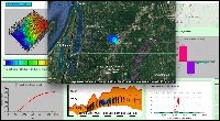
This tutorial provides step-by-step instructions for simulating one of the largest groundwater contamination plumes in the United States – and the largest TCE (trichloroethlylene) plume in Michigan. The source of the contamination is degreasing solvents used at the Wickes Manufacturing plant in the small town of Mancelona during the 1940s and ‘50s. Originally disposed into shallow pits on site, the TCE plume has migrated northwest in the surficial glacial aquifer, toward a well field providing drinking water to private properties and municipalities. TCE is a known carcinogen.
(Data-enabled Modeling Platform- 17)
|
|
|
|
Integrated, Dynamic 3D Visualization
IGW-NET allows a user to graphically present any combination of model inputs and/outputs for graphic display; to compute and graphically display solute mass, water fluxes and/or water budgets over any specified zones or along any specified "compliance surfaces"; and to compute and graphically display heads and contaminant concentrations as a function of time at a monitoring well.
A - Study the Detailed Tutorial on realtime modeling and visualization under MANUALs on the MAGNET4WATER website.
B - Develop a IGW-NET model that reproduces the simulation as depicted in the tutorial
C - Perform sensitivity analysis of your model with respect to different display settings.
(Data-enabled Modeling Platform- 17)
|
|
|
|
Realtime Hierarchical Modeling
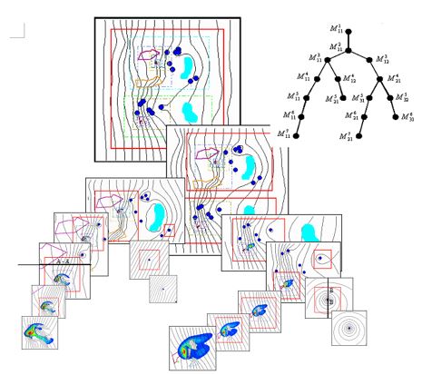
Utilizing its real-time hierarchical modeling capability, IGW-NET allows investigating a complex groundwater system across multiple spatial scales. User can obtain high resolution dynamics in areas of critical interest (e.g., around wells, contamination hotspots) by developing a hierarchy of groundwater models of increasingly higher resolution and smaller domain. Use IGW-NET to reproduce a multi-scale model as demonstrated in the IGW-NET Quick Tutorial.
(Data-enabled Modeling Platform- 17)
|
|
|
|
Integrated Visual Simulation and Analysis
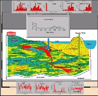
IGW-NET functions as a “digital groundwater laboratory” in which a user can freely and naturally explore and experiment in real-time: creating visually an aquifer of desired configurations and characteristics, interactively applying desired stresses, and then quickly investigating and visualizing on the fly the geology and the dynamic processes of flow and contaminant transport and transformation. Use IGW-NET to reproduce and visualize models as demonstrated in the IGW-NET Quick Tutorials.
(Data-enabled Modeling Platform- 17)
|
|
|
|
Realtime Transport Modeling
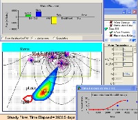
IGW-NET allows a user to initiate particle tracking and/or reactive contaminant transport modeling anytime during the integrated simulation process. Use IGW-NET to reproduce and visualize models as demonstrated in the IGW-NET Quick Tutorials.
(Data-enabled Modeling Platform- 17)
|
|
|
|
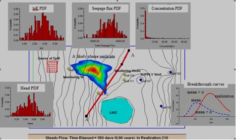
Realtime Stochastic Modeling
IGW-NET allows a user to examine the impact of unmodeled small-scale heterogeneity through stochastic Monte Carlo simulations as well as first-order perturbation techniques. IGW-NET permits many spatial parameters to be modeled as a random field, and any temporal stress to be modeled as a 1-D stochastic process. Use IGW-NET to reproduce and visualize models as demonstrated in the IGW-NET Quick Tutorials.
(Data-enabled Modeling Platform- 17)
(Requires Premium Account)
|
|
|
|
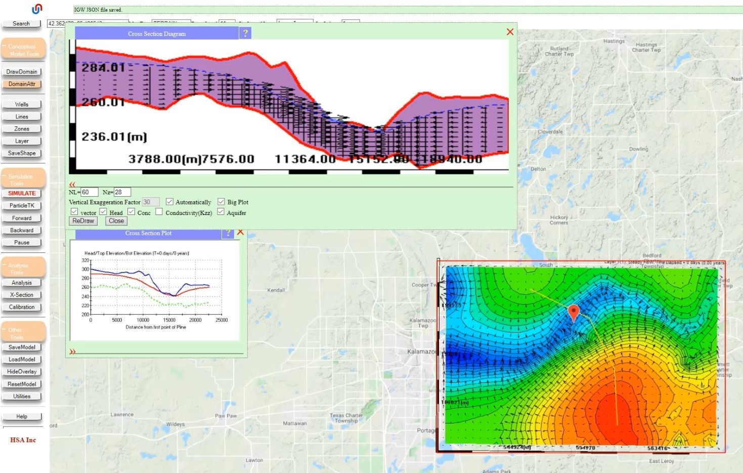
'Quick and Dirty' Data-Enabled Model
IGW-NET allows users to almost instantly create a data-enabled simulation of natural groundwater conditions in the near-surface aquifer (i.e., the unconfined, water table aquifer) critical for water resource development and sustaining of groundwater-dependent ecosystems. This "Quick and Dirty" model is not meant to be complete, but rather serve as a framework for customization – it is a preliminary, default model that can be modified, extended, and further customized based on study objectives and other available (local) data, as well as user experience and expertise. Use IGW-NET to reproduce a Quick and Dirty data-enabled model as demonstrated in a IGW-NET Quick Tutorial.
(Data-enabled Modeling Platform- 17)
|
|
|
|
Realtime Unsteady Flow Modeling
IGW-NET enables the modeler to produce sophisticated 2D and 3D graphical displays of spatial, time-varying information at any point during the modeling process. Being able to visualize the model system's behavior at every time step and evaluate its adequacy is a powerful tool, so that you can interrupt the computations, alter the model in significant ways, and restart computations as you deem necessary. Use IGW-NET to reproduce a realtime unsteady flow simulation as demonstrated in the IGW-NET Quick Tutorial.
(Data-enabled Modeling Platform- 17)
|
|
|
|
IGW-NET Synthetic Models
Sometimes it is necessary to create a model that is not tied to any particular real-world location. Instead, we may need to create a model that represents an idealized or purely hypothetical situation. These "synthetic" models are very useful for understanding groundwater processes and testing proposed methods in groundwater modeling, because all aspects of model construction and parameterization are known (which is never the case when modeling real-world sites.). Learn how to build synthetic models in IGW-NET by reproducing the model presented in a IGW-NET Quick Tutorial.
(Data-enabled Modeling Platform- 17)
|
|
|
|
Vertical Profile Models
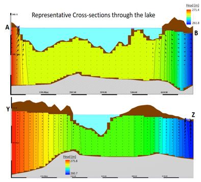
It is sometimes necessary or insightful to develop two-dimensional flow models in the vertical plane. These types of models are called often called vertical cross-section or vertical profile models. IGW-NET offers two quick and easy ways to build a vertical profile model: 1) When the water table is known or prescribed, the y-coordinate can be treated as the vertical dimension; and 2) when the water table is not known ahead of time, a "slice" or cross-section of a 3D model can be analyzed and visualized. Create a synthetic example using both approaches, and discuss the relative advantages and disadvantages of the two different approaches.
(Data-enabled Modeling Platform- 17)
|
|
|
|
Realtime Model Evaluation & Calibration
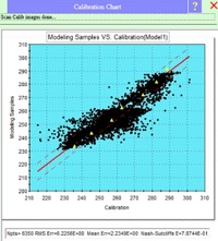
For many real-world modeling applications, it is necessary to evaluate the model performance by comparing simulated outputs (e.g., heads) to measured field parameters (e.g., water levels in monitoring wells). IGW-NET allows almost instant comparison of simulated heads with observed groundwater levels available across the model domain (steady-state, single time-step, or temporally-aggregated) or at discrete locations for all time-steps (time-series comparisons). Use IGW-NET to reproduce the calibration exercises as demonstrated in the IGW-NET Quick Tutorial.
(Data-enabled Modeling Platform- 17)
|
|
|
|
3D Groundwater Models
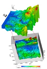
There are instances when we are interested in groundwater conditions in different geological layers (sometimes called hydrostratigraphic units, aquifer layers, or conceptual layers) - or how a leaky confining layer impacts groundwater conditions in an adjacent aquifer layer. Such cases requires a 3D model with two or more aquifer layers. Other times, we may need to resolve vertical processes within one or more aquifer layers. Use IGW-NET to reproduce 3D models of both types as demonstrated in the IGW-NET Quick Tutorial and the Woburn Superfund Site problem.
(Data-enabled Modeling Platform- 17)
(Requires Premium Account)
|
|
|
|

