Now that we have specified the boundaries of our model (but not our boundary conditions) we can define the geometry and the hydraulic properties of the aquifer. This is done by accessing the DomainAttr menu by clicking the Conceptual Model Tools button and then clicking DomainAttr (see Figure 12). When you click this button it changes color and the Domain Attributes menu opens (see Figure 13). Note that there is no heading that specifically identifies the menu as Domain Attributes.
Here you see tabulated the various properties of the groundwater system that you can define. Default values are provided. These can be changed to meet the needs of your particular aquifer system. Some are familiar, such as hydraulic conductivity and storage coefficients that pertain to the groundwater flow calculation, and others are needed for the mass transport simulation capability such as dispersivity, diffusion coefficient, and biochemical information. Also included is information on flow into the system defined by the rectangle provided in the previous DrawDomain step. This would include for example recharge from rainfall.
Notice that at the top of this window there is a layer designation. It states that this information is pertinent to layer 1 which is a Geolayer, or layer that is defined to accommodate geological properties (MAGNET can accommodate multiple vertical layers – see section 7). It is easiest to think of the geolayers as layers of a layer cake with each layer of the cake able to take on different flavors and different thickness. It is also possible to define layers within a geolayer that are used to increase the simulation accuracy in the vertical direction (again, see section 7). You might think of these sub-layers as the incremental layers of cake batter, say one quarter cup, added one increment at a time to build up one cake layer
Notice that there are question marks at the end of each data entry definition, for example next to the Top Elevation heading. If you click one of these question marks you will open a new window that gives an explanation of the meaning of the designated term, in this case Top Elevation.
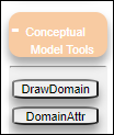
Figure 12: Accessing the Domain Attributes window through the DomainAttr button.
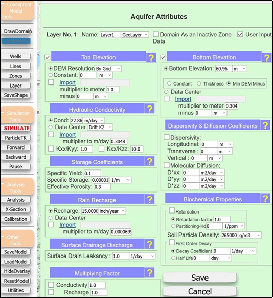
Figure 13: Aquifer attributes selection window.