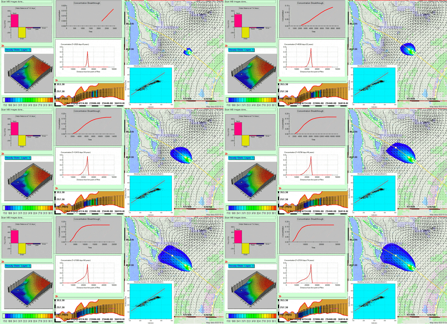
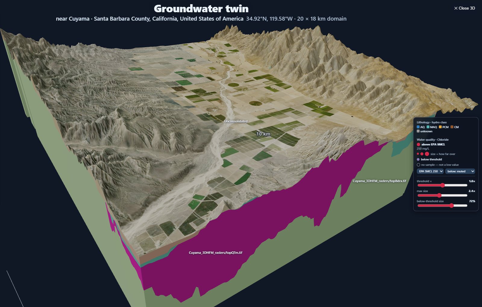
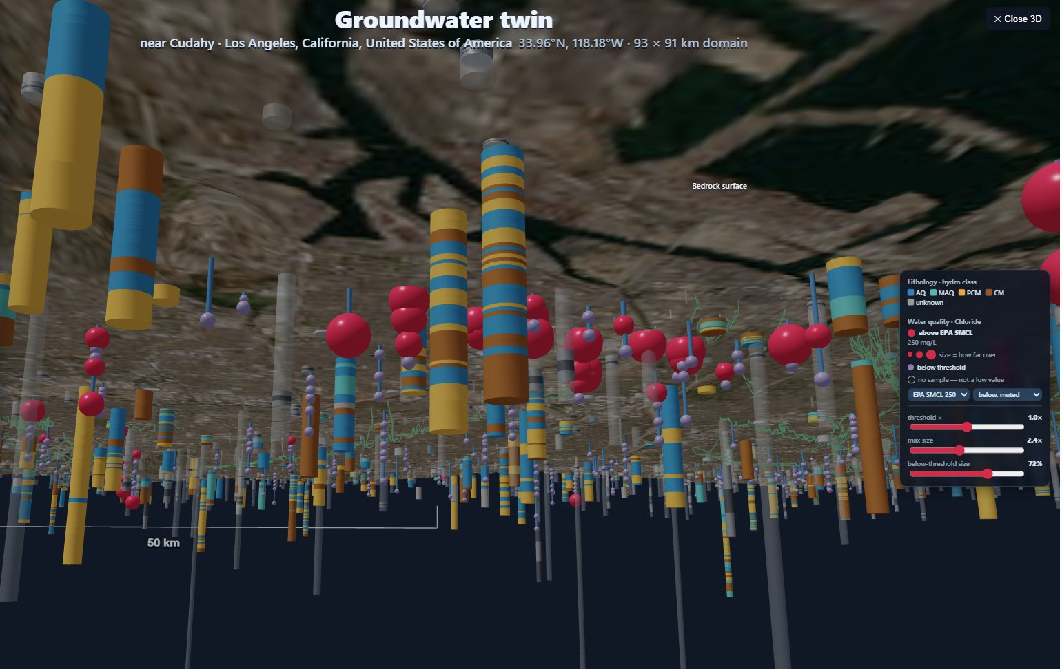
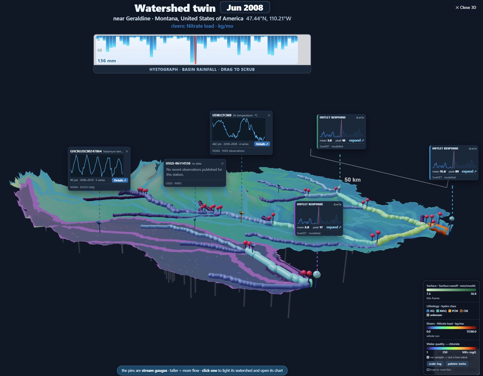
One gesture, five domains — each tile opens a working model, yours to steer and refine.
🎬Loading demo...
💧IGW-NET — Groundwater Intelligence
Draw a box. IGW-NET drapes bedrock, models the aquifer above it, pulls K and recharge from the global base, snaps streams and lakes into place. At LiDAR resolution, seeps and wetlands emerge from the model itself — no hand-mapping. An initial 2D model is live in under a minute. Then you steer: subdivide layers and watch heads, gradients, and plumes resolve in 3D as it solves. Add a confining unit, drop in a sub-model, introduce heterogeneity. Every move shows you the consequence immediately. You arrive at insight, not at setup.
The conventional workflow asks each user to rebuild the same foundation: download terrain, format soils, project climate, hunt for monitoring data, wire it all together. The fifth time around, the wiring is still the work.
MAGNET4WATER inverts that. The planetary spatial fabric is preprocessed once — terrain, soils, climate, hydrography, monitoring networks — federated, multi-resolution, alive. The model travels to the data. The user inherits the foundation from minute one.
This is not a faster way to do the old workflow. It is a different workflow.
Built on shoulders. Built to compound.
We didn't build the foundation. We built the integration.
The data exists. MODFLOW, SWAT, SWMM and EPANET; the observation networks of USGS, NOAA and their counterparts worldwide; the earth observation programs of NASA and ESA Copernicus; global hydrography from HydroSHEDS; soils from USDA and FAO; and the geological and hydrological surveys of dozens of countries — together with agencies in a growing number of states and provinces, and in some cases county and municipal records, which sit closest to the ground. Built by agencies at many levels of government, research institutions and the broader scientific community around the world over decades, often at extraordinary quality, and each source retaining its own terms of use. What was not yet established was the architectural integration.
Little of it arrives ready to work together. Every source is published for its own purpose, in its own format, projection, vocabulary, resolution and release cycle. Harvesting them, reconciling them, resampling each to the scale a model actually needs, and holding all of it current as the sources themselves change — that is the work of years, and it runs continuously rather than finishing. Behind it sits the processing and serving infrastructure to deliver it at model scale, the moment someone draws a box. Done once here, so that it is not done again in every project.
A solo project on day one is already standing on decades of agency work. A solo project on day one thousand is also standing on a thousand days of network refinement.
Not a replacement for the community's work. The layer that lets it compose — and compounds with every model published to the network.
A different operating model
You don't build the model. You steer it.
A working model is there when you arrive. From minute one, you are thinking about the system — not about file formats, projections, units, or whether the boundary conditions are wired correctly. The shift is not faster modeling. It is a different relationship between the user and the system.
🌍The data foundation is already in place.
Preprocessed once, federated, alive. The first object you place becomes a live simulation, not a configuration task. Smart defaults from planetary data; every choice editable — in the platform, with your data, or augmented from DataNET's federated services.
🧭Engines compute together.
Physics, visualization, and the numbers respond to every change in parallel — no export step between them. Pre-, intermediate-, and post-processing all happen in-situ. The machine handles every connection; you handle every decision.
⚖️The loop closes inside one session.
Place, simulate, visualize, refine. The bottleneck moves from setup to decision. Conventional workflows close their loops between project phases; MAGNET4WATER closes them inside a working session.
📡You're inside the loop, not orchestrating around it.
The user steers the system as it evolves — rather than driving a tool that runs in batches. Save, version, and publish from inside any platform; selectively, at the scope you choose. Your team's published work becomes the foundation for their next model.
One global data foundation — continually expanded by HydroSimulatics across the DataNET hub, refined by every model published to the Global Model Network.
Five platforms — each using the foundation the way its physics demands.
This is not better software. This is the infrastructure water work is moving onto.
Production systems across scales of governance — from federal projects to enterprise portfolios to single-site investigations. These projects don't just use MAGNET4WATER. Their published models and data live in the network.
From a school class visiting a local stream on screen with their teacher, to a federal agency mapping a thousand-site portfolio — the work runs on one continuous infrastructure. Same platform. Same data. Same network.
Water work is moving onto digital infrastructure. MAGNET is that infrastructure. Twenty years of research and continuing scientific work, deployed in real programs at real scale, available today.
MAGNET is built on a Global Base Model — terrain, climate, soils, land cover, rivers and lakes, water wells, geology and aquifer properties — assembled once for everyone and kept current as the sources change. Draw a box anywhere on earth and the foundation is already there, matched to the scale of the question you are asking. You don't download big data to your silo. You zoom in, and a working model is ready.
The conventional workflow
Datasets gathered from many sources, downloaded to local machines.
Data cleaned, transformed, and assembled into each project's foundation.
Models built layer by layer, project by project.
Different tools serve design, simulation, analysis, reporting.
Foundation work is necessarily the largest investment in every new project.
MAGNET workflow
For natural systems (groundwater, watersheds): Zoom in — DEM, geology, climate, streams are already there. Refine parameters in the platform, calibrate against local data, publish your work selectively.
For engineered systems (stormwater, distribution): LEGO-style drag-and-connect design on a georeferenced map. Every component physics-coupled. Hydraulics, water quality, and cost respond together as you design.
End-to-end on one steering surface — data, model, analysis, save, publish. No manual handoffs between processing steps.
<10 min
from zoom-in to a working watershed or groundwater model.
A Living System for Global Water Intelligence
At its core is the Global Base Model — a pre-assembled, multi-resolution data foundation covering locations worldwide. Geology, terrain, hydrology, climate, land use, soils — already there, at the resolution your question demands. Continuously enriched by live telemetry networks that monitor the pulse and health of water systems across regions.
The base evolves both ways: top-down through expanding global data services HydroSimulatics harvests and publishes through the DataNET hub, bottom-up through every model published to the Global Model Network. As the harvest deepens and the Network thickens, the foundation gets richer for everyone — and yet every user starts where the value is, refining only what their question requires.
Documentation
Each platform has inline contextual help — hover any element in the interface to see what it does. The website mirrors the same help content for searching and sharing, plus tutorials, concepts, and case studies that go further.
488 recorded simulations · 7 showcases · 5 platforms
See it in action.
Real platforms running on real basins — recorded, captioned, and organized so you can find any capability in seconds. Each showcase auto-flips through every dimension; pause anytime to look closer. This is also what a published model looks like once it is live — what your own work becomes when you choose to share it.
488
Simulations
7
Showcases
30+
Categories
5
Platforms
Two ways to see the platform work — and most modelers use both.
Synthetic mode is the modeler's notepad. An idealized domain where you change one parameter at a time and watch the mechanism unfold without the noise. It's how you crystallize a phenomenon that's too tangled to see clearly on a real site — which is why experts reach for it as often as students, not less.
Georeferenced mode does the opposite. It pulls a real place from the global base model in minutes, then runs the same engine on its actual messiness. Same physics. Same solver. Different starting points.
Synthetic Mode
See the physics
An idealized aquifer. A controlled change. Watch the mechanism unfold without the noise. Tóth flow, plume migration through heterogeneity, capture zones, dam seepage — the kind of clarity real sites rarely offer.
A real watershed. A real aquifer. A real city. Pull the geometry from the global base model in minutes, then run the same engine you saw in synthetic mode — this time on a specific place.
Desktop recommended for the demo. Free tier available.
What you'll see — platform by platform
💧
Groundwater — IGW-NET
Watch a 3D aquifer materialize as you zoom into locations worldwide. See geology layers, recharge zones, and drainage networks assemble automatically from national databases. Then watch MODFLOW solve equations as a streaming 3D movie — water tables rising, contaminant plumes migrating, particles tracing flow paths — all in real time. Toggle between conceptual cross-sections and full volumetric rendering.
3D streaming · Real-time solve · Contaminant transport
Draw a box on the global map. Select an outflow point. Watch the platform delineate the watershed, carve subwatersheds, identify the stream network, assemble decades of climate data, and run a complete SWAT simulation — all in under 10 minutes. The Sankey water balance diagram reveals the complete hydrology: every process, every compartment, every connection. Then calibrate against USGS gauges with genetic algorithms.
Drag sewers, pipes, ponds, and green infrastructure onto a georeferenced map. Every component calculates live hydraulics the instant you place it. Watch flood inundation spread across a 3D urban digital twin. See cost estimates update in real time — CAPEX, OPEX, life-cycle — across 258 world regions. Toggle rain events and watch the network respond. Design like LEGO, simulate like a digital twin.
Design pressurized water supply networks with live hydraulic grade line visualization. Place pipes, pumps, tanks, and valves — EPANET solves continuously as you build. Watch pressure surfaces respond to demand changes. See cost breakdowns update at four hierarchical levels across 258 world regions. Full 3D digital twin with real-time rendering.
Navigate a hierarchical Data Tree connecting NASA, USGS, NOAA, and ESA services. Watch data layers fuse into a living 3D site model: elevation, geology, land use, hydrology, soil, climate, all rendered in CesiumJS and VTK. Query the national sensor network for instant time-series analytics. The data mind that feeds every other platform.
Every model strengthens the Observatory. Every insight moves the needle. MAGNET4WATER is a global water intelligence ecosystem — where data comes alive, models come alive, and mathematics come alive.
The water crisis is a multi-generational problem. It will be solved — or not — by people entering the workforce over the next twenty years. MAGNET is where they learn to solve it, using the same tools, the same data, and the same network as the professionals they'll soon become.
Every other professional platform has a gap. Students learn on a simplified "educational" version — then graduate to a jarring transition where the real tools look different, the real data lives elsewhere, and the real workflow takes years to internalize. The community's strongest professional tools — and the strongest educational tools — typically live in separate environments. MAGNET is one continuous environment from first investigation to professional production. The tool a teacher uses to show a class their neighborhood stream is the same tool a consultant uses to design a stormwater system. Not dumbed down. Not a "student edition." Just with guidance scaffolding appropriate to where each learner is.
Three audiences. One continuous network.
Framed by what they do on MAGNET, not by where they sit in an institutional hierarchy.
🔬
Learners
Undergraduate, graduate, continuing education — and school classrooms through their teacher
Investigate real sites. Build real models. Interpret real data. Publish real Observatory nodes. A senior thesis can extend a published professional model. In school classrooms the teacher drives, taking a class to a real aquifer or watershed the way they would take them to a river — a virtual visit, with the account and the data staying with the instructor. A PhD dissertation can contribute a refinement that others adopt. The work isn't a simulation of the profession — it is the profession, at the learner's current skill level.
Real sites, real dataPublishable portfoliosPeer visibilityCareer continuity
👩🏫
Teachers & Faculty
Assign contemporary problems. Watch work unfold live.
Stop teaching from textbooks frozen years ago. Assign problems on currently active sites — PFAS plumes, aquifer depletion, stormwater retrofits, watershed restoration. Watch students work in real time through collaborative modeling. Connect classroom assignments to the live Observatory so students see their work alongside published professional models. Bridge directly to the practitioners your students will soon become.
Curriculum NetworkLive collaborative sessionsReal sites as assignmentsClassroom-to-profession bridge
🤝
Researchers & Practitioners
The community that welcomes the next generation.
Your published Observatory work becomes teaching material. A model a student forks and refines might surface a question you hadn't considered. A graduate student's novel approach might enter your next project. Recruiting becomes transparent — employers evaluate actual student work in the Observatory, not just resumes. The workforce pipeline becomes continuous rather than transactional.
Teaching-research bridgeMentorship through the networkTransparent recruitingFresh perspectives
Why this is strategic.
Cohort Replacement
Modeling culture doesn't change through persuasion — it changes when new cohorts enter with different expectations. Train the next generation in a network-native environment and they'll bring those expectations into every organization they join.
Workforce Continuity
Enterprises and agencies depend on a steady talent pipeline. Graduates who arrive already fluent in professional tools and data systems reduce onboarding friction. Employers gain project-ready hires instead of months of ramp-up.
Network Effects
Students are already network-native. Their social, academic, and personal lives run on shared tools. Asking them to adopt a collaborative modeling platform isn't a new habit — it's the habit they already have, applied to water. The network grows because the next generation expects it to.
Global Reach
Water crises hit hardest in places with the least modeling capacity. Cloud-based, browser-only, no-installation access means a student in Lagos or Lahore works on the same platform as one in Lansing or London. The talent pipeline widens globally — which is where the problems also live.
MAGNET isn't teaching students to become water professionals someday. It's letting them be water professionals now — at the level they're ready for — and keep growing without transition cost.
Whether you're a consultant accelerating project timelines, a researcher exploring groundwater dynamics, an educator transforming how students learn, or an agency managing hundreds of sites — MAGNET adapts to your work.
Click a card to explore the platform branch · Click Launch to go straight to the live platform
Five platforms. One water intelligence system.
MAGNET combines two complementary layers: a preprocessed global base database that gives each platform an instant starting point, and DataNET, a federated network-of-networks where users assess, fuse, and transfer additional data when the base needs refinement. DataNET provides data-driven modeling and understanding; IGW-NET, SwaNET, StormNET, and ConduitNET provide process-based simulation and design. Together they connect data to insight to simulation to decision.
💧
Flagship Platform
IGW-NET — Groundwater
Remove the data bottleneck. Turn groundwater modeling into a real-time decision system.
IGW-NET starts from a global base model and brings computation to the data. Rivers, lakes, DEM/LiDAR, recharge, wells, hydraulic properties, and monitoring networks become a connected groundwater system. At LiDAR resolution, seeps and wetlands emerge from the model itself — no hand-mapping required. Flow, particles, transport, uncertainty, visualization, and analysis run in one continuous loop — no disconnected data prep, post-processing, or model rebuilding. The machine computes; humans interpret, refine, and decide.
Model-to-data computingGlobal base modelLiDAR / river controlLive calibrationPFAS risk prioritizationHierarchical nestingContaminant transportStochastic Monte Carlo
Signature visual: In-situ streaming — the aquifer solving in real time, rendered at every time step, discarded from memory.
Zoom-in branch: IGW-NET is the groundwater realization of the MAGNET paradigm: model-to-data, global base model, realtime 3D simulation, live observation linkage, scalable uncertainty, and risk-based portfolio management.
Turn global spatial data into watershed system understanding.
SwaNET does the heavy lifting of watershed modeling: DEM, land use, soils, climate, stream networks, HRUs, simulation, visualization, and monitoring data are assembled so users can focus on insight. The Sankey view reveals process connectivity, relative importance, and how the system changes under BMPs, land use, assumptions, and future climate scenarios. You do not refine everything — you refine what matters.
One-click watershed modelFocus on what mattersSankey process connectivityScenario responseGenetic calibrationModel vs USGS comparisonBMPs + land useFuture climate
Engine: USDA SWAT
Signature visual: Sankey Chart — the entire hydrology in one diagram. Every process, every flux, every connection.
Design, simulate, visualize, cost, and iterate urban water systems in real time.
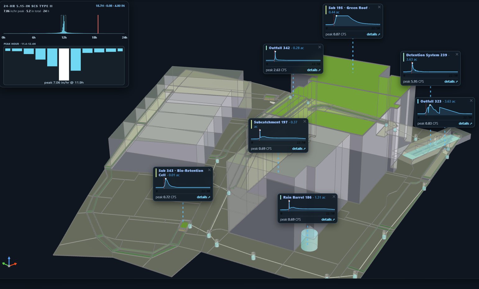
StormNET moves modeling into the urban infrastructure design loop. Place pipes, channels, storage, LIDs, detention, pumps, and controls on a data-enabled landscape; see hydrology and hydraulics respond; view the system as an immersive 3D digital twin; and evaluate CAPEX, OPEX, lifecycle cost, LID performance, circular water, and water–energy implications while the design is still changing.
Real-time design. Live hydraulics. Instant cost feedback.
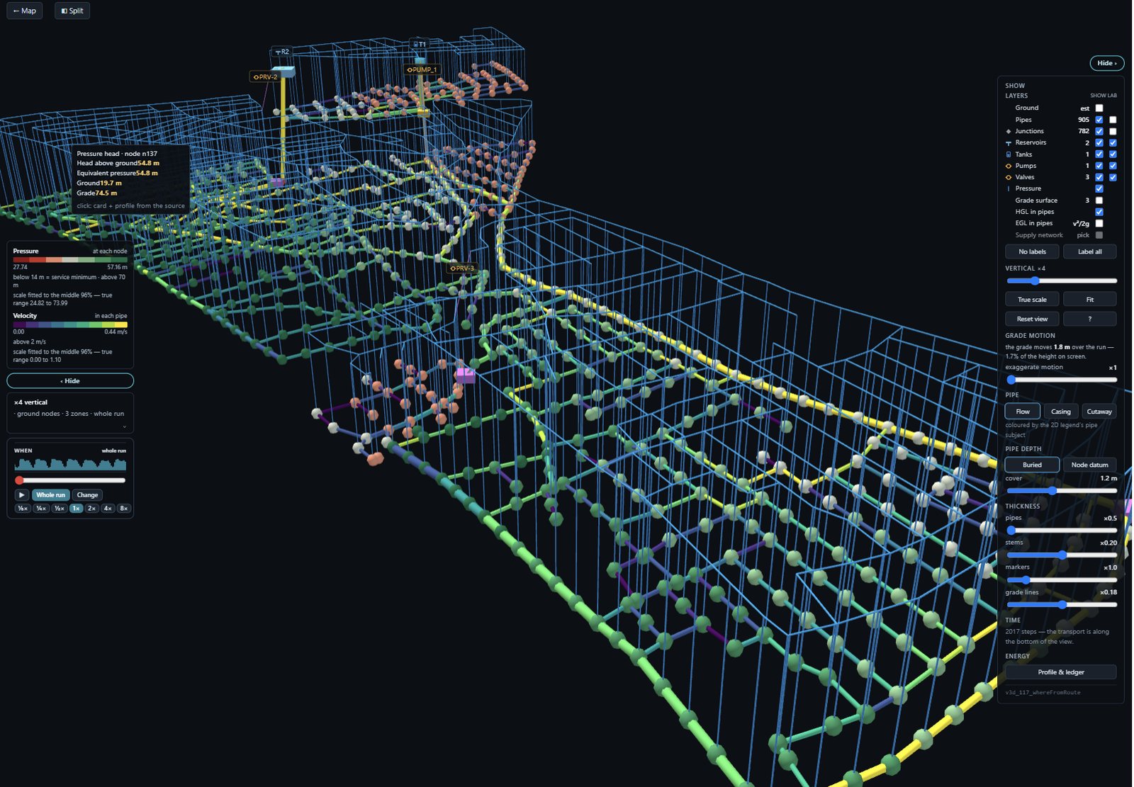
Model pressurized pipe networks across different scales — from a campus loop to a metropolitan supply network. Design pipes, pumps, water towers, storage tanks, valves — simulate pressure, velocity, flow, and water quality across the network. Built on the EPA EPANET engine — the regulator-accepted standard for pressurized distribution, solved efficiently enough to stay responsive from a campus loop to a metropolitan network. The 3D Hydraulic Grade Line visualization shows pressure as a physical surface over the entire network — instantly spot negative pressures, see where booster pumps lift the HGL, watch hydraulics respond to design changes. Hover on any pipe or node for instant tooltips. Built-in cost analysis: CAPEX, OPEX, and life cycle cost calculated as soon as simulation finishes.
3D HGL visualizationCampus to metropolitanCost analysis (CAPEX/OPEX/LCC)Water securityWater quality trackingInteractive tooltipsPattern-based scenariosLeak detection
Engine: EPA EPANET
Signature visual: 3D HGL surface — see pressure across the entire network as a physical landscape. Problems become visible instantly.
Decision Support System — data services, visualization, analytics, and transfer to/from models.
DataNET is the bridge between the standardized global base model and the full messy reality of worldwide data. It federates hundreds of agency data services spanning tens of thousands of layers — WMS/WFS/WCS services, telemetry, model-published layers, local records, county, state and national datasets, indirect evidence, HydroSimulatics-published services, and enterprise workspaces — from national agencies on every continent. Users assess data first, decide what is useful, then map any data to any model field — improving process-based models without forcing everything into one database.
Data service hub (WMS/WFS/WCS)USGS national network live-linkedInstant analytics & time series3D fused site modelsCesium globe + VTK subsurfaceFusion beyond physicsBridge to process-based modelsModel outputs publish back
Built on: OpenLayers · Cesium · GeoServer · VTK
Signature capability: Statistical fusion of soft + hard, quantitative + qualitative, natural + human data — constraints that physics-based models can't hold together.
MAGNET4WATER is five platforms — each delivering a different aspect of water understanding, all connected as one system.
They span the water domain from predominantly natural systems (with their engineered and managed elements) through the integrated urban regime where natural and built water meet, to the engineered infrastructure of pressurized distribution networks. Beneath the four modeling platforms sits a preprocessed multi-resolution database for instant working models; alongside them, DataNET federates the world’s water data services for everything else.
What each platform gives the user:
IGW-NET delivers 3D groundwater understanding — aquifer flow, contaminant plumes, wellfield capture, remediation scenarios. Predominantly natural water, with engineered and managed elements (wells, pump-and-treat, monitoring).
SwaNET delivers watershed-scale understanding — water balance, sediment, nutrients, streamflow, recharge to the aquifer. Predominantly natural water, with managed elements (agriculture, BMPs, land-use change).
StormNET delivers integrated urban water design — stormwater, sanitary sewers, distribution, harvesting, channels — where natural watersheds meet built drainage infrastructure. Where the city’s water systems all become one model.
ConduitNET delivers pressurized distribution network design — pipes, pumps, tanks, valves, demand patterns, water quality. Virtually complete engineered infrastructure.
DataNET delivers the world’s water data plus characterization — observation, fusion, statistical and data-driven modeling. Spans natural and built systems alike. Configured one site / watershed / portfolio at a time to specific project needs.
SwaNET and StormNET — what’s similar, what’s the architectural cut.
SwaNET and StormNET are sister watershed platforms. They are two different products, but their watershed and overland-routing models are similar by design.
Both compute a lumped water balance on a mapped unit — precipitation, evapotranspiration, runoff, infiltration, depression storage, soil moisture — and both route overland flow with Manning-type resistance. Where they differ is how runoff is generated: SwaNET works from infiltration and soil-profile accounting at the HRU, StormNET from a continuous subcatchment balance driven by its infiltration model. Both organize the watershed into units with topology connecting them (SwaNET into HRUs nested within subwatersheds; StormNET into subcatchments). Both handle nonpoint-source pollution and water quality through similar buildup-and-washoff treatment — pollutants accumulate during dry periods and are mobilized during storms.
Both also expose their water balance through a Sankey water-balance intelligence chart — the same diagnostic pattern across both platforms. The chart surfaces the complex process topology, the connectivity between water-balance compartments, and the actual balance (in = out + storage change). The same way of reading a watershed.
The architectural cut is the conveyance network. StormNET runs hydraulics-based conveyance — 1D unsteady Saint-Venant along every conduit and channel, handling pressurized, free-surface, partly-full, and transitional flow regimes across a full library of standard cross-section shapes. The network is solved as connected hydraulic elements with their own state at every timestep. SwaNET runs hydrology-based conveyance — in/out routing through stream networks via Muskingum and variable-storage methods. Right for basin-scale stream networks; not for explicit hydraulic analysis of engineered drainage.
When to use which. SwaNET at basin scale — rural watersheds, agricultural land, continental drainage where the question is yield, sediment, nutrient loading, or land-use scenario analysis. StormNET at infrastructure scale — a city, a campus, a development where the question requires explicit drainage components and full hydraulics: how a particular pipe surcharges, where a CSO discharges, how a LID network performs.
Both share another deliberate simplification — a limited groundwater representation. Which brings us to the question users most often ask: three platforms have groundwater. What’s the difference?
§2 · GROUNDWATER ACROSS THREE PLATFORMS
One platform built for groundwater. Two with simplified aquifers for their own purposes.
Three platforms touch groundwater. Only one of them is built for groundwater questions.
IGW-NET is the dedicated 3D groundwater platform. Head-based Darcy flow, spatial heterogeneity, transport, particle tracking, plume evolution, well-aquifer interactions, surface-water interactions (rivers, wetlands, lakes, ponds, drains), variable density. The MODFLOW 6 family at its core. For groundwater flow, plume transport, wellhead protection, aquifer mining dynamics, contamination assessment — use IGW-NET.
SwaNET’s aquifer is a lumped shallow-aquifer storage per HRU — just enough to close the water balance. It contributes baseflow to the stream, but does not resolve head-driven exchange with rivers, wetlands, lakes, ponds, or wells. It cannot answer groundwater-system questions. Sufficient for its role (computing baseflow contribution to streamflow and tracking water balance), not for groundwater science.
StormNET’s aquifer is a two-zone treatment per subcatchment — an upper unsaturated zone and a lower saturated zone, also a lumped water balance rather than a flow model. Its purpose is to allow groundwater input to drainage nodes and pipes, which matters for urban infiltration and combined-sewer dynamics. Not strong; enough for its role.
The integration story. IGW-NET is loosely coupled to the other three platforms — an offline coupling, where a computed water-table solution is handed across rather than the models being solved together. It arrives as an initial water table in SwaNET (at HRUs) and StormNET (at subcatchments), for antecedent-state initialization in water balance and drainage flux, and as water-table depth in the StormNET and ConduitNET cost models, for excavation, trench dewatering, and infrastructure-cost adjustments. (ConduitNET has no aquifer dynamics — the water table is a static input to the cost engine, not an initial condition for any model state.) Antecedent water-table state strongly shapes surface outcomes in coastal cities, alluvial systems, and climate scenarios; water-table depth strongly shapes infrastructure cost in trenched-pipe construction anywhere with shallow groundwater. Each platform’s use of the water table becomes more accurate when IGW-NET’s full 3D solution feeds it.
And the surface side has its own data flow — SwaNET passes computed recharge into IGW-NET. Which is the next connection.
§3 · THE RECHARGE HANDOFF
Why SwaNET feeds IGW-NET.
SwaNET → IGW-NET is the architectural coupling at the heart of MAGNET4WATER’s surface-subsurface integration.
SwaNET computes process-based daily recharge from its full daily HRU water balance — precipitation, evapotranspiration, snowmelt, infiltration through a multi-layer soil profile, percolation past the root zone. The treatment is empirical-conceptual rather than first-principles physics, but it uses physical processes throughout and produces a recharge field that varies meaningfully in space and time with climate forcing, land use, and soil character.
IGW-NET applies this recharge at the aquifer boundary — in 2D base mode as a surface flux, in 3D layered mode at the top computational layer. The 3D aquifer dynamics solve the rest.
The architectural principle is each platform doing what it’s best at. SwaNET handles the surface complexity (multi-layer soils, vegetation, hydrologic processes); IGW-NET handles the subsurface complexity (3D heterogeneity, head-based flow, transport). The two are coupled through a single meaningful quantity moving across a clean boundary.
Why SwaNET can produce a meaningful recharge field — and what “multi-layer soil profile” actually means — comes down to how each platform handles the unsaturated zone.
§4 · THE UNSATURATED ZONE
Three approaches to vadose-zone water.
The unsaturated (vadose) zone is where infiltrating water moves from the surface down to the water table. It’s the bridge between surface hydrology and groundwater — and the three platforms handle it differently.
SwaNET divides its soil profile into up to 10 layers per HRU. Relatively more layered than StormNET’s single bulk vadose zone. It does not solve the Richards equation — the unsaturated-zone treatment is empirical-conceptual rather than first-principles physics. But layered enough to compute process-based daily recharge, which is what makes SwaNET useful as the recharge source for IGW-NET.
StormNET has a single vadose zone per subcatchment for bulk-subcatchment infiltration. For LID components — bioretention, porous pavement, green roofs, rain gardens — StormNET adds more detailed treatment using infiltration approximations like Green-Ampt and similar methods. More detailed than the bulk treatment because LIDs are the design element being engineered, but still approximate, not first-principles.
IGW-NET does not simulate the vadose zone directly. When coupled with SwaNET, it inherits SwaNET’s unsaturated-zone treatment via the recharge handoff. This is exactly why the recharge coupling exists — IGW-NET specializes in the saturated zone; SwaNET specializes in everything above it; together they cover the full subsurface.
Different physics regimes, deliberate architectural choices. The same principle — each platform handling what its physics is built for — shows up again at the next layer, in the pipe-network family.
§5 · SISTER PIPE-NETWORK PLATFORMS
StormNET and ConduitNET — what’s similar, what’s the architectural cut.
StormNET and ConduitNET are sister pipe-network platforms. Both organize a system as nodes and links, both track water quality through it, and both carry the same physics-based cost architecture. What separates them is the flow regime each is built for — and that difference goes all the way down to the engine.
ConduitNET runs EPA EPANET, built for the pressurized case: always-full pipes, where the network is resolved from conservation of mass and energy and carried through time by demand patterns, pump cycles, control rules and tank storage. That is the right physics for distribution rather than a reduction of something larger, and it is what keeps large networks responsive.
Why they are one family. Both platforms describe flow with the same underlying physics. In a pressurized network two of its terms fall away: the pipe is always full and rigid, so there is no storage change along it, and on distribution timescales inertia is negligible. What remains is conservation of mass at the nodes and the energy relation along each pipe — and that is what EPANET solves. StormNET keeps the full form because its conduits fill, drain, surcharge and run part-full, where neither term can be dropped.
StormNET handles the broader regime — pressurized, free-surface, partly-full, transitions — with full 1D unsteady Saint-Venant across a full library of standard cross-section shapes plus user-defined transects. The engine handles regime changes (pipes surcharging or unsurcharging) as part of normal operation. Both platforms assume incompressible fluid — water hammer (compressibility plus pipe elasticity, millisecond timescales) is a different physics regime, handled in practice through surge-protection devices or specialized water-hammer tools.
The cost model follows the same pattern. Both platforms use a physics-based, bottom-up, location-aware, customizable cost architecture — natural for infrastructure-dominant platforms where engineering design produces real economic decisions. Cost responds to component choices (pipe diameter, pump curve, tank size, ...), to where the project is (regional labor, materials, electricity tariffs), and to user customization (override any unit cost, add custom items). ConduitNET covers pressurized-network items — pipes, pumps, tanks, valves. StormNET covers all of that plus LIDs (bioretention, porous pavement, green roofs, ...), subcatchment-scale elements, storage units (retention, detention), and hydraulic structures (weirs, orifices, outlets). Same cost engine; broader scope in StormNET because the broader physics regime needs broader cost coverage. The cost model is also water-table-aware — excavation depth, trench dewatering, and structural-cost adjustments all depend on where the water table sits, and with IGW-NET alongside, a simulated water table can feed both platforms’ cost models rather than a figure taken from a borehole log or assumed. For StormNET, the water table additionally drives groundwater flux into drainage nodes (it has aquifer dynamics on the flow side too); for ConduitNET, the water table is purely a cost-engine input — no aquifer dynamics, just real subsurface conditions reflected in real cost numbers.
When to use which. ConduitNET for pressurized distribution networks, from a campus loop to a metropolitan system — drinking water, irrigation, recycled water, raw-water transmission, industrial supply. StormNET for mixed pressurized + free-surface networks where pipes can be either, transitions matter, and partly-full conditions occur — long-distance transfers in complex terrain, integrated urban water, combined storm-and-sanitary systems.
All five platforms — the four modeling platforms plus the data platform — share one foundation: the data they reach for.
§6 · TWO DATA ROUTES, AND WHAT THEY UNLOCK
The preprocessed multi-resolution database and DataNET — complementary by design.
Two routes bring data to the modeling platforms, and they complement each other dynamically.
The preprocessed multi-resolution database is already hooked. The essential data layers — terrain, soils, land use, climate, hydrography — curated and pre-shaped at the resolutions each modeling platform’s physics needs, direct-linked to IGW-NET, SwaNET, StormNET, ConduitNET. Very efficient. Working model in minutes, no data work required, no choices needed.
DataNET is the flexible route. Federating water-data services from across the world — USGS, NASA, NOAA, ESA, USDA, EPA, FEMA, NRCan, BGS, IGRAC, and many more — alongside HydroSimulatics’ own GeoServer that converts agency files (shapefiles, CSVs, GeoTIFFs) into web services for the world. Very flexible, very general. Transfer tools handle the mechanics; the user assesses which layers fit the question. The catalog spans local, national, and global data.
The two routes are in active dialogue. We continuously migrate data from the DataNET federation into the preprocessed multi-resolution database — when a layer proves consistently useful, it’s curated, pre-shaped, and promoted to the direct route. The preprocessed database keeps growing; DataNET stays available for everything not yet promoted, and for the long tail of project-specific needs.
DataNET connects to the physics platforms two ways. First, DataNET is a modeling platform in its own right — statistical fusion, visualization, and interpretation of federated data produce a defensible understanding of the system. DataNET shows what is happening; the physics platforms show why. Site characterization motivates the physics question; physics explains the pattern. Site characterization is the first model.
Second, the transfer capability is global infrastructure — not a per-project feature. Across the globe, the worldwide ecosystem of water-data services becomes usable in the physics models, on demand. Each transfer is one instance of a universal relationship between the world’s water data and the platforms that compute with it. DataNET transfers to all four modeling platforms.
🎯 DECISION GUIDE
Which platform answers which question.
— Groundwater, wellfields, contamination, remediation, aquifer dynamics → IGW-NET
— Rural & agricultural watersheds, yields, nutrients, sediment, BMP planning → SwaNET
— Urban water (drainage, sewers, distribution, harvesting, floods, green infrastructure) → StormNET
— Pure pressurized distribution at any scale → ConduitNET
— Worldwide data access, 3D site characterization, data-driven modeling → DataNET
Tie-breaker: for mixed urban-rural watersheds, choose by dominant question. For mixed pressurized + free-surface networks, build directly in StormNET.
Five platforms, each delivering a different aspect of water understanding, connected as one system through architectural relationships the platforms handle automatically. You bring the question; the platforms and the data handle the seams.
Connect with peers across every domain of water intelligence. Share models, debate methods, exchange curriculum, and shape the future of water science — together.
Live community of water professionals, educators, and researchers. Every thread can anchor to a real model. Opens in a new tab.
A social layer grounded in real work.
Most engineering forums float free of the work they discuss. A question lives as text; the model it's about lives somewhere else. Here, every conversation can be anchored to a specific model, a specific Observatory pin, a specific curriculum module — so debates stay close to the artifacts they're about.
The forum is the conversation layer over the rest of the MAGNET4WATER network. Threads tie back to Observatory models, to platform documentation, to curriculum modules — so the discussion never floats free of the work. Ask about a parameter choice, and the model file is one click away. Debate a calibration method, and the data is there to test it.
Who's here.
Three communities that rarely share a room — now sharing one conversation space.
🛠️
Practitioners
Engineers & Consultants
Debugging a stubborn calibration. Comparing approaches before a deliverable goes out. Asking the question you don't want to ask the client. Peer review that's faster than a review meeting.
🎓
Educators & Learners
Students & Instructors
Homework Q&A that doesn't feel like surrender. Instructors sharing what worked in class. Curriculum exchange — modules adopted, adapted, refined across institutions.
🔬
Researchers & Agencies
Scientists & Regulators
Methodology debates worth having in public. Regulatory clarifications, with the underlying models in view. Cross-sector exchange where the model is the common reference, not a slide deck.
How to use it effectively.
Four habits that make the difference between lurking and contributing.
📌
Anchor to a model.
If your question is about a model, link the model. An Observatory pin, a published file, a screenshot — anything that lets the next person see what you see. Most "vague" questions become specific the moment the model is in view.
🧵
Pick the right thread.
Platform threads for technical depth (Groundwater, Watersheds, Stormwater, Rivers, Pipe Networks). General for orientation and cross-cutting questions. Curriculum for teaching exchange. Data and Model Network for the shared infrastructure.
🔍
Search before asking.
A surprising fraction of good questions have already been answered. The forum's history is one of its assets — peer answers from people who've already solved the problem you're meeting today.
↩️
Close the loop.
When you solve it, post what worked. The peer who answered your question becomes the peer whose question you answer next. The forum gets sharper one solved problem at a time.
Part of one network.
The forum doesn't sit alone. It's woven into the Model Observatory (discuss a specific published model), the Curriculum Network (instructors share what worked), and the platform documentation (questions become updates to the docs). When the conversation matures, the network gets sharper.
Ready-to-use teaching resources built on real sites, real data, and real tools. Different platforms, different pedagogies — one unified network. Jump straight to your platform's curriculum, or browse what's shared across all five.
Jump to your platform
Teaching a specific area? Go straight to the curriculum built for it.
Each platform has distinct teaching needs — groundwater depends on physics-based characterization, stormwater emphasizes real-time engineering design, data platforms develop spatial literacy.
Why this matters — strategically
The foundation beneath the network.
A water-modeling platform where students, researchers, practitioners, and agencies work in one continuous system. Where the next generation learns the same way they will work — and where their work, from the first investigation onward, joins the same network experts and decision-makers are using today.
🤝
A union of communities that haven't shared one platform — until now.
Water work has historically lived in separate worlds. Classrooms have taught with simplified educational tools. Researchers have written research code. Practitioners have used commercial software. Agencies have built bespoke systems. The transition between any two of these communities has typically required years of relearning.
MAGNET brings all four communities into the same environment, on the same data, against the same network of published work. A student's investigation can run on the same engine as a federal portfolio analysis. A researcher's published model can become a consultant's starting point. The boundaries between communities — long taken for granted as inherent — turn out to be artifacts of the workflows.
🌐
The next generation is already network-native.
Today's students grew up inside networks. They expect to find what others have done, build on it, publish their own work, see who's using it, iterate. The conventional workflow — install software, download data, build from scratch, document in PDF — was designed for a different era.
The MAGNET network is designed for how the next generation already works. They don't have to be persuaded that a published-model network has value. They have been operating in similar networks their entire lives. Their adoption is not a hurdle — it is the natural state.
⏳
Today's water decisions shape what they inherit.
The extraction we permit, the contamination we delay addressing, the infrastructure we build, the systems we let degrade — these are decisions whose horizon extends decades. The next generation is who lives with them.
Giving emerging professionals the same intelligence infrastructure used by the practitioners making those decisions today — while they are still in school — is the most concrete commitment that can be made to their future. Not "education about water" as a separate activity. Full participation, from the beginning, in the work of getting water right.
What this enables
📚
Learning becomes real.
Science, engineering, and math come alive through actual water problems on actual sites — not textbook exercises. Students investigate, model, and defend their thinking the way professionals do.
🎓
Teaching becomes fluid.
Educators assign contemporary problems with real data, watch students work in real time, connect classrooms to the live Observatory, and bridge directly to the profession their students are joining.
🌊
The profession renews itself.
Graduates arrive project-ready. Employers see actual student work in the Observatory, not just resumes. The workforce gap shrinks. The water crisis gets the talent it needs — faster.
The educational innovation
How teaching changes with MAGNET4WATER.
A new way of teaching water — engaged, active, visual, design-driven, consequence-aware — made possible by real-time, cost-aware simulation. This is what the curriculum network is built to propagate.
Water education has always asked students to memorize what they'll eventually need to use. MAGNET4WATER flips this. Every platform is a living field site where students investigate, design, and defend their thinking in real time — with real data, real physics, and real costs. The classroom becomes the laboratory. The lecture becomes an interactive notebook. Homework becomes a design problem with consequences.
The deepest shift is pedagogical. When students are designing the lowest-cost distribution network, the most protective remediation plan, or the greenest stormwater system, they cannot separate science from engineering from economics. The problem refuses to decompose. Students learn integrated reasoning because the software won't let them do one thing at a time.
Three teaching patterns appear across all five platforms.
The live-thinking lecture.
The instructor builds a model in front of the class while students predict, propose, and observe. Intuition develops because prediction is followed immediately by simulated reality — not by the next slide.
The design competition.
Students design under budget and performance constraints. The software keeps score. The winner defends their design. Competition energy transforms routine problem sets into experiences students remember years later.
The calibration competition.
A professor builds a system with known truth, samples it sparsely, and hands the data to students to reconstruct. Students learn scientific reasoning by diagnosing their own mistakes. At its fullest expression — the IGW-NET monitoring-and-remediation competition — students don't just reconstruct given observations. They decide what to measure, at what cost, then design interventions based on their own characterization. A form of teaching that was not practical before this kind of platform existed.
▼
What this looks like, concretely.
A student's moment when memorized equations become reasons to win.
A student in a least-cost distribution design competition shrinks all the pipes to cut capital cost — she takes the lead. But when she runs the simulation, pressure collapses at the far node. Residents have no water. She adds booster pumps; pressure recovers, but annual energy cost climbs relentlessly. Over twenty years, her "cheap" system costs more than every competitor's.
And then it clicks. The Darcy-Weisbach equation she memorized last semester — head loss inversely proportional to diameter to the fifth power — stops being a formula. It becomes a reason. Halve the diameter, multiply the loss by thirty-two. That's why pressure collapsed. She learns life-cycle economics in a single afternoon — but she also learns Darcy-Weisbach in the only way that actually sticks: as the thing she needed to understand to win.
Every platform enables its own version of this moment — when formulas become reasons, when students realize what they've been learning is valuable, when engineering becomes something they do rather than something they watch.
This is why we built the Curriculum Network. A new way of teaching needs infrastructure — a place where educators can find problems that embody this pedagogy, adapt them for specific courses, and contribute their refinements back. The pedagogy is the point. The network exists to propagate it.
What all five platform curricula share.
The specific problems differ from platform to platform; the design does not. By construction, all five platform curricula — groundwater, watersheds, stormwater, distribution, and data — are built on the same four shared foundations.
🌍
Real-World Site Studies
Students model actual contamination sites, real watersheds, live stormwater systems, real distribution networks. The Global Base Model provides the data. The platform provides the tools. The student provides the thinking. Different platforms, across scales, with global coverage.
Any site · Any scale · Real data
🔭
Observatory Publishing
Student work publishes to the Observatory with AI-generated reports — becomes part of the global intelligence network. Assignable portfolios. Peer review at platform level. Credit for contribution. The classroom becomes visible to the profession.
Publishable portfolios
👥
Live Collaborative Sessions
Watch students work in real time during class. Guest-invite a practitioner for a live review. Pair students across institutions on joint problems. The same collaboration features professionals use — available to every classroom.
Real-time classroom
📝
Ready-to-Use Units
Assignments with rubrics, assessment frameworks, deliverable templates. Performance-based evaluation — the object of assessment is the model students build. Designed for flipped classrooms, remote instruction, and collaborative learning.
Plug-and-play
How the curriculum network grows.
The same evolutionary principle that drives the modeling side — but with one key difference: curriculum is always open. Every adapted problem rejoins the network for others to build on. Quality improves through collective iteration, not gatekeeping.
1
📥
Adopt a seed problem.
Browse the curriculum network. Find a problem close to what you need — a Superfund investigation, a watershed calibration exercise, a stormwater design brief, a data fusion project. Fork it into your workspace with one click.
2
✏️
Adapt for your course.
Change the learning objectives. Swap the site for a local one. Adjust the difficulty. Add your rubric. Simplify for an intro course or deepen for a graduate seminar. Work in draft mode — your edits are private until you're ready.
3
🌐
Publish. It joins the network.
When you publish, your adapted version enters the open curriculum network automatically. Others can now adopt and adapt your version. The attribution chain is preserved — your name, your institution, your contribution travel with the work.
📝
Draft / Publish
Work in draft as long as you need — private to you, visible only when you choose to publish. No half-finished materials going live. But once published, it's open to the world — that's the deal.
🔗
Attribution Chain
Every adaptation credits the full lineage: original seed → Professor A (University X) → Professor B (University Y). Your contribution is visible. Your name travels with your work through every subsequent fork.
🌱
Perpetual Remix
No curriculum unit is ever "finished." Every version is a starting point for the next adaptation. Quality emerges through use and iteration — not through editorial perfection. Perpetual beta applies to teaching too.
🔓
Open by Default
Unlike professional modeling (where confidentiality is the default), curriculum is always open. Educational materials benefit from maximum circulation. The whole point is that quality improves through collective iteration.
Contribution isn't an extra step — it's a side effect of normal use. Adapt a problem for your course and you've already contributed.
Create. Adapt. Or both.
Most educators will start by borrowing and adapting — that's the fastest path to a working course. But you can also create entirely new problems from scratch. Either way, your published work enters the network and becomes a seed for others.
✨
Create from Scratch
Build an entirely new problem — your site, your learning objectives, your rubric, your deliverables. It enters the network as a new seed that others can adopt and adapt.
📍
Suggest a Site
Know a location that would teach well — a famous case, a local aquifer, an interesting watershed, a campus stormwater system? Submit it for curriculum integration.
🎓
Share a Framework
Publish the way you structure a course around MAGNET — syllabi, weekly plans, assessment strategies. Help other instructors design theirs.
💬
Join the Conversation
Instructor forums per platform. Share what's working, what isn't, what your students responded to. Learn from peers teaching the same material.
Discovery & recognition.
As the curriculum network grows, the best work surfaces naturally. Social tools help educators find what's working and get recognized for what they create.
🔥
Most Adopted
Which problems are being forked most often — the crowd validates
⭐
Featured Innovations
Editor picks for creative pedagogy — fresh approaches to teaching water
💬
Instructor Reviews
Peer comments on specific problems — what worked, what to improve
🌳
Adaptation Trees
See how a seed problem branched — the full lineage of remixes and variations
📊
Curriculum Analytics
Which platforms are growing fastest, which topics need more content
Why this changes everything for educators.
The conventional classroom
Real sites are often hazardous, regulated, or otherwise hard to bring inside the classroom.
Fieldwork and lab setups carry significant cost and logistical overhead.
Subsurface system dynamics evolve over months and years — far longer than a semester.
Software installation, data acquisition, and post-processing consume substantial class time.
The structural shape of the work constrains what students can investigate firsthand.
MAGNET classroom
Any site in the world — accessible instantly, safely, from any browser.
No software to install. No data to download. No operating system requirements.
Real-time simulation — see groundwater dynamics unfold in minutes, not months.
Students focus on hydrology, not IT. The platform removes the "irrelevant task" overhead.
Students investigate, model, defend, and discover.
For professional practice
Where practitioners find value.
The five canonical competitions were designed for educators, but their pedagogical structure makes them directly useful for practicing professionals. MAGNET is a production tool, not just a teaching tool — and the canonical examples carry profound messages for any engineer, scientist, manager, or regulator working with water.
Five profound messages the canonical examples encode.
Every canonical competition teaches a principle that senior practitioners recognize immediately and new graduates rarely internalize:
Message 1
Water practice is a design discipline, not a calculation discipline. Consultants who can size a pipe cannot always design a system — and that gap is where professional growth lives. Most engineering education treats water as a set of calculation techniques. MAGNET teaches it as design: a space of decisions made under uncertainty with real consequences.
Message 2
The most important decisions happen under real constraints. Cost, uncertainty, stakeholder pressure, regulatory complexity. Every canonical competition is a constrained optimization, because that is how real engineering actually works. Nobody gets to pick their favorite design; professionals pick the best design within the constraints they actually face.
Message 3
Integrated thinking is the core professional competency. Single-physics models produce confident wrong answers when applied to multi-dimensional problems. Every canonical competition forces reasoning across physics, economics, ecology, regulation, and community simultaneously. This is the competency most hiring managers describe as missing in new graduates.
Message 4
Holistic characterization precedes everything — and is itself a design discipline. Good simulation depends on good characterization, and good characterization is an act of weaving heterogeneous evidence into a coherent spatial story. The discipline DataNET teaches is the foundation of every professional water decision, whether the practitioner is a consultant, an agency scientist, a utility planner, or a regulator.
Message 5
The tools to teach and practice all of this finally exist. Climate change, aging infrastructure, nonpoint source pollution, water scarcity, contaminated sites — every rising water problem demands the integrated design thinking the canonical competitions develop. The workforce pipeline matters. The moment matters. MAGNET is the tool that closes the gap between how water engineering has been taught and how it actually needs to be practiced.
What each canonical competition offers the professional world.
💧
IGW-NET — The monitoring and remediation competition
Onboarding junior hydrogeologists on site investigation judgment; training regulatory staff on characterization standards; sharpening a senior consultant's intuition on unfamiliar site types; expert-witness preparation where demonstrating reasoning matters as much as demonstrating conclusions.
🌊
SwaNET — The watershed restoration design competition
Stakeholder workshops where community participants see critical-source-area concepts emerge from their own choices; continuing education for TMDL implementation teams; training new staff at conservation districts and agencies; testing restoration scenarios before committing real-world resources.
⛈️
StormNET — The circular water infrastructure design competition
Training stormwater staff on modern regulatory frameworks; running developer design charrettes where constraints-plus-cost focus conversations quickly; demonstrating LID economics to skeptical clients with quantified lifecycle numbers; supporting integrated water plans with physics-based defensibility.
🚰
ConduitNET — The long-distance water transfer design competition
Training new utility engineers on the storage-demand decoupling insight; mid-career development for planners moving into major capital planning; demonstrating multi-billion-dollar trade-offs to utility boards and public officials; supporting bid preparation where cost optimization drives competitive proposals.
📡
DataNET — The site characterization design competition
Onboarding new consulting staff on the discipline of characterization; stakeholder communication where a compelling spatial story moves decisions; project scoping where fast characterization guides which simulations to run; cross-disciplinary projects where geologists, planners, ecologists, and community representatives need a shared picture.
The invitation to practitioners.
Consulting firms, utilities, regulatory agencies, and water nonprofits use MAGNET directly — for actual projects, not simulated ones. From Superfund characterization in the United States to the Cholistan groundwater recharge work in Pakistan, the same platforms that support university teaching also support real professional practice.
Professional development programs can run any of the five canonical competitions as short courses or onboarding modules. The Observatory publishing system lets practitioners publish their characterizations, model setups, and designs as living portfolios — demonstrating expertise to clients, peers, and employers. MAGNET closes the gap between how water engineering is taught and how it is actually practiced. The same tools serve both.
How the five platform curricula relate
Five platforms, parallel pedagogy.
All five platforms teach through the same pedagogical spine — real-time simulation, integrated problem-solving, design competitions, calibration exercises. But each specializes for its domain, because the teaching problem is genuinely different in each.
💧
IGW-NET teaches the physics of what students cannot see.
Groundwater's challenge is invisibility and slow timescales. The platform makes the subsurface observable to the instructor, who controls what students see — enabling the signature move: the monitoring and remediation competition, where students characterize an invisible plume under real cost constraints, then design cleanup based on their own characterization. The full professional workflow, compressed into a semester, with known ground truth the instructor uses to grade.
🌊
SwaNET teaches watershed engineering as iterative design.
Watershed teaching used to be bottlenecked by data — weeks of GIS work before any meaningful analysis. SwaNET delivers a complete working model in under ten minutes, worldwide. The signature move is the watershed restoration design competition: students transform a severely degraded watershed by targeting the 15–20% of land area producing 60–80% of the loading, discovering that land-use and management changes in critical source areas matter more than scattered structural BMPs. Dramatic, visible regime change as the Sankey water balance reorganizes in real time.
⛈️
StormNET teaches students to engineer sustainability, not talk about it.
Real cities experience water as one coupled infrastructure — stormwater, sanitary, supply, and harvesting. StormNET simulates all of it in one dynamically coupled model with physics-based bottom-up cost for every component. The signature move is the circular water infrastructure design competition: a constraint-plus-cost optimization where students meet every regulatory requirement (no flooding, no downstream impact, circular water use, self-cleansing velocities) at the lowest total lifecycle cost — and discover that distributed source capture with reuse is not a sustainability premium. It's the cheapest way to meet modern requirements.
🚰
ConduitNET teaches pressurized water engineering across scales.
Distribution design is where the three fundamental equations — Darcy-Weisbach, conservation of mass, the energy equation — each become a tool students must pick up to win. The signature move is the long-distance water transfer design competition: students engineer a complete bulk water system from source to service — transmission, storage, distribution — discovering that a single design insight (storage to decouple peaky demand from steady supply) can cut lifecycle cost by 30–50%. The physics and the economics are inseparable, and both become visible as students design.
📡
DataNET teaches characterization as a design discipline.
Every water professional spends their career fusing heterogeneous data to characterize sites — but no course teaches this as a named skill. DataNET does. In 2–5 minutes a default 3D model builds from global data services; students iterate from there, adding layers based on their objective. The signature move is the site characterization design competition: students pick a site, pick an objective, and must tell a convincing, actionable story that stakeholders can understand. They discover that the model is the data — that characterization is an act of modeling, and the choices they make in data fusion are the model. This is the characterization foundation that feeds every other platform's canonical competition.
Platforms are designed to be used independently (each is complete for its domain) or in combination (a capstone course might assemble a DataNET foundation, an IGW-NET regional aquifer model, a StormNET site design, and a ConduitNET distribution layout for the same location). The curriculum network supports both modes — problems tagged by platform, by interconnection, and by course level.
Every platform curriculum page follows the same pedagogical structure. An educator who has read one platform's page will find the others immediately familiar.
Explore a platform curriculum
You've read the full pedagogical approach. Now explore how it plays out in your domain.
The communities are converging. The work continues.
The boundaries between student, researcher, practitioner, and agency have been artifacts of incompatible workflows — not differences in the work itself. As those workflows converge on one platform, the boundaries dissolve in real time. A student's investigation joins the same network a federal program is using. A researcher's published model becomes the next learner's starting point. A consultant's calibration informs the next agency's screening.
The next generation of water professionals is already arriving network-native — given, by design and not by accident, the infrastructure their water-decision careers will require. They begin in school where they will continue in practice. The continuity is the point.
Everyone wins. Professors teach with tools that make concepts vivid. Students graduate with real-world modeling skills and a living portfolio. Employers gain project-ready hires who already know the professional platform. And practitioners benefit too — curriculum problems are formulated to highlight what's possible, often demonstrating capabilities more clearly than messy real-world projects. The curriculum network doubles as the best showcase of what MAGNET can do.
"Students don't just learn about water — they investigate it, model it, defend it."
The most developed platform curriculum in MAGNET. Designed for courses in hydrogeology, contaminant transport, aquifer mechanics, and environmental geoscience. Real sites, real physics, real regulatory relevance. Students investigate the way professionals do.
Active Learning with IGW-NET
Groundwater is the hardest water science to teach — the system is invisible. IGW-NET makes it visible, then puts students to work. Four ways in: watch it, investigate it, design with it, and solve with it.
① Watch
See the invisible.
Short, narrated simulations that turn the abstract equations of flow and transport into visible behavior — from the foundations to the research frontier.
Open-ended cases where students investigate the way professionals do — each case reframes the simulations as a problem to solve, not a topic to memorize.
Science in the CourtroomDesigning Cleanup SchemesOpen-ended Conceptual ModelingPredicting Plumes in Variable Media
③ Design
Engineer a solution. Compete to win.
Game-based design challenges. Each has a scenario, a budget, and a win condition — students compete inside IGW-NET, and the physics is learned through the game. Every brief is an adaptable template you can make your own.
The four rungs are what students do. Groundwater is the hardest water science to teach because students can't see the system; IGW-NET makes the subsurface visible and responsive, so it stops being a topic to memorize and becomes a system to investigate. Here's how you put that to work.
The teaching move
The live-thinking lecture
Pose a question, sketch the aquifer live, ask students to predict, then run the model — and let them see who was right and why intuition failed.
Course fit
Where this fits
From a single live-thinking demo in an intro course to a semester-long capstone in advanced hydrogeology — adopt one rung or build the whole ladder.
Deliverables
What students produce
Capture-zone designs, calibration reports, characterization-and-cleanup plans — professional artifacts, not problem-set answers.
Community
The instructor network
Publish a seed problem; other instructors adopt and adapt it. The curriculum grows the way the platform does — built once, refined by all.
Built for courses in surface water hydrology, watershed management, nonpoint source pollution, and agricultural water quality. SwaNET's one-click watershed generation turns semester-long setup into a 5-minute in-class demonstration — leaving the real learning time for hydrology itself.
Active Learning with SwaNET
Four ways in: watch it, investigate it, design with it, and solve with it. The Design rung is live today; the rest arrive in upcoming releases.
① Watch
See it run.
Short, narrated simulations — the foundation rung.
Coming next release
🎬
Concept Lessons
Guided SwaNET runs of runoff, the Sankey water balance, and sediment & nutrient transport — on real basins.
② Investigate
Ask a real question.
Open-ended cases where students investigate the way professionals do.
Coming next release
🧭
Inquiry Cases
Diagnose an impaired stream, attribute a nutrient load, or test a TMDL — question-driven cases on real watersheds. Each case is open-ended: students form a hypothesis, interrogate a real site with the model, and defend a conclusion from evidence — the way professionals actually work.
③ Design
Engineer a solution. Compete to win.
Game-based design competitions — already developed. Students compete inside SwaNET, defending plans with simulated outcomes, not opinions.
Watershed teaching has always been bottlenecked by data. A single analysis used to require weeks of GIS work — downloading DEMs, digitizing soils, delineating subbasins, acquiring land cover, configuring hydrologic response units, running calibration, verifying against gauge data. A semester-long class might build one model. Students saw one watershed, one set of conditions, one analysis — usually at the end of the semester, when there was no time to do anything meaningful with it.
Teaching move
The ten-minute watershed
Draw a box on the global map. Pick an outflow point. Watch a complete watershed model build itself in under ten minutes — DEM, soils, land use, climate, delineation, full simulation, USGS comparison. Students stop watching videos of watersheds and start investigating them. The first class session is no longer a slideshow; it's a live demonstration where the instructor loads, runs, and explains any watershed a student asks for.
Teaching move
Climate-sensitivity labs
Run the same watershed under 1990 precipitation, 2020 precipitation, and projected 2050 conditions. Students see their watershed's climate vulnerability with their own eyes — peak flows, baseflow, snowmelt timing, water quality — which is very different from reading about it. Then ask: what design choices would be robust across all three futures?.
Extensively used at Michigan State University for undergraduate design in water resources engineering, engineering hydrology, and capstone hydrology design. Students work on half a dozen real sites across Michigan — designing stormwater systems with live hydraulics, 3D visualization, cost feedback, and green infrastructure evaluation.
Active Learning with StormNET
Four ways in: watch it, investigate it, design with it, and solve with it. The Design rung is live today; the rest arrive in upcoming releases.
① Watch
See it run.
Short, narrated simulations — the foundation rung.
Coming next release
🎬
Concept Lessons
Narrated StormNET runs of urban drainage, LID performance, and 1D unsteady hydraulics.
② Investigate
Ask a real question.
Open-ended cases where students investigate the way professionals do.
Coming next release
🧭
Inquiry Cases
CSO diagnosis, flood-risk attribution, and green-vs-grey trade-offs on real urban districts. Each case is open-ended: students form a hypothesis, interrogate a real site with the model, and defend a conclusion from evidence — the way professionals actually work.
③ Design
Engineer a solution. Compete to win.
Game-based design competitions — already developed. Students compete inside StormNET, defending plans with simulated outcomes, not opinions.
Real cities experience water as one coupled infrastructure — stormwater, sanitary, and supply are one system. Rainwater harvested from roofs couples drainage with water supply. Combined sewer overflows couple sanitary with stormwater. Green infrastructure couples hydrology with hydraulics with ecology. But most curricula teach these in silos, one course each, and students graduate having never designed them as the coupled system they actually are.
Teaching move
Drag-and-connect lab sessions
Give students a parcel, a design storm, and a performance target. They build the drainage system live in a 90-minute lab — sketch, simulate, adjust, resimulate. Real-time hydraulics means they discover why oversizing pipes is wasteful and why distributed storage matters. The feedback loop is tight enough that students iterate dozens of times in a single session.
Teaching move
The eco-creek retrofit
Take an existing concrete channel on campus. Students redesign it as a living creek with wetland benches, meanders, and riparian planting. They demonstrate that the retrofit meets the same hydraulic performance and creates habitat and raises adjacent property values — a real argument for every mayor in the country.
Teaching move
The coupled-system failure analysis
Simulate a real urban district with stormwater, sanitary, and water supply all active and coupled. Introduce a stress — a 100-year storm, a sanitary blockage, a water main break, a CSO event. Students identify cascade failures: stormwater overwhelms the combined sewer, which forces sewage into the eco-creek, which contaminates the downstream pond. They redesign for resilience. Teaching coupled urban water systems this way — where failures propagate between subsystems the way they do in real cities — has rarely been practical in classroom settings.
Used at Michigan State University in fluid mechanics for pipe network design and in water distribution modeling and design. Students design real pressurized networks with live hydraulic grade line visualization, pressure zone analysis, and cost feedback. Real modeling, real visualization, real-time design — not textbook exercises.
Active Learning with ConduitNET
Four ways in: watch it, investigate it, design with it, and solve with it. The Design rung is live today; the rest arrive in upcoming releases.
① Watch
See it run.
Short, narrated simulations — the foundation rung.
Coming next release
🎬
Concept Lessons
Guided ConduitNET runs of pressurized flow, pump cycles, tank dynamics, and water age.
② Investigate
Ask a real question.
Open-ended cases where students investigate the way professionals do.
Coming next release
🧭
Inquiry Cases
Pressure-deficiency diagnosis, leakage attribution, and resilience analysis on real networks. Each case is open-ended: students form a hypothesis, interrogate a real site with the model, and defend a conclusion from evidence — the way professionals actually work.
③ Design
Engineer a solution. Compete to win.
Game-based design competitions — already developed. Students compete inside ConduitNET, defending plans with simulated outcomes, not opinions.
Distribution engineering has been taught the same way for decades: students memorize Hazen-Williams, compute a few pipe networks by hand or with EPANET, and graduate knowing how to analyze an existing system but not how to design one under real constraints. This is the gap the profession has lived with for a generation.
Teaching move
The small-city network design
Students design a complete water distribution system for a small city: source, treatment, transmission mains, distribution grid, storage. They iterate on pipe sizes and pump selection watching HGL and cost update live. Network hydraulics, pressure zones, and the classic Hazen-Williams problem learned by doing. Excellent foundational exercise before students take on the capstone.
Teaching move
Resilience stress tests
A main breaks. A pump fails. Demand spikes on the hottest day of the year. Students have 20 minutes to redesign their system and defend their choices in front of the class. Real utility engineers face this test weekly; now students do too.
Teaching move
Contamination response drills
A contaminant enters a node. Students identify who's affected, design isolation valves, and plan the restoration sequence — within a realistic emergency-response window. Public health and hydraulics merge into one decision problem.
For courses in environmental data science, GIS, hydroinformatics, and environmental monitoring. DataNET's unique pedagogical strength: students learn data-driven modeling and spatial thinking without needing to master a physics engine first — but they can bridge into process-based modeling whenever they're ready.
Active Learning with DataNET
Four ways in: watch it, investigate it, design with it, and solve with it. The Design rung is live today; the rest arrive in upcoming releases.
① Watch
See it run.
Short, narrated simulations — the foundation rung.
Coming next release
🎬
Concept Lessons
Guided DataNET walkthroughs of federated services, 3D site characterization, and data fusion.
② Investigate
Ask a real question.
Open-ended cases where students investigate the way professionals do.
Coming next release
🧭
Inquiry Cases
Site-characterization investigations — what the data can, and cannot, tell you about a place. Each case is open-ended: students form a hypothesis, interrogate a real site with the model, and defend a conclusion from evidence — the way professionals actually work.
③ Design
Engineer a solution. Compete to win.
Game-based design competitions — already developed. Students compete inside DataNET, defending plans with simulated outcomes, not opinions.
Every water professional spends a substantial portion of their career characterizing sites by fusing heterogeneous data — DEMs, well logs, soil surveys, land use rasters, satellite imagery, agency reports, historical photographs, local monitoring records. Consulting hydrogeologists, watershed scientists, utility planners, regulators, and agency engineers all do this work constantly. It's how real projects begin. It's how regulatory submissions get made. It's how stakeholder conversations happen.
Teaching move
The virtual field trip
Students pick a place — their neighborhood, a famous site, a location in the news. In 2–5 minutes DataNET builds a 3D data-driven model of that site from global services: terrain, subsurface, land use, monitoring points, historical context. The first class session is no longer a slideshow. Students explore real places, with real data, before they've written a line of code or opened a textbook chapter.
Teaching move
Sensor network analytics
Connect to live USGS gauges, NOAA stations, state monitoring networks. Students work with real sensor data — the kind that arrives noisy, intermittent, and in proprietary formats. They clean, analyze, visualize, and defend their interpretations. Environmental data literacy as an active skill, not a theoretical topic.
Teaching move
The bridge-to-modeling lab
Use DataNET to characterize a site first. Then push the characterization into IGW-NET, SwaNET, StormNET, or ConduitNET as the starting point for a physics simulation. Students experience what real engineering practice looks like: characterization precedes simulation. The data work is not separate from the modeling work. It is the modeling work's foundation.
Your models, your data, your control. Every paid account on MAGNET4WATER is protected through layered security controls commonly used in modern cloud platforms — encryption in transit and at rest, enforced two-factor authentication, audit logging, and private-by-default sharing.
You choose who holds the encryption key — us, you, or your organization. For organizations whose work requires more, Enterprise extends protection into hardware-enforced confidential computing — an emerging class of cloud security architecture increasingly adopted for regulated and high-sensitivity workloads.
How your work is protected.
Every paid account on MAGNET4WATER is built on layered security controls commonly used in modern cloud platforms.
TLS 1.3 between your browser and our servers
AES-256 encryption at rest on every storage volume
Enforced two-factor authentication on every account
Audit logging of authentication and data access
Account isolation — your work is not accessible to other users unless explicitly shared through platform controls
Private by default — sharing happens only on your terms
These are the foundational controls a professional cloud platform is expected to operate, and the ones enterprise security reviews ask about first. Our current security documentation and certification status are available to customers on request under NDA. On top of them, you choose how the encryption keys themselves are managed — three modes, selected at account setup.
You own your data. Users retain ownership of all Protected Data of the User (PDY), including uploaded models, telemetry, simulation outputs, configurations, and associated metadata. MAGNET4WATER processes PDY solely for the purpose of providing requested platform services, subject to the controls and commitments described in the Privacy Policy, EULA, and applicable Enterprise Agreements.
You choose who holds the key.
Encryption keys can be managed in three modes. You pick at account setup based on your work and how much key responsibility you want to take on.
Platform-managed
The default for most professional work
MAGNET4WATER holds your encryption key. We use it to decrypt your data when our systems run models on your behalf. You don't have to think about key management. If you forget your password, you can recover access.
The cryptographic capability we possess to decrypt your data in this mode is governed by enforced authentication, audit logging, separation-of-duties controls, and the binding commitments described in our Privacy Policy and EULA — we do not sell, share, transfer, or use your content to train AI models.
User-managed
Cryptographic sovereignty
You hold your own encryption key. MAGNET4WATER never holds it. Without your key, we cannot decrypt your data. HydroSimulatics does not possess the cryptographic capability to access your PDY in this mode, and does not maintain recovery mechanisms capable of reconstructing or overriding User-managed encryption keys.
The trade-off is real and final: if you lose your key, your data is permanently inaccessible. We cannot recover it. We cannot help. That is the point. The same mathematics that protects your data from us also means we cannot save you from your own key loss. At signup, you'll confirm that you understand and accept this trade-off before User-managed mode is activated.
User-managed mode is the right choice for solo practitioners or small teams whose work demands cryptographic sovereignty — and who have a reliable plan for keeping their key safe.
Organization-managed
Through your institution's existing key infrastructure
Your organization holds the encryption key through its existing key management infrastructure. MAGNET4WATER integrates with AWS KMS, Azure Key Vault, and similar institutional systems. Your organization controls who can use the key, when, and under what conditions — and can revoke at any time.
This is the right choice when your work is governed by institutional policy — regulated research, federally funded projects, and corporate environmental data — where your organization's IT or security team is responsible for key custody. If your organization already operates a key management system for other regulated platforms, MAGNET4WATER integrates with the infrastructure you already have.
On the Free tier.
Free access is the right starting point for tutorials, classroom exercises, evaluation, and work with public data. Connections are protected by TLS 1.3, and accounts are isolated from one another.
Free accounts do not include encryption at rest, and they do not include key management, enforced two-factor authentication, enhanced audit capabilities, or the enterprise-grade protections available in Premium and Enterprise. Free is for public and non-sensitive work. For client work, proprietary data, or anything requiring professional-grade discretion, Premium is the appropriate tier.
Three tiers of visibility.
Every model exists at the visibility level you choose. A global corporation doesn't need the world to see their models — but every engineer in the company should.
🌍 Open
Published to the global Observatory. Anyone can find, view, run, and comment.
Researchers, educators, open science
🤝 Selective
Shared with specific people or organizations. Client reviews, project teams, regulators.
Consultants, multi-stakeholder projects
🏢 Closed
Your network only. Custom access controls. Data access and sharing remain restricted to the organization's configured security and visibility controls. Confidential computing available for Enterprise customers.
Corporations, defense, sensitive data
Compliance & Governance
GDPR · CCPA · CPRA · U.S. State Privacy Laws · International Frameworks
HydroSimulatics designs platform governance and operational practices with consideration for these frameworks, as described in §9 of the Privacy Policy; the list indicates the regimes we design against, not certifications held. Oversight is coordinated through our data stewardship and security review processes, and Enterprise engagements can add custom audit, sovereignty, and compliance requirements.
Enterprise: beyond industry standard.
Industry standard is encryption in transit, encryption at rest, enforced authentication, and audit logging — the protections every responsible cloud platform delivers. MAGNET4WATER meets that standard for every paid account, with three key-management modes giving you control over who holds the cryptographic keys.
Enterprise goes further. We add hardware-enforced confidential computing — your data is protected through hardware-enforced memory isolation during execution within attested Trusted Execution Environments (TEE) on Intel TDX or AMD SEV-SNP processors. This is an emerging class of cloud security architecture adopted for regulated and high-sensitivity workloads. Where a specific regulatory framework governs your organization, we scope the required controls, documentation, and contractual terms as part of the Enterprise engagement.
Enterprise also includes dedicated infrastructure options, remote attestation on request, and custom contracts shaped to your obligations — compliance addenda, audit rights, data residency, deployment model.
Enterprise is engaged through direct conversation with our team — not a subscription tier above Premium, but a different category of engagement. If your work has these requirements, talk to us.
No security architecture can eliminate all operational, software, hardware, legal, or human risk. The controls described on this page are intended to significantly reduce unauthorized access and improve data protection across supported deployment modes. Specific protections available to a User depend on account category, deployment configuration, and selected key-management mode.
How HydroSimulatics, Inc. collects, processes, stores, and protects your information when you use the MAGNET4WATER platform.
Effective Date: May 13, 2026 · Last Updated: September 14, 2026 · Data Controller: HydroSimulatics, Inc., State of Delaware, United States
1. Overview
HydroSimulatics, Inc. ("HydroSimulatics," "we," "us") is committed to protecting the privacy of all users of the MAGNET4WATER platform. This Privacy Policy describes what information we collect, how we use and protect it, and the rights you have regarding your data.
This Privacy Policy applies to all users of the Platform, including Free accounts, Premium subscriptions (per-platform or bundled), and Enterprise engagements. Where protections differ by category, those distinctions are noted explicitly — see §4 for the security architecture and key-management modes. For non-binding context on the security architecture, see also the Security & Trust page; binding terms appear in this Policy and in the End-User License Agreement.
This Privacy Policy governs operational data-handling practices associated with the Platform. Additional descriptive information regarding Platform security architecture is provided in the Security & Trust documentation.
2. Information We Collect
2.1 Account Information
When you register, we collect your name, email address, institutional affiliation (if applicable), and authentication credentials. This information is necessary to create and maintain your account, process payments, and provide customer support.
2.2 Protected Data of the User (PDY)
All files, inputs, outputs, models, configurations, telemetry streams, metadata, and any other content uploaded, generated, or processed by you within the platform constitutes Protected Data of the User ("PDY"). The specific protections applied to PDY depend on your account category (Free, Premium, or Enterprise) and, for Premium subscribers, on the key-management mode selected at account setup. See §4 (Data Security) for the full description of protections and key-management modes.
Users retain all ownership rights, title, and interest in PDY, including uploaded files, models, telemetry, simulation outputs, configurations, metadata, and associated content processed through the Platform. HydroSimulatics processes PDY solely for the purpose of providing requested Platform services, subject to the controls and commitments described in this Policy, the End-User License Agreement, and any applicable Enterprise Agreement.
2.3 Usage and Telemetry Data
We collect non-content metadata such as timestamps, file sizes, session durations, feature usage patterns, and transmission logs. This data is used for performance monitoring, platform improvement, and security auditing. Metadata is stored separately from PDY and is not intended to reconstruct or expose User content.
2.4 Analytics
The MAGNET4WATER website uses Google Analytics (ID: G-TBWBDDP47H) to collect anonymized usage statistics including page views, session duration, and referral sources. HydroSimulatics configures analytics services to minimize transmission of personally identifiable information to third-party analytics providers. You may opt out of analytics tracking by adjusting your browser settings or using a browser extension such as the Google Analytics Opt-out Add-on.
2.5 Cookies
The platform uses strictly necessary cookies for authentication, session management, and security. We do not use advertising cookies, behavioral tracking cookies, or third-party marketing cookies. Session tokens are encrypted, time-bound, and auto-terminate after inactivity.
3. How We Use Your Information
HydroSimulatics uses collected information solely for the following purposes:
(a) Account provisioning, authentication, and session management (b) Subscription billing and payment processing (c) Platform performance monitoring, debugging, and improvement (d) Security monitoring, breach detection, and incident response (e) Legal compliance and regulatory reporting (f) Customer support when initiated by the user
We do not: sell, rent, or share your data with third parties for marketing, advertising, or profiling purposes. HydroSimulatics does not use PDY to train, fine-tune, or improve generalized AI models.
4. Data Security
MAGNET4WATER applies layered security controls to protect PDY across all account categories. The specific protections in effect depend on your account category and selected key-management mode.
4.1 Free Accounts
Free accounts are protected in transit by TLS 1.3 and are isolated from one another. Free accounts do not include encryption at rest, key-management options, enforced two-factor authentication, enhanced audit capabilities, or the enterprise-grade protections available in Premium and Enterprise offerings. Free accounts are appropriate for tutorials, evaluation, classroom use, and work with public or non-sensitive data, and should not be used for proprietary, confidential, or regulated content.
4.2 Premium Subscriptions
Every Premium subscription includes the following protections, regardless of which platform(s) are subscribed to:
In Transit: TLS 1.3 encryption for all data exchanged between User devices and platform servers, and for internal service-to-service communication.
At Rest: AES-256 encryption for stored PDY, including models, telemetry, outputs, and metadata. PDY is protected through encrypted storage systems and encrypted internal communication channels designed to reduce unauthorized access during storage and processing.
Authentication: Enforced two-factor authentication on every paid account; encrypted, time-bound session tokens that auto-terminate after inactivity.
Audit Logging: Authentication events and data access are logged for security monitoring and compliance auditing. Logs are stored separately from PDY.
Account Isolation: Platform controls are designed to restrict User access to PDY not explicitly shared through authorized Platform mechanisms.
Privacy by Default: PDY is private by default and is not accessible to other Users unless explicitly shared through Platform controls configured by the User or organization.
4.3 Key Management (Premium Subscriptions)
Premium subscribers select one of three key-management modes at account setup. The selected mode determines who holds the encryption key and, consequently, who has the cryptographic capability to decrypt the User's PDY.
Platform-managed (default): In Platform-managed mode, HydroSimulatics possesses the cryptographic capability to decrypt PDY for the purpose of providing requested Platform services, subject to the operational controls and contractual commitments described herein and in the EULA. Password recovery is supported.
User-managed: In User-managed mode, HydroSimulatics does not possess the cryptographic capability to decrypt PDY without the User-provided encryption key. If a User loses a User-managed encryption key, associated encrypted PDY may become permanently inaccessible. HydroSimulatics does not maintain recovery mechanisms capable of reconstructing or overriding User-managed encryption keys. The User must explicitly acknowledge and accept this trade-off at account setup before User-managed mode is activated.
Organization-managed: In Organization-managed mode, encryption keys are controlled through the organization's external key-management infrastructure (e.g., AWS KMS, Azure Key Vault, or equivalent) and authorization policies. The organization retains the right to revoke key access at any time. HydroSimulatics does not store the organization's master key.
4.4 Enterprise Engagements
Enterprise engagements may include hardware-enforced confidential computing on top of the Premium protections described above. Enterprise confidential-computing environments are designed to significantly reduce the ability of infrastructure operators or unauthorized processes to inspect or extract PDY during execution within attested Trusted Execution Environments (TEE), such as Intel TDX or AMD SEV-SNP. Cryptographic attestation, dedicated infrastructure, and custom deployment options are available on request as part of the engagement. Specific Enterprise terms are governed by the customer's individual Enterprise Agreement.
5. AI Privacy & Model Isolation
MAGNET4WATER incorporates AI-assisted features for modeling, data interpretation, and platform navigation. These features are subject to the following binding commitments:
No training on User content: HydroSimulatics does not use PDY to train, fine-tune, or improve generalized AI models.
No external transmission: HydroSimulatics does not transmit PDY to external third-party AI providers for model training or inference unless explicitly authorized by the User.
Session-bounded processing: AI processing pipelines are designed not to retain PDY beyond the operational duration necessary to complete the requested task, except where temporary retention is required for security, debugging, abuse prevention, legal compliance, or explicitly enabled Platform features.
Tier-aware cryptographic scope: For Premium subscribers in Platform-managed key mode, AI inference occurs on the same procedurally-controlled infrastructure that handles model execution. For Premium subscribers in User-managed or Organization-managed key mode, AI inference requires the same authorization process as any model execution — your key, or your organization's gateway, must release the data for AI processing. For Enterprise customers with confidential computing enabled, AI inference can run inside the same hardware-attested enclave as the model execution.
6. Breach Response
HydroSimulatics maintains continuous monitoring for unauthorized access attempts and anomalous behavior. Notification timelines may vary where modified by applicable law or Enterprise Agreements. Upon confirmation of a security breach:
Affected systems are immediately isolated and contained.
Affected users are notified within 72 hours of confirmation, or sooner where required by applicable law (e.g., GDPR Article 33).
Notification includes a description of the incident, the nature and scope of the data potentially affected, the measures taken to mitigate the breach, and recommended actions for the User.
For Premium subscribers in User-managed key mode: because HydroSimulatics does not hold the User's encryption key, encrypted PDY cannot be decrypted by an attacker who compromises HydroSimulatics infrastructure alone.
For Premium subscribers in Organization-managed key mode: the User's organization's key management infrastructure governs decryption authorization; the scope of exposure depends on the organization's key custody practices.
For Premium subscribers in Platform-managed key mode (including Enterprise customers who select Platform-managed mode): incident response includes assessment of whether platform-held keys were compromised, with notification scope adjusted accordingly.
For Enterprise customers: notification and incident-response procedures may be supplemented or modified by the customer's individual Enterprise Agreement.
7. Data Retention & Deletion
Upon account termination or subscription cancellation, PDY is retained for a limited period (typically 30 days) to facilitate account recovery or subscription reactivation, unless you request immediate deletion. After this retention period, PDY is permanently deleted from our active systems and from backups during the normal backup rotation cycle.
Certain operational logs, security records, backups, and compliance-related records may persist temporarily beyond primary PDY deletion windows as part of normal operational and legal processes.
For Premium subscribers in User-managed key mode, retained PDY remains encrypted with your key during the retention period. HydroSimulatics has no means to decrypt or access this content without the User providing the key.
You may request immediate deletion of all PDY and associated metadata at any time by contacting us. We will confirm deletion within 30 days, or sooner where required by applicable law.
8. Your Rights
Depending on your jurisdiction, you may have the right to:
Access the personal data we hold about you
Correct inaccurate or incomplete personal data
Delete your personal data and all associated content
Export your data in a portable format
Restrict or object to certain processing activities
Withdraw consent where processing is based on consent
To exercise these rights, contact us. We will respond within 30 days, or sooner where required by applicable law.
9. Legal Compliance
HydroSimulatics designs Platform governance and operational practices with consideration for applicable privacy and data-protection frameworks, including, where applicable:
General Data Protection Regulation (GDPR)
California Consumer Privacy Act (CCPA) and California Privacy Rights Act (CPRA)
Applicable U.S. state privacy laws
Jurisdiction-specific frameworks required by institutional contracts
Governance oversight is coordinated through HydroSimulatics data stewardship and security review processes. Internal audits and external reviews are conducted upon request.
10. Children's Privacy
MAGNET4WATER is not directed at individuals under the age of 16. We do not knowingly collect personal information from children. If we become aware that a child under 16 has provided personal data, we will take steps to delete such information promptly.
11. Third-Party Services
MAGNET4WATER integrates with third-party data services (e.g., USGS, NASA, NOAA telemetry networks) for live data feeds. These integrations are configured to process publicly available environmental or telemetry data and are not intended to expose PDY except where explicitly initiated or authorized by the User. Payment processing is handled by third-party payment processors; HydroSimulatics does not store credit card numbers or financial account information on its servers.
12. Changes to This Policy
HydroSimulatics reserves the right to update this Privacy Policy at any time. Material changes will be communicated via the platform or email at least thirty (30) days before taking effect. Continued use of the platform following such notice constitutes acceptance of the revised policy.
13. Contact
For privacy-related inquiries, data requests, or to exercise your rights under this policy:
No security architecture can eliminate all operational, software, hardware, legal, or human risk. The controls described in this Policy and in HydroSimulatics's Security & Trust documentation are intended to reduce unauthorized access and improve data protection across supported deployment modes. Specific protections available to a User depend on account category, deployment configuration, and selected key-management mode.
The terms and conditions governing your use of the MAGNET4WATER platform, operated by HydroSimulatics, Inc.
Effective Date: May 13, 2026 · Last Updated: September 14, 2026 · Governing Law: State of Michigan, United States
1. Acceptance of Terms
By accessing, subscribing to, or using the MAGNET4WATER platform ("the Platform"), you ("the User") expressly agree to be bound by all terms and conditions set forth herein. If you do not agree to these terms, you must not access or use the Platform.
These Terms of Service apply to all categories of access to the Platform: Free accounts, Premium subscriptions, and Enterprise engagements. They should be read in conjunction with the Privacy Policy and the End-User License Agreement (EULA). Enterprise engagements may be governed by additional or modified terms in the customer's individual Enterprise Agreement.
The Privacy Policy governs operational data-handling practices associated with the Platform. Security & Trust documentation provides descriptive information regarding Platform security architecture and controls.
2. Scope of Service
The Platform encompasses all sub-platforms (IGW-NET, SwaNET, DataNET, StormNET, ConduitNET), services, interfaces, and associated infrastructure operated by HydroSimulatics, Inc.
HydroSimulatics reserves the right to update, modify, or discontinue any part of the Platform at its sole discretion, provided that such changes do not retroactively alter the terms of this Agreement without notice. Users may be subject to additional terms if accessing the Platform through an institutional deployment, enterprise license, or third-party integration.
Certain Platform capabilities, security controls, and deployment configurations may vary by account category, subscription level, Enterprise Agreement, or regional deployment model.
3. Account Registration
You must provide accurate, complete, and current information when creating an account. You are responsible for maintaining the confidentiality of your login credentials and for all activity that occurs under your account. You must notify HydroSimulatics immediately of any unauthorized use of your account.
Additional authentication and security controls applicable to Premium and Enterprise accounts are described in the Privacy Policy and Security & Trust documentation.
4. Acceptable Use
You agree not to:
(a) Copy, modify, or create derivative works of the Platform or its components;
(b) Distribute, sell, lease, or sublicense the Platform to third parties;
(c) Use the Platform to violate applicable laws, regulations, or third-party rights;
(d) Attempt to gain unauthorized access to any portion of the Platform or its infrastructure;
(e) Circumvent or disable any security features, including 2FA, encryption boundaries, or access controls;
(f) Reverse-engineer, decompile, or attempt to extract the Platform's source code, algorithms, or internal architecture;
(g) Upload malicious code, interfere with Platform operations, conduct unauthorized automated extraction of Platform content, or use the Platform to develop competing services through unauthorized scraping, reverse engineering, or model extraction activities.
Users on any account category shall not attempt to circumvent the security controls, feature limits, or access scopes applicable to their account category.
5. Account Categories & Fees
5.1 Free
A no-cost access category to the Platform, subject to usage limits on problem size and certain feature limitations per the published feature matrix. Free accounts do not include the advanced encryption controls, enhanced audit capabilities, key-management options, or enterprise-grade protections available in Premium and Enterprise offerings. Free is appropriate for tutorials, classroom use, evaluation, and work with public or non-sensitive data.
5.2 Premium
A paid subscription granting time-limited access to the full Platform features. Premium subscriptions are sold per individual platform (IGW-NET, SwaNET, DataNET, StormNET, ConduitNET) or as bundles. Premium subscriptions include enhanced security controls, encryption protections, enforced authentication requirements, audit capabilities, and configurable sharing controls as described in the Privacy Policy and Security & Trust documentation. At account setup, Premium subscribers select one of three key-management modes (Platform-managed, User-managed, or Organization-managed) as defined in the EULA.
5.3 Enterprise
A separate category of engagement for organizations whose work requires additional protections beyond the standard Premium offering. Certain Enterprise engagements may include confidential-computing environments, dedicated infrastructure, custom deployment configurations, compliance addenda, and other negotiated operational terms. Enterprise engagements are individually negotiated and may be governed by additional or modified terms in the customer's Enterprise Agreement. Enterprise is engaged through direct conversation with HydroSimulatics, not standard subscription signup.
5.4 Payment Terms
Subscription fees shall be paid in accordance with the pricing schedule published by HydroSimulatics or agreed upon in writing in an Enterprise Agreement. A monthly subscription purchases one month of service; an annual subscription purchases one year. Subscriptions renew automatically at the end of each period at the then-current rate, unless the User cancels before the period ends. Cancellation stops the next charge; access continues to the end of the period already paid for. A User may cancel within one (1) hour of purchase for a full refund. Apart from that window, fees are non-refundable except as required by applicable law or as expressly stated in an Enterprise Agreement. HydroSimulatics may modify pricing or billing terms with thirty (30) days' notice. Continued use of the Platform after such notice constitutes acceptance of the new terms.
5.4(a) Consumer Cancellation Rights — European Union and United Kingdom
This clause applies only where a User purchases as a consumer — that is, as an individual acting outside a trade, business, craft or profession — and is resident in the European Union or the United Kingdom. It does not apply to purchases made by or on behalf of an organisation, or to Enterprise engagements.
A User to whom this clause applies may cancel a subscription within fourteen (14) days of the subscription commencing, without giving a reason. Where the User has expressly requested that the subscription begin during that period, HydroSimulatics is entitled to a proportionate amount for the service supplied up to the time the User communicates the cancellation. That amount is calculated by reference to HydroSimulatics' published standard monthly rate for the subscribed platform, pro-rated by the number of days from commencement to cancellation, and shall not exceed the amount paid. Annual pricing reflects a commitment to a full subscription year and does not apply to a period cancelled under this clause. The balance is refunded within fourteen (14) days of cancellation.
To cancel, the User should contact HydroSimulatics by email at admin@magnet4water.com, or using the details in §13. A cancellation request is effective on the date the email is sent. Nothing in these Terms limits the statutory rights of consumers under applicable law.
5.5 Non-Payment
Failure to pay applicable fees may result in suspension or termination of access to Premium subscription features or Enterprise engagement features. Suspension affects access to platform features; it does not change the User's selected key-management mode, which is governed by the EULA (see EULA §2.6 and §4.2).
6. Intellectual Property
The Platform, including all software, algorithms, interfaces, documentation, and visual design, is the exclusive property of HydroSimulatics, Inc. and is protected by copyright, trademark, and other intellectual property laws. Nothing in these Terms grants you any right to use HydroSimulatics trademarks, trade names, or service marks without prior written consent.
Users retain all ownership rights, title, and interest in Protected Data of the User (PDY), including uploaded files, models, telemetry, simulation outputs, configurations, metadata, and associated content processed through the Platform. Except as necessary to provide requested Platform services, HydroSimulatics acquires no ownership interest in PDY.
7. Termination
This Agreement shall remain in effect until terminated by either party.
7.1 By the User
You may cancel a subscription at any time by emailing HydroSimulatics at admin@magnet4water.com. Cancellation takes effect at the end of the current billing period: no further charge is made, and access continues until that period ends. Ceasing to use the Platform does not by itself cancel a subscription. You may also request deletion of your account and associated Protected Data at any time.
7.2 By HydroSimulatics
HydroSimulatics may terminate this Agreement or suspend access immediately, without prior notice, if: the User breaches any provision of this Agreement; required fees are unpaid or disputed; or continued access poses a security, legal, or operational risk.
7.3 Effect of Termination
Upon termination: all licenses granted shall immediately cease; and you may request deletion of all retained data, subject to applicable retention policies and legal obligations. For Premium subscribers in User-managed key mode, encrypted content retained during the deletion grace period remains inaccessible to HydroSimulatics without the User's encryption key. For Premium subscribers in Platform-managed or Organization-managed modes, retention and deletion follow the procedures described in §7 of the Privacy Policy.
HydroSimulatics may preserve operational logs, security records, backups, and legally required records following termination in accordance with the Privacy Policy and applicable legal obligations.
8. Disclaimers & Limitation of Liability
8.1 Disclaimer of Warranties
The Platform is provided "as is" and "as available," without warranties of any kind, express or implied. HydroSimulatics does not warrant that the Platform will be uninterrupted, error-free, or free of harmful components; that modeling outputs or simulations will be accurate, complete, or suitable for any specific purpose; or that encryption or security features will prevent all forms of unauthorized access or data loss. HydroSimulatics disclaims all implied warranties, including merchantability, fitness for a particular purpose, and non-infringement.
No security architecture can eliminate all operational, software, hardware, legal, or human risk.
8.2 Limitation of Liability
To the maximum extent permitted by law, HydroSimulatics shall not be liable for indirect, incidental, special, consequential, or punitive damages; loss of data, revenue, profits, or business opportunities; or damages arising from unauthorized access, use, or disclosure of Protected Data.
HydroSimulatics' total liability under this Agreement shall not exceed the amount paid by the User for the Subscription during the twelve (12) months preceding the claim.
8.3 User Acknowledgments
You acknowledge that: (a) for Premium subscribers in User-managed key mode, loss of the encryption key will result in permanent inaccessibility of the User's encrypted content, and HydroSimulatics has no means to recover it; (b) Free accounts do not include the advanced encryption controls, enhanced audit capabilities, key-management options, or enterprise-grade protections available in Premium and Enterprise offerings; and (c) use of the Platform is at your own risk.
9. Relationship Between Documents
The Privacy Policy, Security & Trust documentation, End-User License Agreement (EULA), and applicable Enterprise Agreements are incorporated into these Terms by reference.
In the event of conflict between these Terms and an applicable Enterprise Agreement, the Enterprise Agreement shall control to the extent of the conflict. In the event of conflict between these Terms and the EULA on a matter specifically addressed by the EULA (such as the license grant, security architecture, or key-management modes), the EULA shall control. In the event of conflict on operational data-handling matters specifically addressed by the Privacy Policy, the Privacy Policy shall control.
The Privacy Policy governs operational data-handling practices associated with the Platform. Security & Trust documentation provides descriptive information regarding Platform security architecture and controls but does not independently modify contractual obligations unless expressly incorporated into an Enterprise Agreement.
10. Additional Provisions
10.1 AI-Assisted Features
AI-assisted Platform features are governed by the Privacy Policy and applicable Platform security controls.
10.2 Export Controls
Users may not access or use the Platform in violation of applicable export-control, sanctions, or trade laws. Users are responsible for compliance with all such laws applicable to their use of the Platform.
10.3 Force Majeure
HydroSimulatics shall not be liable for any delay or failure to perform under this Agreement resulting from causes beyond its reasonable control, including but not limited to acts of nature, war, terrorism, civil unrest, governmental action, labor disputes, infrastructure outages, third-party service failures, or other events of force majeure.
11. Governing Law & Jurisdiction
This Agreement shall be governed by and construed in accordance with the laws of the State of Michigan, without regard to its conflict of law principles. Any disputes arising under or in connection with this Agreement shall be resolved exclusively in the state or federal courts located in Michigan, and the parties consent to personal jurisdiction therein. The United Nations Convention on Contracts for the International Sale of Goods shall not apply.
12. Changes to These Terms
HydroSimulatics reserves the right to update these Terms of Service at any time. Material changes will be communicated via the platform or email at least thirty (30) days before taking effect. Continued use of the Platform following such notice constitutes acceptance of the revised terms.
The software license and security architecture governing the MAGNET4WATER platform and all sub-platforms.
Effective Date: May 13, 2026 · Last Updated: September 14, 2026 · Governing Law: State of Michigan, United States · Incorporation: HydroSimulatics, Inc., State of Delaware
1. Introduction
MAGNET4WATER is designed to protect User work — including model inputs, telemetry streams, simulation outputs, and decision support artifacts — through a combination of cryptographic, architectural, and operational controls. The specific protections that apply to a User's work depend on the User's account category (Free, Premium, or Enterprise) and, for Premium subscribers, on the key-management mode selected at account setup.
By accessing, subscribing to, or using the Platform, the User expressly agrees to be bound by all terms and conditions set forth herein. If the User does not agree to these terms, they must not access or use the Platform. This EULA should be read in conjunction with the Privacy Policy and Terms of Service.
2. Definitions
2.1 Platform
The MAGNET4WATER software system, including all sub-platforms (IGW-NET, SwaNET, DataNET, StormNET, ConduitNET), services, interfaces, and associated infrastructure.
2.2 Account Categories
MAGNET4WATER provides three categories of access, each with distinct rights, obligations, and protections:
Free: A no-cost access category for tutorials, evaluation, classroom use, and work with public or non-sensitive data. Free accounts have limits on problem size and certain features per the platform's published feature matrix.
Premium: A paid subscription to one or more individual platforms (IGW-NET, SwaNET, DataNET, StormNET, ConduitNET) or to bundles. Premium subscribers select a key-management mode at account setup (see §2.6).
Enterprise: A separate category of engagement for organizations whose work requires hardware-enforced confidential computing, dedicated infrastructure, custom contracts, or compliance addenda beyond the standard Premium offering. Enterprise engagements are governed by individually-negotiated Enterprise Agreements that may supplement or modify these terms.
2.3 Protected Data of the User (PDY)
All files, inputs, outputs, models, configurations, telemetry, metadata, and any other content uploaded, generated, or processed by the User within the Platform. This includes personally identifiable information (PII), modeling artifacts, and simulation outputs. The protections applied to PDY depend on the User's account category and selected key-management mode (see §4).
Users retain all ownership rights, title, and interest in PDY, including uploaded files, models, telemetry, simulation outputs, configurations, metadata, and associated content processed through the Platform. HydroSimulatics processes PDY solely for the purpose of providing requested Platform services, subject to the controls and commitments described in this Agreement, the Privacy Policy, and any applicable Enterprise Agreement.
2.4 Encryption Standards
TLS 1.3 (Transport Layer Security): A cryptographic protocol used to encrypt data exchanged between User devices and Platform servers, and between Platform internal services. Applied to all User connections regardless of account category.
AES-256 (Advanced Encryption Standard, 256-bit): A symmetric block cipher used to encrypt PDY stored on Platform servers. Applied to all PDY belonging to Premium subscribers and Enterprise customers.
2.5 Confidential Computing
Certain Enterprise engagements may include hardware-attested confidential computing environments utilizing Trusted Execution Environment (TEE) technologies such as Intel TDX or AMD SEV-SNP, as further described in applicable Enterprise Agreements and Security & Trust documentation. Confidential Computing is not included in the standard Premium subscription.
2.6 Key-Management Modes (Premium Subscribers)
Premium subscribers select one of three key-management modes at account setup: Platform-managed (the default; HydroSimulatics holds the key), User-managed (the User holds the key, with no recovery), or Organization-managed (the User's organization holds the key through its existing key management infrastructure). The selected mode determines who has the cryptographic capability to decrypt the User's PDY. See §4.2 for full definitions and operational consequences of each mode.
2.7 Additional Definitions
Trusted Execution Environment (TEE): A hardware-isolated execution environment that encrypts data in memory and prevents inspection or extraction by software running outside the enclave. Used in Enterprise engagements (see §2.5 and §4.4).
Session Token: A time-bound, encrypted credential used to authenticate User sessions. Auto-terminates after inactivity and is governed by 2FA.
Dissemination Tools: Platform features that allow Users to publish, share, or collaborate on modeling outputs, governed by User-selected visibility settings and access permissions.
Enterprise Agreement: An individually-negotiated contract between HydroSimulatics and an Enterprise customer that specifies the technical, operational, and compliance terms of that customer's engagement. Enterprise Agreements may include compliance addenda, custom audit rights, data residency commitments, dedicated infrastructure options, and other terms.
AI Support: AI-assisted Platform features are governed by §5 of the Privacy Policy and the applicable Platform security controls described in §4 of this Agreement.
3. License Grant
Subject to the terms of this Agreement, HydroSimulatics grants the User a non-exclusive, non-transferable, revocable license to access and use the Platform during the Subscription term or Free access period.
Except for the limited rights expressly granted herein, HydroSimulatics retains all rights, title, and interest in and to the Platform, associated software, algorithms, interfaces, documentation, and related intellectual property.
Free accounts are licensed for internal research, modeling, evaluation, and educational use. Premium subscriptions and Enterprise engagements additionally include the right to use the Platform for commercial and professional work, including client engagements, consulting deliverables, and regulatory or litigation support. In every category the licence is for the User's own work: redistribution, resale, sublicensing, or providing the Platform itself as a service to third parties is prohibited unless expressly authorized in writing by HydroSimulatics.
The license does not grant any rights to inspect, reverse-engineer, or extract the Platform's source code, algorithms, or internal architecture. HydroSimulatics's access to PDY is governed by §4 of this Agreement and the User's selected key-management mode.
4. Security Architecture
MAGNET4WATER applies layered cryptographic, operational, and contractual controls to protect PDY. The specific controls in effect depend on the User's account category and selected key-management mode.
4.1 Premium Subscriptions — Standard Protections
The following protections apply to all Premium subscriptions, regardless of which platform(s) are subscribed to:
In Transit: TLS 1.3 encrypts all data exchanged between User devices and MAGNET4WATER servers, and for all internal service-to-service communication.
At Rest: AES-256 encryption secures all stored PDY, including models, telemetry, outputs, and metadata. Continuous re-encryption is applied at internal service boundaries so that PDY exists in plaintext only during active computation.
Authentication: Two-factor authentication is enforced on every Premium account. Session tokens are encrypted, time-bound, and auto-terminate after inactivity. Anomalous login behavior triggers automated containment and User notification.
Access Controls: HydroSimulatics access to systems that handle PDY is governed by enforced authentication, role-based access control, separation-of-duties controls, code review, and recorded change management.
4.2 Premium Subscriptions — Key-Management Modes
Premium subscribers select one of three key-management modes at account setup. The selected mode determines who holds the encryption key for the User's PDY and, consequently, the cryptographic relationship between HydroSimulatics and the User's data.
Platform-managed (default): In Platform-managed mode, HydroSimulatics possesses the cryptographic capability to decrypt PDY for the purpose of providing requested Platform services, subject to the operational controls and contractual commitments described herein and in the Privacy Policy. Password recovery is supported.
User-managed: In User-managed mode, HydroSimulatics does not possess the cryptographic capability to decrypt PDY without the User-provided encryption key. If a User loses a User-managed encryption key, associated encrypted PDY may become permanently inaccessible. HydroSimulatics does not maintain recovery mechanisms capable of reconstructing or overriding User-managed encryption keys. The User must explicitly acknowledge and accept this trade-off at account setup before User-managed mode is activated.
Organization-managed: In Organization-managed mode, encryption keys are controlled through the organization's external key-management infrastructure (e.g., AWS KMS, Azure Key Vault, or equivalent) and authorization policies. The organization retains the right to revoke key access at any time. HydroSimulatics does not store the organization's master key.
Enterprise engagements add the following protections beyond the Premium standard:
Hardware-Enforced Confidential Computing: Sensitive operations — including model execution, AI inference, and data processing — occur within hardware-attested Trusted Execution Environments (Intel TDX or AMD SEV-SNP). Within the TEE, PDY remains encrypted in memory; the data is not accessible to hypervisors, host operating systems, privileged system processes, or HydroSimulatics infrastructure personnel during execution.
Cryptographic Attestation: Available on request — provides cryptographic proof that the Customer's workload is running inside a verified TEE enclave on legitimate hardware.
Dedicated Infrastructure: Available on request — ranges from shared infrastructure with stricter access controls to fully dedicated observatory nodes never shared with other tenants, structured to the Customer's specific requirements.
Custom Contracts: Enterprise engagements may include compliance addenda, audit rights, data residency commitments, deployment models, and other terms negotiated in the individual Enterprise Agreement.
4.4 Audit Logging & Transparency
For Premium subscribers and Enterprise customers, MAGNET4WATER maintains audit logs covering authentication events, key management events, and data access. Logs are stored separately from PDY. Users may request audit summaries for their own accounts. HydroSimulatics does not retain logs that expose plaintext PDY.
4.5 Free Accounts
Free accounts do not include the advanced encryption controls, audit capabilities, key-management options, or enterprise-grade protections available in Premium and Enterprise offerings. Free accounts are appropriate for tutorials, evaluation, classroom use, and work with public or non-sensitive data. Users with proprietary or regulated work should upgrade to a Premium subscription before uploading such content.
5. Relationship Between Documents
This Agreement should be read together with the Privacy Policy, the Terms of Service, the Security & Trust documentation, and (where applicable) the User's individual Enterprise Agreement. The Privacy Policy and Security & Trust documentation are incorporated into this Agreement by reference.
The Privacy Policy governs operational data-handling practices, including collection, use, retention, disclosure, and User rights. The Security & Trust documentation provides descriptive information regarding Platform security architecture and controls but does not independently modify contractual obligations unless expressly incorporated into an Enterprise Agreement.
In the event of conflict between this Agreement and an applicable Enterprise Agreement, the Enterprise Agreement shall control to the extent of the conflict. In the event of conflict between this Agreement and the Terms of Service or Privacy Policy on a matter specifically addressed by this Agreement (such as the license grant or security architecture), this Agreement shall control. In the event of conflict on operational data-handling matters specifically addressed by the Privacy Policy, the Privacy Policy shall control.
6. Enterprise Engagements & Sovereignty
Enterprise engagements may include dedicated infrastructure, customer-controlled key management, hardware-attested confidential computing, custom audit rights, data residency commitments, and other terms negotiated in the individual Enterprise Agreement. The specific protections and rights of each Enterprise customer are governed by their Enterprise Agreement, which supplements and where applicable modifies these terms. To discuss an Enterprise engagement, contact HydroSimulatics directly through the channels listed in §10.
7. Summary of Protections by Category
The following summary is provided for clarity and does not modify the binding terms in §§1-6.
Free
TLS 1.3 in transit
Account isolation
No encryption at rest
No 2FA enforcement
No key management
For tutorials, evaluation, public data
Premium
TLS 1.3 in transit
AES-256 encryption at rest
Continuous internal re-encryption
Enforced 2FA
Audit logging
Private by default
Three key-management modes: Platform / User / Organization
For professional consulting, research, engineering
Enterprise
All Premium protections
Hardware-enforced confidential computing (TEE)
Cryptographic attestation (on request)
Dedicated infrastructure options
Custom contracts & compliance addenda
For regulated industries, sensitive corporate data, government, defense
8. Security Architecture Summary
Free accounts are protected by TLS 1.3 in transit and account isolation, with no encryption at rest.
Premium subscriptions encrypt PDY in transit and at rest. Premium subscribers choose at account setup which party holds the encryption key: HydroSimulatics (Platform-managed mode, with operational and contractual controls), the User (User-managed mode, with no key recovery), or the User's organization (Organization-managed mode, brokered through the organization's KMS).
Enterprise engagements add hardware-enforced confidential computing for protection of PDY during active processing, with cryptographic attestation, dedicated infrastructure, and custom contract terms available on request.
For all accounts, HydroSimulatics commits in §3 of the Privacy Policy not to sell, share, or use PDY to train AI models.
No security architecture can eliminate all operational, software, hardware, legal, or human risk. The controls described in this Agreement and in HydroSimulatics's Security & Trust documentation are intended to reduce unauthorized access and improve data protection across supported deployment modes. Specific protections available to a User depend on account category, deployment configuration, and selected key-management mode.
You already have a network of problems. MAGNET is the network-scale way to solve them, and there are three ways in. The open global Observatory, where each pin is a living model, the sensors around it are visible, and every contribution compounds — open to the people who need the answer, not only to the people who can build it. A private, dedicated network configured for your organization, where your teams work on your sites and your data, visible to the people you authorize and not beyond them. Or our own experts working the portfolio with you, when the problems are urgent and the in-house modeling capacity isn't there. All three run on the same engines and the same global base model. This is how water intelligence actually scales.
Live global pin-based model network. Every pin is a working model. Opens in a new tab.
Everything is a network.
Data is a network. Technology is a network. Models cite and build on models. People are a network. And the problems themselves — aquifers crossing state lines, contamination crossing watersheds, climate cascading across continents — are networks. The approach must match the problem's topology.
Until now, the tools didn't support network-native work. Data had to move to a desktop. Models had to be rebuilt for each site. Collaboration happened in email. The technology forced the workflow to be siloed — not by choice, but by constraint. MAGNET4WATER removes the constraint.
Who benefits from network-native modeling?
Three very different kinds of users — all with network-shaped problems. Until now they rarely interacted. MAGNET brings them into one connected space, together with everyone who needs to understand a model without building one.
🏢
Enterprises & Consulting Firms
Your portfolio is a network. Treat it like one.
Global consulting firms manage hundreds of sites. Corporate operators like BP, Coca-Cola, Google, and Microsoft have water footprints across continents. Every site shares hydrogeology, watershed context, and lessons with its neighbors. Network-native modeling turns "coordinating separate projects" into "operating one intelligence system." We configure a private network your firm runs itself: every site in the context of its neighbors, your practitioners collaborating across offices and continents, your clients' work confidential inside your own world. Knowledge compounds across the firm instead of walking out with departing staff. And what you choose to show, you show on your terms: firms publish selected work outward as a live demonstration of capability — prospective clients, sponsors and partners exploring a real model your team built, at whatever depth you allow, instead of reading a capability statement about it.
Dedicated observatory networkSelective public showcasePortfolio-wide intelligenceConfidential computingInternal collaboration at scaleKnowledge retention
🏛️
Government Agencies
Your mission is inherently networked.
DOD manages installations on multiple continents. DOE runs national labs with regional water challenges. State DEQs oversee portfolios of contaminated sites. International development banks (World Bank, ADB, IDB, AfDB) evaluate infrastructure projects across dozens of countries. USGS, NASA, NOAA, USDA, EPA all generate data that belongs in the same analysis but lives in separate systems. MAGNET is the unified operating layer across installations, districts or jurisdictions, with the security and data sovereignty agency work requires. Agencies with their own modeling staff run it as a private, dedicated network. Those without bring in our experts to work the portfolio with them.
Run it or hand it to our expertsMission-scale operationsMulti-jurisdiction coordinationRegulatory-grade enginesData sovereignty
👤
Individual Professionals
Your work, in action — not a bullet list.
Consultants, researchers, educators, graduate students, small firms. A resume, LinkedIn profile, or portfolio PDF describes your work in text and static images. Your Observatory node shows it in action: your model running live in 3D, animations of what you simulated, AI-generated reports explaining your assumptions and findings, and critically — the USGS sensor network rendered around your site, placing your work in its real observational context. Prospective employers, recruiters, funders, sponsors, peer reviewers and potential clients can explore your thinking at any depth. Generated instantly when you publish. Your living resume.
Living interactive portfolioAI-generated report (instant)USGS sensor network overlayProfessional visibility
Your work, in action.
A resume is a list of claims. A LinkedIn profile is a list of claims. A portfolio PDF is a flattened snapshot. An Observatory node is your work running — the model you built, the system you understand, the thinking you did. Generated instantly when you publish.
📄 The conventional portfolio
Bullet list: "Modeled regional water system in Michigan"
AI-generated report: assumptions, processes, data sourced, implications
USGS sensor overlay: the real observational context around your site
Generated effortlessly: a few keystrokes and your node is live
Explorable at any depth. Credible through context.
A prospective funder can see exactly what kind of modeling you do. A recruiter can see your technical depth. A peer reviewer can interrogate your assumptions. A potential client can evaluate fit for their site. Your best work stops living in PDFs and starts living in the Observatory.
How the network works.
Specific mechanics — not vague promises. Each capability designed to make network-scale work actually feasible.
👥
Live Collaborative Modeling
You and invited guests work on the same model simultaneously — from anywhere in the world. This isn't Google Docs for hydrology. It's shared simulation state. Changes propagate in real time. Discussions happen around the live model, not around emailed screenshots. Field staff, office team, external reviewer, international partner — all inside the same working session.
🔒
Your Own Dedicated Network
For organizations that want to run the modeling themselves, we configure a private, dedicated network — your sites as pins, your teams inside it, your data and models moving between them the way the problems themselves connect. Access is limited to your own people. Two-factor authentication, encrypted transmission, encryption at rest, and encryption during computation, so work stays confidential even while it is being computed. You decide what leaves the network, when, and at what level of detail: exploration stays private, finished work goes public only when you say so. The network is licensed annually and sized to your organization, so it grows with the number of your people who need it.
📍
Pin-Based Global Observatory
Every published model becomes a pin on the world map. Click a pin → enter that local observatory. See the model in 3D, watch auto-captured animations, browse the input data, inspect calibration results, read the AI-generated report. The pin shows not just the model but the sensor network around it — monitoring wells, stream gauges, weather stations, quality sampling points. Context travels with the work. For whoever published it, that pin is a standing demonstration of what they can do, discoverable by anyone looking at that part of the world.
📄
AI-Generated Reports
When you publish, MAGNET's AI reads your complete model state — inputs, parameters, calibration, simulation results, data sources — and generates a professional technical report. Assumptions documented. Processes explained. Data sourced and cited. Implications interpreted. Something only MAGNET can do, because only MAGNET can see inside your actual model. Your publication becomes a finished deliverable, not just a file dump.
🔗
One-Click Model Adoption
Found a published model that's relevant to your work? Load it into your own platform session with one click. Fork it, refine it, adapt it to your site, extend its scope. The barrier between "I saw this model" and "I'm working with this model" disappears. Predecessor work becomes raw material for your next analysis — with attribution preserved.
📊
Social Analytics
Comments on specific aspects of a model. Endorsements from peers. Trend tracking of which models get reused or cited. Quality emerges through use, not editorial gatekeeping. Researchers see what approaches are gaining traction. Agencies see what methodologies peers are adopting. Individual professionals build reputation through visible contribution.
Your model, embedded in reality.
Every Observatory pin automatically renders the USGS sensor network around your site — monitoring wells, stream gauges, water quality sampling points, weather stations, soil moisture sensors. Whether the sensors were used in your specific model or not. Soon: national and regional sensor networks worldwide. Model is data. Data is model. They belong in the same view.
Publish at any stage you see fit — early exploration, partial models, teaching examples, work in progress, final deliverables. The sensor network overlay doesn't judge your model against the data; it gives viewers context. A model that matches nearby sensors tells one story. A model that diverges from them tells another — often more interesting — story: where the physics might be missing something, where new data would help, where a hypothesis deserves testing. Both are worth publishing. Both belong in the Observatory.
This is what makes MAGNET's Observatory structurally different from generic 3D model hosting. Anyone can render a model in 3D. What they can't do is place it automatically alongside the living observational infrastructure of that location. Your model becomes a node inside a larger conversation — between what you simulated and what's being measured nearby, right now.
🎯
Data reveals model gaps
Sensor data that the model didn't use may point to what the physics missed
📡
Model reveals data gaps
Simulations show where new sensors would add the most information — data worth
⇄
Both evolve together
As sensors and models grow, the shared representation of the system gets sharper
Communities that rarely interact — now can.
A BP hydrogeologist, a USGS scientist, a Drexel professor, a consulting firm partner, a state regulator, a graduate student — all have complementary knowledge of the same water system. Before, that knowledge lived in separate institutions. Now, at whatever level of disclosure each user chooses, it can flow.
A social layer grounded in real work.
Observatory social tools aren't generic likes on witty posts. Every interaction is anchored to a substantive technical artifact — a model someone actually built, published, and documented. The quality floor is structurally higher. Two layers serve different conversations:
Layer 1
Inside each local observatory.
When someone enters your pin, they're inside your specific model's observatory. The conversation here is intimate, technical, and specific — scholarly dialogue around a particular piece of work. Think GitHub issues meeting peer review, but around a living, runnable model.
💬
Comment
Ask about assumptions, calibration choices, interpretation
See the author's future published models and updates
🔖
Bookmark
Save models you may adopt, reference, or revisit later
Layer 2
Across the global ecosystem.
Zoom out from any single pin to the entire Observatory. This is the bird's-eye view — where the ecosystem reveals itself. Discovery, analytics, promotion, trend-spotting across thousands of models in every water domain.
🔍
Search & Filter
By domain, region, engine, author, date, keywords
📈
Trending Now
Which models are getting attention, adopted, cited
⭐
Featured Work
Editor picks, community highlights, exemplary contributions
Core publishing, the pin-based Observatory, AI-generated reports, and foundational commenting are live today. Richer social mechanics — advanced analytics, trend surfaces, featured-work curation, cross-pin discussions, notifications, following — will roll out as the community grows. We're building this with our users, not just for them. If you have ideas for what would serve the network best, we want to hear them.
Public Observatory. Private Network. Your Choice.
🌍 Public Observatory
Anyone can explore, learn, and contribute
Models published as pins on the global map
AI reports, visualizations, data fully accessible
Benchmark against published work — stop reinventing
🏢 Private Network
Secure, confidential workspace for your organization
Live collaboration within your team or across sites
Full modeling, reporting, analytics — all internal
Share selectively when ready — sovereignty preserved
AI-Powered Publication
Your model is data-rich. Let AI translate it into a professional, citable, stakeholder-ready report — instantly.
📝
Publish a Model. Get a Report.
One click transforms your published model into a professional technical document.
When you publish to the Observatory, MAGNET's AI reads everything — every data source, every parameter, every calibration target, every simulation result. It understands what went into the model because it built the model with you. Then it writes what no public AI ever could: a technically accurate, fully sourced report grounded in your actual model, not hallucinated from general knowledge.
Model geometry, parameters, boundary conditions, recharge, data sources — the AI knows what went in because the platform assembled it
📊
AI Interprets Results
Calibration residuals, water balance, plume extent, capture zones, head distributions — translated from numbers into professional narrative
📄
You Get a Report
Site description, conceptual model, methodology, calibration discussion, results, conclusions & recommendations — ready for clients, regulators, or journals
Why can't public AI do this?
ChatGPT and Claude are powerful — but they can't see your model. They don't know your hydraulic conductivity grid, your 47 calibration wells, your simulated PFAS plume. They would guess. MAGNET's AI doesn't guess — it reports what actually happened in your simulation, with every number traceable to its source.
The incentive is simple: publish your model → get a professional report for free. Your contribution strengthens the global base model. The report saves you hours of writing. Both sides win.
The Network Effect
Every model published to the Observatory strengthens the global base. A consultant in Michigan calibrates a water system model — a student in Germany learns from it. A government agency models PFAS contamination — every other agency facing the same crisis gains access to the methodology. Individual contributions produce collective intelligence as a side effect.
One platform. Hundreds of sites. Consistent methodology. Growing intelligence.
Not everyone on this map builds models. Many read them, run them, question them, and act on them — agency staff, utility operators, planners, elected officials, teachers, students, community groups. Alongside the modelers who publish the work, they are what makes it a network rather than a tool. From state agencies to universities, from consulting firms to international development programs, across six continents.
MAGNET4WATER and its underlying engines are documented in peer-reviewed journals, presented at international conferences, and indexed in NASA/ADS. The science is published. The results are reproducible.
All publications are indexed in NASA/ADS (Astrophysics Data System) and available through the American Geophysical Union proceedings. The underlying engines — MODFLOW, SWAT, SWMM, EPANET — each carry their own extensive publication records spanning decades.
"Standing on the shoulders of giants. Decades of proven science — now cloud-native, continuously steerable, and available to everyone."
10 success stories that transform how we model, manage, and protect water — across geographies, portfolios, and missions.
From local planners protecting drinking water to national agencies shaping groundwater strategy. From energy firms optimizing infrastructure to conservation teams safeguarding ecosystems. From courtroom testimony to classroom transformation.
Each story is real. Each solution is scalable. Each impact is measurable.
Why water resources sustainability transformation cannot happen without water resources digital transformation — and what that means for the organizations leading the response.
The price of civilization
8 billion people. Three faces of the same strain.
The water footprint of humanity has surged. Industrialization, urbanization, digitalization, intensive agriculture, and militarization have reshaped the planet — and strained its most vital resource. The numbers are not just alarming. They are unsustainable.
⅔
Severe Water Scarcity
Two-thirds of the world experiences severe water scarcity at least one month each year — straining agriculture, industry, and daily life.
⅓
Flood Exposure
One-third of the global population lives at risk of flooding — and climate stress widens the exposure envelope every year.
½
Sanitation Gap
Nearly half of humanity lacks access to safely managed sanitation — the public-health face of the same water-systems challenge.
Beneath the surface, one-third of the world's major aquifers are rapidly depleting — the long-term reserve quietly draining.
These are not isolated metrics. They are faces of the same strain. Population is growing. Climate is intensifying. Urban and industrial demand is accelerating. The status quo is no longer viable — humanitarian, environmental, regulatory, or economic.
The digital revolution adds to the load
AI cooling is now a water question.
The technology that promises to help solve the crisis is itself a source of it. Artificial intelligence training and cloud operations consume enormous and accelerating volumes of water for cooling and energy generation. As AI adoption accelerates, so does its water footprint — water-smart innovation is no longer optional, for sustainability or for the future of computing itself.
The fundamental challenge
We cannot understand, quantify, or manage human–water systems fast enough.
Behind every crisis above sits one root condition: our inability to understand, quantify, and manage human–water systems cost-effectively — in an uncertain world and a changing climate. The science exists. The data exists. The technology exists. What is missing is the infrastructure that turns all three into decisions at the speed and scale the problem demands.
Leaders are converging on this diagnosis. The Water Resilience Coalition — more than 100 major corporations — has pledged to become water-positive, elevating water stress to the top of the global corporate agenda. Microsoft's 2024 Environmental Sustainability Report reached four hard conclusions: the world is not on track for its water goals; traditional replenishment projects alone will not meet the required scale; the pace of action must accelerate dramatically; and decision-making with a system mindset is no longer optional. Breakthroughs are urgently needed.
The water community knows what to do. The bottleneck is the cost and the pace at which knowledge becomes action.
Where the conversation is moving
From compliance to operational infrastructure.
As the recognition broadens, the framing itself is shifting. For a generation, water sustainability sat on the CSR officer's desk as a reporting line and a compliance burden. That frame is collapsing under operational reality. AI training facilities are constraining where they can be built by water availability. Semiconductor fabs are sited by aquifer math. Beverage operations are halting in water-stressed basins. State and federal regulators are managing contamination portfolios with thousands of sites and finite budgets. Insurance and credit markets are pricing water exposure into corporate ratings.
None of this is sustainability messaging. It is operational infrastructure — the same category as power, cloud, security. And it has moved from the CSR officer's desk to the CFO's. From the regulatory compliance team to the agency director. From the sustainability report to the board agenda.
The organizations — corporate and governmental — that develop real water intelligence will out-compete and out-deliver those that treat it as compliance. This is the strategic moment.
One problem, three exhibits
Different audiences. Different dollar figures. Same structural problem.
Look closely at the largest water-related programs underway worldwide today. The actors look different. The reporting frameworks are different. But the structural challenge is identical: too many sites, unequal in risk and value, finite resources, no path to depth-everywhere.
Case · Maximum Scale
DOD's global footprint
The U.S. Department of Defense operates installations on multiple continents — thousands of sites across diverse climates, geologies, and regulatory regimes. Firefighting foam was standard issue at most of them for decades; PFAS in groundwater is a national-scale liability now measured in the hundreds of billions of dollars. DOD cannot deep-study each installation. It must triage. The decisions about where to remediate, where to monitor, and where to defer are being made right now — and they require methodology that works the same in Germany as it does in Texas.
Case · Regulatory Scale
State regulatory portfolios
Allegan County alone has 351 documented sites of concern. Multiply across a state — then across the nation — and the operational picture becomes clear. State environmental quality departments oversee contamination cases at a scale that makes site-by-site contracting structurally inefficient. The work is too important to leave inconsistent. Michigan EGLE moved from site-by-site contracting to a unified MAGNET deployment; EGLE put the avoided conventional cost at roughly $30 million, with consistent methodology reaching every case.
Case · Corporate Scale
Fortune 500 water programs
Global manufacturers, beverage operators, semiconductor leaders, and hyperscalers operate hundreds of sites across multiple continents. Each one shares hydrogeology, watershed context, and regulatory exposure with the others. Each has different priority. After a decade of corporate water-positive programs, the pattern is unmistakable: the companies that built networked intelligence are out-pacing those that built site-by-site reports. Same structural problem the regulators face — different stakeholder set, different dollars, same answer.
The diagnostic case
PFAS makes the abstract concrete.
PFAS is the example everyone now recognizes. It crosses every actor: industry creates it, government regulates it, communities live with it, insurance prices it, capital markets factor it. It is genuinely present nearly everywhere. And it is persistent — that is what "forever chemicals" means.
But persistence is precisely why prioritization matters. Persistence doesn't mean all sites warrant the same response, the same urgency, or the same dollars. Some sites require active remediation today. Some warrant ongoing monitoring as conditions evolve. Some are best documented and prioritized below sites of greater impact on people and ecosystems. The challenge isn't whether to act — it is how to make defensible decisions about where to focus finite resources across thousands of sites where the contamination is real but the priorities are unequal.
PFAS is the canonical case for the multi-tier, multi-scale approach. It is also why a screening-then-deep paradigm with one consistent methodology is a viable response. The same question applies to other contamination classes, watershed risks, and water-resource challenges at scale.
The structural answer
One framework. Two axes.
The only response that scales is one architecture that works consistently across both axes of the problem — vertically through levels of detail, horizontally across the portfolio. Same engine. Same assumptions. Same methodology. Insights propagate naturally between sites and between depths.
↕
Vertical: depth of analysis
From screening-level analysis — the fast pass that tells you which sites warrant attention — to intermediate analysis for triage and prioritization, to deep, fully calibrated, physically-based simulation where decisions and budgets demand it. The same engine at every level.
A finding at screening depth at one site can be deepened on demand. A deep model in one watershed seeds screening analyses across the region. Insights flow between levels because the architecture is one architecture — not two disconnected tools.
↔
Horizontal: across the portfolio
Across sites. Across watersheds. Across continents. The global base model that backs every MAGNET deployment means analysis begins at a base in Germany the same way it begins at a base in Texas, at a contamination site in Allegan the same way it begins at one in California. Consistent methodology across the entire portfolio.
When sites speak the same modeling language, portfolios become navigable. A finding at one location informs decisions at others. Methodology consistency is what makes regulatory defensibility scalable.
The alternative is what every organization tries first and abandons later: site-by-site deep custom science (too expensive, too slow, doesn't scale) or broad shallow analysis across the portfolio (cheap, fast, not credible). MAGNET is neither — it is both, in one framework, with insights flowing freely between depths and across sites.
The thesis
Water resources sustainability transformation requires water resources digital transformation.
The multi-tier, multi-scale infrastructure described above is not a feature wishlist. It is the structural response the scale of the problem demands — the system-mindset breakthrough that leaders across the corporate and scientific community have called urgently necessary. The organizations that build this layer now — corporate or governmental — will define the cost structure and decision quality of their sector for the next decade. MAGNET is that infrastructure. Twenty years of research and continuing scientific work, deployed in real programs at real scale, available today.
Every plan includes the Global Base Model, cloud compute, and browser-based access — no software to install. Start free for as long as you like, take a single month when you want the full capability on a real project, and move to annual once you know. No commitment beyond the period you have paid for.
Free
Free forever
Free forever, not a trial that expires. Full access to all simulation platforms with core modeling capabilities and supporting Big Data — the limit is the size of the problem, not the length of time or the features you can reach. Well-suited for students, educators, and evaluation.
All simulation platforms — Groundwater, Watersheds, Stormwater, River Networks, and Water Distribution
Unlock unlimited resolution, advanced modeling, 3D visualization, and professional capabilities. Per-platform subscriptions — upgrade only what you need.
Everything in Free, plus:
Unlimited grid cells, layers, & time steps
Multi-species transport, Monte Carlo, coupled modeling
The four simulation platforms are priced independently — subscribe to one or all, and upgrade only what you need. Where two of them are coupled, an active subscription to both is required, since a model runs on each side. DataNET works differently, and is described below.
DataNET is not access to a data library, and not a map with layers switched on and off. It is a working twin of a place — disjointed evidence assembled into one coherent picture. It fuses what is simulated with what else is known about the same ground — terrain, geology, wells and water levels, water quality, soils, land cover, climate, live monitoring networks, and the local records that no model has a slot for — and puts decision tools on top of it: trace where water goes, screen wellheads, rank hazards, map vulnerability, scan water quality, read a gauge or a monitoring well without leaving the view. Questions that used to require a study, a budget and a season can be asked and answered in an afternoon.
And it is not built for one problem. A decision-support system commissioned the conventional way is scoped to a question — wellhead protection, or flood exposure, or contamination screening — and when the next question arrives, much of the work starts over. Here the area is the unit. Inside it you move from site to site and from question to question, because the evidence underneath is already assembled and stays current.
What it costs follows how much ground it has to cover. A single site. A wellfield or a treatment system. A watershed. A basin. A county, or a state program with hundreds of sites inside it. The data to be assembled, conditioned and kept current scales with the area, so the price does too.
If the modeling capacity is not in-house, we can run the simulation that feeds it — screening-level, or calibrated to local observations. Your own records belong in it too — monitoring history, permits and as-builts, sampling results, the reports sitting on a drive. Public evidence gives you a twin of a place; your own material makes it a twin of your operation. Tell us the area you need to cover and the confidence the decisions require, and we will scope it.
Clicking "Upgrade" adds the subscription to your cart in the MAGNET4WATER Store. You'll log in (or register free), review, and complete checkout via Stripe. Monthly buys one month of service; annual buys one year. Subscriptions renew at the end of each period unless you cancel before it ends — cancel and you simply are not charged again, with service continuing to the end of the period you have already paid for. To cancel, email admin@magnet4water.com. Cancel within one hour of purchase for a full refund. Consumers in the EU and UK have a statutory 14-day right to cancel, with a proportionate charge for the access used — see Terms of Service §5.4(a).
Have a promotional code?
Institutions, courses, and sponsored projects may receive promotional codes that unlock Premium access at special pricing — including free. If you've received a code from your instructor, employer, or project lead, here's how to redeem it:
1
Go to the MAGNET4WATER Store
2
Login or register for a free account
3
Add a Yearly subscription to your cart
4
Enter your code & complete checkout
Redeem Code →Your order total will update to reflect the promotional pricing.
Promotional codes are typically limited to one use per person and tied to a specific platform subscription (e.g., ConduitNET Yearly). Use the Yearly product — monthly subscriptions are not compatible with promotional codes.
Included in every plan
🌐
Global Base Model
☁️
Cloud Compute
🖥️
Browser Access
📡
Live Data Networks
🤖
AI Assistants
🔒 Security & data control
Premium subscriptions are protected by encryption in transit and at rest, enforced two-factor authentication (2FA), audit logging, and private-by-default sharing. At signup, you choose one of three key-management modes — Platform-managed (default, with password recovery), User-managed (you hold the key), or Organization-managed (your institution's KMS).
Whether you're a student exploring or an enterprise managing hundreds of sites — MAGNET adapts to your work.
🎓
Education
Academic Access
For students, educators, and researchers
Full platform across all simulation platforms - for teaching and research. Build courses around MAGNET with ready-made curriculum modules. Students get hands-on experience with MODFLOW, SWAT, SWMM, EPANET — in a browser. No lab setup. No software licenses.
Classroom-readyCurriculum modulesStudent accountsPromo codes available
👤
Individual
Professional Access
For consultants, researchers, and independent professionals
Full modeling capabilities across one or more simulation platforms. Access the Global Base Model, run simulations on elastic cloud compute, publish to the Observatory, and collaborate with clients and colleagues.
Full simulation capabilitiesCloud computeObservatory accessAI publication reports
👥
Team
Team Access
For project teams and consulting firms
Real-time collaboration — multiple users on the same model simultaneously. Shared project spaces, synchronous editing, and guest accounts for client-facing work.
Hardware-enforced confidential computing, organization-managed encryption keys, and dedicated infrastructure options for regulated industries. Closed observatories, portfolio dashboards, federated data integration, and compliance addenda structured to your obligations. Licensed annually across your network rather than bought seat by seat: we size the licence to how many of your people need access, and the rate per person improves as the network grows.
For advanced groundwater modelers who need a dedicated desktop application. Hierarchical modeling, stochastic modeling, geological modeling, coupled groundwater-surface water modeling, 3D site characterization. One-time purchase.
Thank you for your interest. Our team will respond within one business day.
Refund policy: You may cancel within one (1) hour of purchase. After 1 hour, all payments are non-refundable and service continues until end of billing period. See Terms of Service §5.4 for binding payment terms. For transactions: admin@magnet4water.com · Technical support: support@magnet4water.com
HydroSimulatics is the consulting and engineering team that built MAGNET — and the team that operates it daily on real engagements. When the platform overhead disappears, the time goes to the problem itself: where contamination is moving, how a basin's water budget actually balances, which sites in a portfolio warrant action now. Deeper work. More defensible answers. Value that compounds beyond the engagement.
What makes our consulting different
Where the time goes determines what the work becomes.
In typical water-modeling consulting, the majority of an engagement disappears into platform mechanics — setting up software, troubleshooting calibration, debugging data integration, training staff on tooling. The actual water problem gets whatever's left. HydroSimulatics inverts that ratio.
The unique position
We built the platform. We operate it daily.
Building the platform and using it daily on live engagements gives HydroSimulatics unusually broad exposure to real water problems. We know what data MAGNET expects, where calibration drifts, which regional adaptations work, what the failure modes look like before they appear. The hours that other consultants spend learning the tool, our team spends understanding your hydrology.
The substantive consequence
Time on the problem means work that lasts.
Deeper investigation of the contaminant transport mechanism. More rigorous testing of the basin water budget. More defensible documentation of the assumptions and uncertainty. Answers that hold up in court, in regulatory hearings, in board reviews, and in front of communities. The work doesn't end when the engagement ends — your team owns the living model, your institution owns the methodology, and the substance compounds across future projects.
"We don't just hand you a model. We build your capacity to create, calibrate, interpret, and defend your own models — and to teach others to do the same. The goal is independence, not dependence."
Concrete capabilities
What we can help solve.
Every domain below builds on platform capabilities we know intimately. Whether you need a single site assessment, a multi-basin program, or a portfolio-wide strategy, the work starts from where MAGNET already is — not from a blank screen.
🌍
Sustainable Water Management
Long-horizon planning across supply, demand, quality, and ecosystem function — at site, watershed, basin, and regional scales.
💧
Water Resources System Modeling
Coupled groundwater–surface water–watershed–distribution systems modeled together, with consistent methodology from screening to deep simulation.
🛡️
Pollution Control & Aquifer Protection
Source-water protection, wellhead delineation, regulatory defensibility for drinking water supplies and groundwater dependent ecosystems.
♻️
Managed Recharge & Recovery
Site selection, operational design, recovery efficiency, regulatory framework, and long-term performance monitoring for MAR projects.
Probabilistic flood modeling, infrastructure design under climate uncertainty, resilience planning, and documentation prepared to the standards regulatory flood reviews require.
🏞️
Watershed Management
Land use impact assessment, pollutant load reduction strategies, basin-scale planning, and integrated catchment management.
🌾
Nonpoint Sources & Agricultural BMPs
Field-to-watershed nutrient and sediment modeling, conservation practice evaluation, and water quality trading frameworks.
☔
Stormwater Treatment & Harvesting
Green infrastructure design, stormwater capture and reuse, treatment train modeling, and combined-sewer overflow mitigation.
🌿
Low Impact Development
Site-scale design for LID/green infrastructure, cumulative watershed benefits, regulatory compliance, and post-construction performance.
🚰
Efficient, Resilient Water Supply Systems
Source-to-tap optimization, climate-resilient design, demand management, distribution system modeling, and integrated planning.
Don't see your specific challenge? Talk with us — most water problems map to capabilities we already operate at scale. We'd rather have an honest conversation about fit than try to be everything to everyone.
A domain where we deliver exceptionally well
Expert Witness & Litigation Support
When the deadline is the court — or the contested permit hearing, the regulatory review, the insurance dispute — water modeling has to do something traditional water consulting rarely manages: produce credible, visual, defensible insight on a schedule that doesn't move, in the working language stakeholders and decision-makers already use. This is the work HydroSimulatics is built for.
Visualization is the language.
Tables of contamination concentrations don't persuade juries. Spreadsheets of aquifer parameters don't move judges. Static diagrams don't carry the day in a contested permit hearing. Animated, three-dimensional, time-lapsed visualizations do. A jury that can see a contamination plume migrating from a source over decades, or watch how a marina basin's vertical leakage would alter dune-aquifer flow without a clay liner — that jury, or that regulator, or that judge, can make an informed decision. MAGNET's visualization layer is built for exactly this.
Speed
Court deadlines don't move.
When a hearing is in 8 weeks, there's no time to build a model from scratch, calibrate it, troubleshoot software, and produce exhibits. Starting from the calibrated global base model and a platform we operate daily, our team produces credible visualizations and defensible analyses on timelines that hold up against fixed legal calendars. Weeks instead of years. Cost-effective because the platform overhead disappears.
Visualization
Judges, juries, and regulators can follow the science.
3D animated cross-sections of the subsurface. Time-lapse contaminant transport. Side-by-side scenario comparisons. Watershed flow paths visualized in plan and section. The science doesn't change — but the audience finally sees it. Iteration in days, not months. Exhibits the legal team and the technical expert can build together, in real time.
Defensibility
Open architecture. Built to be examined.
Opposing counsel will probe every assumption, every parameter, every calibration choice. MAGNET's physics-based, peer-reviewed engines and open architecture mean every input is traceable, every step is reproducible, every assumption is visible — methodology that has matured through twenty years of research and continues to advance with the broader scientific community.
Proof — two contested-case outcomes
Contested cases. Documented outcomes.
Two different kinds of contested-case work, both demonstrating the same advantage: credible, visual, defensible water-resources analysis delivered in time to matter.
If you're an attorney, in-house counsel, or litigation manager working on a water-related case — or a developer facing a contested permit review — talk with us early. The work is more effective, and more cost-effective, when MAGNET enters the analysis before the modeling deadline arrives.
Technical Services
Most organizations with a portfolio of water problems work through them one site at a time, because that is how conventional modeling is scoped and paid for. We work the portfolio instead — the same engines, the same base model, the same team across every site — so the rate at which problems get resolved changes rather than the cost per site. Every service below runs on MAGNET, the same platform you'll use after we leave. No black boxes, no proprietary formats, no vendor lock-in: you own the model, the data, and the understanding.
💧
Water Resources Modeling
Groundwater · Watersheds · Stormwater · Distribution · Rivers
Full-spectrum modeling across all five platforms. Hierarchical, multiscale, calibrated — delivered as a living model.
Land use impacts, nutrient transport, BMP evaluation, climate scenarios, and flood modeling.
🏗️
Infrastructure & Resilience
Supply systems · Green infrastructure · LID · Recharge · Storage
Source protection, demand forecasting, managed aquifer recharge, and LID site-scale design.
🌐
Dedicated Observatory Networks
Your sites · Your data · Your teams · Your access rules
For organizations running the modeling in-house: a private network configured to your structure, reachable by the people you authorize, hardened with two-factor access and encryption in transit, at rest and during computation.
Training & Capacity Building
The best technology creates dependency if users can't operate it independently. Our training programs transfer capability — not just knowledge. After training, your team models, calibrates, and communicates on their own.
Tailored for utilities, consultants, and government teams. Your sites, your data, your decisions.
🚀
Faculty & Student Bootcamps
Intensive, experiential learning. Leave with a completed model, a calibration report, and confidence.
How Our Services Are Different
The conventional consulting workflow
Each project starts by building its own modeling foundation
Deliverables are documents and figures — the model itself lives with the consultant
Data collection is typically a major project phase, often months
Models, methods, and institutional knowledge ride with the practitioner
Each engagement is independently scoped and resourced
MAGNET-Powered Services
Start from the Global Base Model — data foundation already assembled
Client owns the living model — keeps refining after we leave
Data Center provides instant access to pre-processed data
Training transfers capability — your team operates independently
Every model strengthens the observatory — institutional memory accumulates
The Result
Deeper: Time invested where it matters — the actual hydrology, the actual contamination, the actual decision
More defensible: Documentation, calibration, and uncertainty handling that stands up in regulatory and legal contexts
Lasting: Your team owns the living model — capability stays after we leave
Faster at portfolio scale: One site or one thousand — problems get worked in parallel rather than queued one behind another
Compounding: Every engagement adds to your institutional water intelligence
Partnership Tiers
For organizations that want to run the modeling themselves. Three levels of deployment, from a private dedicated network to a fully customized intelligence platform tailored to your mission. All three are licensed annually across your network — sized to how many of your people need access, with the rate per person improving as the network grows. If you would rather we did the work, that is the consulting engagement above, and the two combine.
Closed Network
Private, dedicated network — your people only
Secure sharing across your teams
Full modeling and visualization
Minimal setup, fast deployment
Start modeling within days
Pre-Calibrated
Models calibrated to your geography
AI-powered reporting in multiple formats
Operational teams act on validated baselines
Spatial reasoning is the working language
Intelligence built into the workflow
Fully Customized
Interface tailored to reduce training needs
Proprietary database integration via open standards
Sector-specific dashboards and workflows
Portfolio-wide screening and simulation
Your platform, your intelligence
We work iteratively — define goals, scope collaboration, build together, launch with confidence. Whether you run it yourself, bring us in to work the portfolio, or do both, we scale to your ambition.
Water is no longer a sustainability question — it's an infrastructure constraint on growth. AI training facilities run on water. Semiconductor fabs are sited by water availability. Beverage operations halt when regional aquifers run dry. The organizations that develop real water intelligence — across sites, basins, and jurisdictions — will out-compete the ones that treat it as compliance. MAGNET is that operating layer.
The competitive landscape has changed
Water is now operational infrastructure — not a sustainability line item.
The companies sitting at the frontier of AI, manufacturing, and consumer goods are discovering this in real time. Water risk has moved from the CSR officer's desk to the CFO's desk — and from the CFO's desk to the boardroom. The signals are everywhere; the question is whether your organization has the intelligence layer to act on them.
Signal · AI & Cloud
Hyperscaler regions are being declined on water grounds.
AI training facilities consume billions of gallons of water for cooling. Major hyperscalers have already had data center permits denied or delayed in water-stressed counties. The capacity build-out that powers modern AI now depends on water availability the way it once depended only on electricity. Companies that can model, defend, and negotiate their water demand will continue to build; those that can't will stall.
Signal · Heavy Industry
Billion-dollar siting decisions now pivot on water.
Semiconductor fabs require tens of millions of gallons of ultra-pure water per day. New facility siting now begins with watershed analysis before zoning. Heavy manufacturing, chemical processing, and energy operations face the same constraint. The organizations with credible, defensible water intelligence move faster through permitting, command better terms in negotiations, and can locate where competitors cannot.
Signal · Operational Continuity
Bottling plants halt when regional aquifers run dry.
Major beverage operators have had to suspend or relocate production in water-stressed basins. Food processing, agriculture, pharmaceutical manufacturing — any industry with water-intensive operations across many sites — is exposed to the same disruption. Insurance premiums and continuity planning now factor in basin-level water stress projections, not just facility-level inputs.
Signal · Capital Markets
Credit ratings now price water risk.
Major rating agencies have integrated water stress into corporate credit assessments. Banks, insurers, and institutional investors increasingly require disclosure of water-related operational exposure. The cost of capital itself is becoming water-aware. Companies with credible water intelligence — not vague sustainability narratives — defend better valuations and access cheaper financing.
This is the strategic moment. The frame is shifting — from compliance to competitiveness, from ESG line item to operational infrastructure, from CSR officer to CEO. The organizations that build a real water intelligence layer now will define the cost structure and growth trajectory of their entire sector for the next decade. The economics that follow describe how MAGNET delivers that layer.
The cost of doing it site-by-site
You're already paying for a network. You're just not getting one.
When water modeling is done one site at a time, three costs compound silently — and they show up everywhere in the budget. Most organizations don't see them as a category, because they're spread across consultant invoices, internal staff time, and the lost knowledge that walks out the door with every departing senior modeler.
$20–80K
Per Site, Every Time
A site-specific groundwater model typically takes weeks of data assembly, calibration, and reporting. At consultant rates of $150–300/hour, that's $20–80K every time the work is done. For an enterprise with 50+ sites, that recurs — often paying multiple firms for substantially overlapping work.
90% → 10%
Flip the Ratio
In traditional water modeling work, the majority of expert time goes to data acquisition, cleaning, and integration rather than to analysis and judgment. MAGNET4WATER changes that balance. The platform handles the data foundation. Your team focuses on the expertise that creates value.
$30M
Saved — Real Case
When the Michigan Department of Environment, Great Lakes and Energy (EGLE) replaced site-by-site contracting with a unified MAGNET deployment across statewide contamination cases, EGLE put the avoided conventional cost at roughly $30 million. Read the case →
The status quo isn't free — it's just unbilled. Every site re-done from scratch is a line item that doesn't appear on any single invoice. MAGNET turns those scattered costs into one connected investment that compounds.
A decade of corporate water programs — what's missing
Five gaps the status quo can't close. MAGNET was built for each one.
After a decade of corporate water-positive journeys, five gaps consistently block progress at scale. They aren't problems of effort or commitment — they're problems of infrastructure. Water sustainability transformation is not possible without water resources digital transformation. MAGNET is that infrastructure.
1
Dramatically more cost-efficient
The gap: No two watersheds are alike, no two sites identical. Custom science per site is prohibitively expensive. On-site monitoring everywhere is rarely feasible. Hiring consultants "forever" to keep the work going is not a sustainable model.
What MAGNET delivers: A global base model that gets each site most of the way there before a consultant ever logs in. Custom work — when needed — is focused, not foundational. Pre-calibrated observatories deliver decision-ready capability without bespoke modeling.
2
Systems-based, not low-hanging fruit
The gap: Real progress requires longer-term visions and the ability to chart paths to those visions. Attacking the easy wins doesn't add up to impact. Companies need standard models that quantify water balance and watershed outcomes — not just point measurements.
What MAGNET delivers: Physics-grounded simulators that connect water balance, quality, and watershed function. The same engines that win regulatory cases and stand up in courtrooms — now serving strategy decisions across your portfolio.
3
Multi-tiered corp-consultant collaboration
The gap: The most efficient division of labor is two-stage — corporations run holistic screening across their portfolio, then hand focused, detailed work to consultants where it matters most. But corporations need screening tools that can be directly handed off — and the unit economics must support investing across multiple basins per year.
What MAGNET delivers: The same platform serves both tiers natively. Your corporate team runs portfolio-wide screening. Your consulting partners drop in for focused engagements. One operating environment, two workflows — and the cost point that lets you invest in many basins, not just one.
4
Multiscale — telescoping from enterprise to site
The gap: Local goals must connect to basin health, and enterprise commitments must connect to local action. Teams need to navigate between enterprise portfolios and individual watersheds — and need telescoping models that work the same way at every scale, so insights flow between them.
What MAGNET delivers: One engine. Continental basin → regional watershed → local site → specific facility. Same architecture, same data fabric, same simulation logic. Zoom from your global portfolio view to a single well without changing platforms, models, or assumptions.
5
Smart, collective solutions — the network effect
The gap: Despite unprecedented interconnectedness, we work disconnected — in modern silos. Massive amounts of existing data go underutilized. Across companies, agencies, and consultancies, much of every project's effort goes into work that other teams have already done elsewhere — the data assembly, the foundational modeling, the standard analyses. The Internet became a platform, but for water work we've used it mostly as static storage.
What MAGNET delivers: A networked observatory where every model is reusable, every dataset is connectable, and your contributions compound. Selective sharing means you control what enters the network — proprietary work stays private; insights can be shared with named partners or published when you choose. That duplicated effort doesn't disappear because everyone tries harder. It disappears because the infrastructure stops requiring it.
We've reached an inflection point. Sustainable water management is not a technology project — it is a transformation. And that transformation cannot happen without the digital infrastructure to support it. MAGNET is the answer corporate water teams have been describing for a decade.
Who benefits most
Your portfolio is already a network. Treat it like one.
Five categories of organization recognize this pattern instantly. If you're in one of them, you've felt the cost of fragmentation. MAGNET is built for the way your work actually flows — across sites, offices, jurisdictions, and decades.
🏢
Fortune 500 Operators
Water footprints across continents
Global manufacturers — the kind of organization Coca-Cola, Google, Microsoft, Dow, and DuPont represent — operate hundreds of sites with shared hydrogeology, watershed context, and regulatory exposure. Every facility's water assessment overlaps with the others. MAGNET lets your global water team operate as one network: a model built in one region becomes the starting point for the next, and a sustainability commitment in one watershed informs decisions a continent away.
DOD operates installations on multiple continents. DOE runs national labs with regional water challenges. EPA, USGS, NOAA, USDA, USFWS each generate analyses that belong in the same view but live in separate systems. International development banks (World Bank, ADB, IDB, AfDB) evaluate infrastructure projects across dozens of countries. MAGNET provides the unified operating layer — with the data sovereignty, security posture, and regulatory-grade engines that agency work requires.
State environmental quality departments oversee portfolios of contaminated sites, water rights claims, and regulatory compliance cases. Allegan County alone has 351 sites of concern. Multiplied across a state — the workload, the modeling, the consultant invoices — site-by-site contracting is structurally inefficient. MAGNET replaces the contracting churn with an operating system: one platform, hundreds of sites, consistent methodology, growing institutional intelligence.
A regional aquifer doesn't stop at the county line. A stormwater watershed crosses three municipal boundaries. Drinking-water distribution networks span jurisdictions. For county and municipal water managers, the budget for sophisticated modeling is constrained — but the questions are sophisticated. MAGNET makes high-fidelity, defensible water modeling accessible without a dedicated modeling team, and lets neighboring jurisdictions share work without losing local control.
Affordable enterprise tierCross-jurisdictional sharingModeling without a modeling teamPublic-engagement-ready reports
🤝
Large Consulting & Engineering Firms
Your project portfolio IS a network
Every site shares hydrogeology, regulatory context, and methodology with its neighbors. MAGNET lets your firm institutionalize the knowledge that currently lives in individual modelers' heads — and deliver consistent, defensible work whether a project lands in Michigan, Texas, or Singapore. Your firm's competitive advantage stops walking out the door with every senior departure. The same screening-to-deep capability that serves your government and corporate clients also makes your delivery faster and more profitable.
Knowledge institutionalizationCross-project methodology consistencyMulti-client portfolio supportFaster, more profitable delivery
Three tiers — meet you where you are
From private collaboration to full custom intelligence.
Pick the tier that fits your readiness today; upgrade as your network matures. Every tier runs on the same MAGNET platform — so what your team learns in Tier 1 transfers seamlessly to Tier 3.
Tier 1
Fastest deployment
Closed Network
A private, dedicated network for organizations that run their own modeling — your sites and teams inside one connected system, reachable by the people you authorize, with two-factor access and encryption in transit, at rest and during computation. Full MAGNET platform capabilities, nothing exposed publicly unless you choose it. Licensed annually and sized to your network. Best for teams that want network-native collaboration quickly, without customization overhead.
What's included
✓Private branded internal observatory
✓Confidential computing — encrypted in transit, at rest, during compute
✓Live collaborative modeling across your team
✓Full access to all 5 MAGNET platforms
✓Global base model + your private data
✓AI-generated reports for every model
Fits: small-to-medium consulting firms, county governments, municipal water authorities, single-mission agencies starting their network.
Most Popular
Tier 2
Decision-ready out of the box
Pre-Calibrated Observatory
A working observatory calibrated to YOUR geography and YOUR water systems before you ever log in. Your team starts from a validated baseline — not a blank canvas. Designed so analysts, planners, and decision-makers on your staff can run scenarios, generate reports, and inform decisions with full physical credibility behind them.
Everything in Tier 1, plus
✓Pre-calibrated models for your specific sites
✓Your historical data integrated and validated
✓Non-modeler-friendly scenario workflows
✓AI reports in executive / technical / public formats
✓Training and capacity building for your team
✓HydroSimulatics expert support during ramp-up
Fits: state DEQs, federal field offices, regional water authorities, Fortune 500 operators standing up a global water program.
Tier 3
Mission-specific
Fully Customized Intelligence
A bespoke water-intelligence operating system for your organization — purpose-built UI, deep database integration, sector-specific dashboards, custom decision-support workflows. For agencies and enterprises whose mission warrants a system that looks and works exactly like the way they think.
Fits: DOD, DOE, EPA, large state agencies, multinational development banks, global Fortune 100 with mission-critical water exposure.
The network only works if you control it
Selective sharing. By design.
Enterprise interest in the network concept is strong — the value of shared methodology, common modeling foundation, and cross-site learning is obvious. What enterprises need to know is that the architecture gives them control over what enters the network. Three layers, one continuous spectrum:
🔒
Private
Your team only
Proprietary modeling stays inside your private observatory — visible only to whom you authorize. Full encryption. No external exposure. The default state for sensitive work.
🤝
Network
Invited collaborators
Selected partners inside your organization — or named external collaborators — gain visibility into specific models or datasets, at the depth you choose. A finished analysis can be shared while the underlying calibration data stays private.
🌍
Public
Global Observatory
When you choose, your work can be published to the global Observatory — visible to the broader water community. Contribution happens on your timeline, by your explicit choice, at the level of detail you decide.
A model can be private today, shared with a named partner next quarter, and published as a final deliverable next year — all without rebuilding. You own the visibility timeline.
What makes the tiers possible
The platform capabilities your enterprise actually depends on.
Every tier above is grounded in the same platform foundation — capabilities you can hold us accountable to, in writing, in your procurement document.
🔒
Confidential Computing
An extra security measure that goes beyond industry standard. Most enterprise platforms encrypt data at rest (in storage) and in transit (over the network). MAGNET adds a third leg: encrypted during computation itself — your data and models stay protected inside hardware-backed enclaves even while they're being used. Invisible to the cloud provider, the operating system, and HydroSimulatics. Your data sovereignty is structural, not contractual.
👥
Live Collaborative Modeling
Shared simulation state across your global team. Field staff, office team, external reviewer, international partner — all inside the same working session. Not Google Docs for hydrology — live simulation state.
🌐
Open Data Integration
Standard protocols (WMS, WFS, WCS, OGC API, ArcGIS REST) connect MAGNET to your existing data infrastructure. Bring your GeoServer node, your monitoring database, your lab system — they stay on your infrastructure.
📄
AI-Generated Reports
Publish a model → get a professional technical report. Assumptions documented, parameters cited, results interpreted. Executive, technical, and public formats. The report writes itself because MAGNET sees inside your actual model.
🔗
One-Click Model Adoption
Found a relevant model — yours or a colleague's? Load it into your session in one click. Fork it, adapt it, extend it. The barrier between "I saw this model" and "I'm working with this model" disappears. Knowledge compounds across your portfolio.
⚙️
Five Specialized Platforms
IGW-NET (groundwater), SwaNET (watersheds), StormNET (urban hydrology), ConduitNET (pressurized networks), DataNET (federated data). One unified environment — five engineering depths. Use one, use all.
This is not theory
Real deployments. Real numbers.
Two case studies, two scales, same approach: replace site-by-site contracting with a unified MAGNET deployment. Both deliver the network effect — at very different orders of magnitude.
How we engage. From first call to confident launch.
Enterprise procurement has its own rhythm. We respect that. Here's the path most successful deployments follow — typically 4–12 weeks from first call to operational pilot, depending on the tier and your organization's procurement timeline.
1
30-min call
Define Goals
What does your network actually look like? What work is currently being re-done? Where is the highest-value pilot? We listen first, recommend second.
2
1–2 weeks
Scope Pilot
Pick 2–3 representative sites for an initial deployment. Define success criteria. Identify data sources to integrate. Confirm tier and scope.
3
4–10 weeks
Build Together
Iterative, transparent deployment. Your team participates from day one. Branded observatory stands up. Pre-calibrated models validate against your data. Training begins.
4
Ongoing
Confident Launch
Pilot proves the network effect. Expand across the enterprise as ROI confirms. HydroSimulatics partnership continues — through expansion, calibration refresh, and new capability rollout.
Let's talk about your network.
Schedule a 30-minute executive briefing to explore whether a MAGNET deployment fits your organization. We'll show you the platform live, walk through a relevant case study, and sketch what a pilot in your environment could look like. No commitment — just a clear conversation about the math.
One platform. Hundreds of sites. Consistent methodology. Growing intelligence.
The status quo isn't free — it's just unbilled. The network effect isn't speculative — it's measured. The path forward isn't complicated — it's a 30-minute call.
For the broader strategic argument — why this moment, why both corporate and government leaders face the same structural challenge — read The Inflection Point →
A global platform for water intelligence, collaboration, and impact — transforming how we model, manage, and teach water systems across scales and sectors.
What Is MAGNET4WATER?
Multiscale, Adaptive, Global NETwork for WATER
MAGNET4WATER is a simulation-driven ecosystem that delivers living, data-driven solutions — from basin-wide strategies to site-specific diagnostics, from national observatories to local hotspots. It connects people, models, and decisions across domains and borders, turning fragmented data into living systems and isolated efforts into collective intelligence.
Water challenges are shared and interconnected. They cross boundaries, disciplines, and generations. MAGNET is designed to reflect that reality — linking users and solutions into a living, adaptive network.
Why MAGNET?
To solve today's water challenges, we need more than tools. We need a new kind of solution.
🔬
Multiscale
From aquifers to continents, from pipe leaks to planetary change. One platform handles every scale — and connects them.
🔄
Adaptive
Conditions shift, data evolves, communities grow. The platform adapts with you — models are living instruments, not frozen snapshots.
🌍
Global
The challenges are planetary, and so must be the response. One platform, one data foundation, and a community on six continents that reaches well beyond the people who build the models.
🔗
NETwork
Only connected intelligence can match the complexity of the real world. Every model strengthens the observatory. Every insight moves the needle.
MAGNET4WATER is magnetic from both directions — top-down (national observatories, global data fusion, shared infrastructure) meets bottom-up (local models, community-driven insights, grassroots innovation). Our logo features two magnets — one pulling from above, one rising from below — because the most powerful solutions emerge when vision meets action.
Our Mission
Democratize hydrologic intelligence — making simulation, visualization, and decision support accessible to everyone.
🔍
Transparency
Making the invisible visible through data and storytelling
🔗
Connectivity
Linking users, models, and domains across disciplines
Five platforms for groundwater, watersheds, stormwater, water distribution, and data intelligence — all browser-based, cloud-powered, instantly interactive. Not sure which platform fits your question? The Cross-Platform Guide walks you through the differences, the physics, and how the platforms couple together.
Water challenges are universal. Solutions are not. MAGNET adapts to your context — the same global data fabric, the same industry engines, tailored to the pain points and workflows that define your sector.
— all extracted automatically from open data, at the resolution your box demands.
Then you take over.
Refine with your data, customize for your question, simulate, steer.
See IGW-NET in action.
Six dimensions of groundwater modeling — recorded sessions running on real basins. Pick a category and watch.
Modeling anywhere · Multiscale flow systems · Risk-based decisions under uncertainty · Contamination & cleanup · Sustainable management · 3D visualization
What makes IGW-NET different.
📐
Grid-independent conceptual model
Wells, rivers, boundaries defined in real-world coordinates. Change resolution from 500m to 5m — features auto-remap. Dynamic aggregation when the grid is coarser than the data (15M+ wells, fine LiDAR streams, dense lake networks — their cumulative effect on regional water budget survives even when individual features can't be resolved); interpolation when finer (sparse regional features fill in onto nested child grids). This is what lets hierarchical nesting and multi-resolution Monte Carlo actually work.
🏔️
Drainage as solution, not input
Drainage networks emerge from the physics — not prescribed as boundaries. At LiDAR resolution, this resolves rivers AND seeps, wetlands, and fens — features that conventionally require expensive hand-mapping at every project. They emerge from the model itself. Scientifically correct, and fails gracefully.
🎬
In-situ streaming visualization
Visualization at the moment of computation. Plan view, cross-section, and 3D — synchronized at every time step.
🎛️
Human in the loop
Steer the model as it runs — conceptual, numerical, visual. Change boundaries, properties, sources; add a plume; swap solvers — the simulation responds without restarting.
🔄
Hierarchical nesting
Models inside models. Coarse regional context feeds fine-resolution detail — zoom in without losing the big picture.
🎲
Stochastic Monte Carlo
Generate heterogeneous aquifers from real borehole lithology. Run 1,000 realizations — memory stays constant.
Built on shoulders. Built to compound.
Standing on the shoulders of giants.
IGW-NET doesn’t reinvent the engine, generate the data, or build the network. It stands on three foundations decades of community work has produced — and connects them in a way that wasn’t possible before.
🔬 Community Science
USGS MODFLOW family — the gold-standard open-source 3D groundwater modeling engines for flow, contaminant transport, particle tracking, and stochastic heterogeneity. Refined for decades by USGS and the international community. Taught in every hydrogeology program worldwide.
🗺️ Community Data
USGS national water monitoring (well records, water-level observations). State Geological Surveys (well logs, lithology, hydrogeologic frameworks). Multi-resolution US and global terrain. National stream networks (US hydrography). Detailed and broad-scale US soils. US climate records and recharge forcing. Satellite groundwater storage change. International groundwater monitoring.
🌐 Community Network
The Internet itself — the data lives there. Standard web data services (WMS/WFS/WCS) for federated data exchange across agency portals. Google Maps API for global base mapping. Cloud computing + real-time streaming 3D rendering (WebGL + VTK) make Interactive Groundwater possible in the browser — the kind of 3D groundwater modeling that previously required specialized desktop software.
Water-resources sustainability transformation requires water-resources digital transformation. IGW-NET puts industry-standard engines, standardized data, and the digital network together — the way they were meant to be used.
Calibration moves into the live loop.
Conventional calibration is a phase — run, export, plot, adjust, rerun. IGW-NET puts it inside the live loop. Two fundamentally different observation paradigms feed it, and integrating both is what makes calibrate-anywhere real. Static water levels from drillers' records are dense wherever wells have been logged — noisy as individual measurements, but many noisy measurements beat a few precise ones for resolving regional spatial pattern.Live monitoring networks add the precision of real time at sentinel sites — historical and live time series, pulled automatically into the comparison while the simulation runs.
📍
Water wells · dense where they were drilled
15M+ water wells, where they were drilled
Practical observations from drillers' records — fundamentally different from traditional monitoring wells. Wherever those records have been filed and published, they are in the base. Every US state and every Canadian province contributes its well database, each as complete as the agency that keeps it (Michigan alone holds 800K+ records); static water levels, lithologies, and groundwater quality attach where state agencies provide them. Coverage isn't everywhere yet — not every state provides SWL data today — but it continuously expands through DataNET, and the principle generalizes as records become available globally. Lots of noisy data beats a few precise measurements for regional-scale pattern.
📡
Temporal · live API
National sensor networks, live-linked
Direct API into USGS National Water Information System (US) and Government of Canada monitoring well networks (Canada) — historical records and live time series at sentinel sites, pulled automatically into the comparison view. Where stations exist, the temporal pattern is fit on the fly. Hydrographs of modeled vs. observed update as the simulation advances.
What IGW-NET makes possible, end-to-end.
IGW-NET runs the entire groundwater workflow as one live system. Draw a domain anywhere — the geology, recharge, and drainage are already there at the right scale. Steer the simulation while it runs: nest a finer model around your site of interest, add a contamination source, calibrate against live well and sensor data, enable probabilistic realizations. The regional, subregional, and site models all run together, coupled live at their boundaries. Flow, transport, and water quality stream simultaneously across every realization. The plume becomes a fan of plumes; the breakthrough becomes a confidence band.
This is not faster groundwater modeling — it restructures the workflow itself. Probabilistic, time-resolved, 3D simulation across regional and site scales, on current data, with statistics and visualization streaming continuously alongside the solver. The expert is in the loop, not at the end of it.
Where IGW-NET sits in the family. Groundwater is 3D, time-resolved, and uncertainty-rich, so the live computational loop runs at the time-step level — you watch h(t) evolve while editing parameters. For watershed (SwaNET), urban stormwater (StormNET), water distribution (ConduitNET), and data fusion (DataNET), the same architectural principles produce coarser-grained continuous loops — between scenarios, design alternatives, and configurations. Same architecture. Different loop granularity. Groundwater is the most fine-grained case.
A computational steering system.
IGW-NET is not just a model that runs — it is a computational steering system. While the simulation streams forward, the user steers. Two decisions in particular: which solver, and where the recharge comes from. Both are steering surfaces, not configuration files.
Two engines. One workflow.
IGW for speed and exploration — solve equations in real time, stream results as a movie, test ideas at the speed of thought. MODFLOW 6 for regulatory validation — the industry standard, USGS-maintained, accepted by every agency worldwide. Same conceptual model. Same grid. Different solver. Switch with one click.
IGW-NET produces a complete groundwater solution from the base — at any given time, you have a working groundwater model with preprocessed recharge, geology, drainage, and hydraulic properties all in place. Within that complete solution you evaluate, refine, customize — including, when the question demands it, how the recharge itself is sourced.
The base ships with preprocessed long-term recharge — USGS and other agency rasters, calibrated against stream baseflow. For most groundwater questions — steady-state aquifer modeling, long-term-mean sustainability, regional resource assessment — this is what the question requires. Decades of careful statistical work already in the raster.
When local process detail matters — different soil, land cover, or climate scenarios than the static rasters reflect — IGW-NET's built-in INFIL model produces a process-based recharge boundary from local data. INFIL is a narrow USGS watershed model focused on recharge: complete enough to close the boundary, fast enough to stay inside the iteration loop, simple enough to keep the user focused on the groundwater problem.
For the deepest sustainability questions — what happens to the aquifer under decades of climate and land-use change — recharge itself has to evolve. Coupled SwaNET-IGW-NET resolves this. SwaNET reflects climate variability and land-use change in the surface water balance — different rainfall regimes, expanding impervious surfaces, shifting crops and irrigation — and computes the consequences for runoff, infiltration, and ultimately the recharge that reaches the aquifer. IGW-NET applies that recharge field with head-driven physics: cones of depression that develop one well at a time, the gradual capture-curve baseflow signature, wetlands that emerge where head meets surface and shrink as pumping grows.
Most groundwater work runs on the base. INFIL and coupled SwaNET are there when the question demands more.
The three sources, at a glance
🗺️
Base default
Preprocessed rasters
USGS and other agency products, calibrated against stream baseflow. Often what the question requires.
🌧️
Built-in process
INFIL model
USGS process-based recharge model, embedded in IGW-NET. When local detail matters.
🌊
Coupled SwaNET
Sustainability questions
Full basin water balance under climate & land-use change. When recharge itself must evolve.
Subsurface truth receives surface truth — the handshake is automatic.
What you can investigate.
From regional aquifer assessment to site-scale contamination, from sustainable yield to remediation design — all in one platform, across scales, with real-time feedback.
Publish your groundwater model to the global Observatory network. AI-generated report, USGS sensor overlay, one-click adoption by others. Your living portfolio.
The subsurface is the hardest topic in water education precisely because students can't see it. IGW-NET changes that. Students watch cones of depression develop, plumes advance, and capture zones shift as they work — observing the subsurface the way hydrogeologists reason about it, not just computing head values on a worksheet.
The platform enables teaching patterns that were previously impractical: design competitions with real cost feedback, live-thinking lectures where students predict and the model responds, and a capstone monitoring and remediation competition in which the plume is hidden from view — students must characterize an invisible contaminated aquifer under budget constraints, then design cleanup based on what they learn. The full professional workflow of a hydrogeologist, compressed into a semester, with the professor holding the ground truth no real-world investigator has ever had.
One action from you. Everything else builds automatically.
🗺️
Terrain & drainage
DEM, streams, outlets, and subwatershed boundaries — all resolved from one terrain analysis. Seamless multi-resolution terrain worldwide, with LiDAR-grade detail across North America where national programs have collected it. Working resolution follows basin size automatically — finer for a small watershed, coarser for continental drainage — so you delineate rather than shop for a DEM. At basin scale, finer terrain detail does not improve subwatershed flux accuracy.
🌿
Land use & soil
Assembled with hydraulic lookup tables for runoff, infiltration, and water-holding capacity. National land cover and soil survey data where agencies publish it, seamlessly gap-filled, with global coverage everywhere else — hydrologic soil groups plus runoff and infiltration parameters, already attached to each response unit rather than looked up by hand.
⛅
Climate forcing
Precipitation and temperature drive the water balance. Continuous historical climate worldwide, at higher resolution across the United States, live-linked rather than downloaded, plus climate-change projections — SwaNET's pathway for climate scenario work. Design-storm IDF data is not used here, since SWAT does not handle event-based storms; that is StormNET's domain.
🧩
HRUs configured
Land use × soil × slope grouped into Hydrologic Response Units inside each subwatershed. Heterogeneity preserved without grid refinement.
⚙️
Intelligent defaults
Curve Number, channel routing, infiltration, evapotranspiration, baseflow — calibrated starting values, ready to refine for your basin.
What you see
Three synchronized views of the same model — readable the moment the run completes.
🌊
Signature (Sankey diagram)
The watershed's hydrologic fingerprint — in one image. The signature of its dynamics and health.
Process topology: which water processes are at work and how they feed into each other. Interrelationships: which processes dominate, which are marginal. Cumulative water balance:every drop accounted for, from where it fell to where it went.
⏱️
Time (hydrographs)
Streamflow at every outlet. Where USGS gauges sit near outlets, observed time series is overlaid on the fly — model vs. measurements, side by side, the moment the run completes.
🗺️
Space (maps & 3D)
Land use, soil, runoff, ET, recharge, sediment, nutrients, baseflow — as 2D maps or as live textures on an interactive 3D DEM of the watershed.
Built on shoulders. Built to compound.
SWAT (USDA) · USGS · NOAA · NASA · ESA · FAO decades of work by national agencies and the broader scientific community
Assembled once for everyone, refined locally for you.
The conventional weeks and months of data wrangling are gone.
You arrive at a model that already shows you what matters.
The hydrographs reveal regime — and where USGS gauges exist, they show fit. The maps reveal where the action is. The Sankey ties it all together.
What you do
Then you act — anywhere in the model.
⚡
Downstream (act)
Calibrate, test scenarios, refine, assess soil and water.
Feedback within minutes.
🛠️
Upstream (reshape)
Reach into the fabric — DEM resolution, land use, soil, HRUs, the delineated watershed itself.
Minutes more — the fabric itself is rebuilt.
Both keep you inside one continuous iteration loop — scenario after scenario, hypothesis after hypothesis. SwaNET does the heavy lifting; you stay focused on what matters.
The Sankey is what makes the loop intelligent — it shows which processes dominate, where refinement would change something, and where it wouldn't. Understand the Sankey before you calibrate. Refine what matters.
The base enables rather than constrains.
See SwaNET in action.
Six dimensions of watershed modeling — recorded sessions running on real basins. Pick a category and watch.
What makes SwaNET unique · Built fresh or imported from SWAT · United States · Worldwide · Coupled surface/subsurface with IGW-NET
What makes SwaNET different.
The architectural commitments that shape what SwaNET does, how it scales, and where it earns trust.
🧩
Natural cells. Exact between. Tractable at scale.
Every watershed model divides into cells. Accuracy depends on quantifying the flux across cell boundaries — and that flux is exactly what the Saint-Venant equations of conventional grid-based watershed solvers exist to handle. SwaNET solves the flux problem differently: it uses natural cells — subwatersheds delineated from terrain. The boundaries are drainage divides; the overland flux across them is exactly zero by construction. Solved by geometry, not by numerics.
Modern high-resolution DEMs make this work everywhere — accurate subwatersheds delineated worldwide. No Saint-Venant to discretize, no stability constraints, no tiny cells or short time steps. Computation at basin scale stays tractable. Heterogeneity inside each subwatershed is preserved through HRUs (land use × soil × slope). This architecture is why SWAT became the global standard for watershed-scale modeling.
🏛️
Built on USDA SWAT.
The watershed-modeling engine adopted worldwide — by USDA, EPA, FAO, and watershed agencies in dozens of countries. The same engine the regulators expect, wrapped in a real-time computational steering system.
🔄
The iteration loop lives in the platform.
No export to a separate tool. No re-import. Change a BMP, change land use, refine the DEM — the Sankey reorganizes, the water balance updates, the USGS comparison re-runs. Every iteration closes in the same environment.
🔍
Start coarse. Refine only where it matters.
Refinement works like in any watershed model — higher-resolution DEM, lower stream-delineation threshold, more subwatersheds, more compute. The principle in SwaNET is when. Because the flux between subwatersheds is exact at any resolution, finer DEMs don't improve flux accuracy. What they do improve is the delineation itself — where the subwatershed boundaries get drawn, and the slope and stream-network structure inside each one. So begin coarse: 90m for typical watersheds, 30m where complexity warrants, 1000m for continental scale.
The initial solution shows you which subwatersheds drive the response and where finer detail would change something. Refinement becomes another dimension of steering — guided by the initial run, not by a guess. Everything has a purpose; nothing is finer than the question requires.
Subwatersheds are how nature drains, how SwaNET computes, and how watershed management actually operates. Conservation districts plan BMPs by subwatershed. Regulators assess loads by subwatershed. Water agencies monitor flow at subwatershed outlets. SwaNET's computational unit is the same. No aggregation. No reprojection. No translation step. The model speaks the language of the people who use it.
Built on shoulders. Built to compound.
Standing on the shoulders of giants.
SwaNET doesn’t reinvent the engine, generate the data, or build the network. It stands on three foundations decades of community work has produced — and connects them in a way that wasn’t possible before.
🔬 Community Science
USDA SWAT — the open-source watershed-modeling engine refined since the early 1990s; adopted globally by USDA, EPA, FAO, and watershed agencies in dozens of countries. The de-facto standard for watershed-scale water balance, sediment, and nutrient modeling.
🗺️ Community Data
Multi-resolution US and global terrain. US and global land cover. Detailed and broad-scale US soils; global soils (FAO). US climate records and climate-change projections. Streamgage observations for calibration (USGS in the US; Water Survey of Canada). North America today; international gauge networks expanding.
🌐 Community Network
The Internet itself — the data lives there. Standard web data services (WMS/WFS/WCS) and modern data APIs (USGS WaterServices, MSC GeoMet) for federated data exchange. Google Maps API for global base mapping. Cloud computing + real-time browser simulation + VTK scientific visualization make platform-scale watershed modeling possible without local install.
Water-resources sustainability transformation requires water-resources digital transformation. SwaNET puts industry-standard engines, standardized data, and the digital network together — the way they were meant to be used.
Coupled to IGW-NET.
SwaNET sees the basin. IGW-NET sees the aquifer.
Recharge fields pass directly from SwaNET to IGW-NET — the same automatic handshake, the same watershed boundary, the same iteration loop. Your SwaNET model's surface water balance becomes IGW-NET's subsurface input. Rerun IGW-NET, and the aquifer responds to today's surface dynamics, not yesterday's assumptions.
Coupled, the two platforms resolve sustainability questions neither answers alone. SwaNET reflects climate and land-use change in the surface water balance — different rainfall regimes, expanding impervious surfaces, shifting crops and irrigation — and computes the consequences for runoff, infiltration, and ultimately the recharge that reaches the aquifer. IGW-NET applies that recharge with the wells, withdrawals, and head-driven physics of the aquifer itself. Together they resolve ecosystem-scale outcomes — cones of depression that fail one well at a time, baseflow depletion that follows the gradual capture-curve signature, wetlands that emerge where head meets surface and shrink as pumping grows. Outcomes the surface water balance alone cannot produce.
Surface truth flows into subsurface truth — the handshake is automatic.
🔭
Publish to the Observatory
Publish your watershed model to the global Observatory network. AI-generated report, USGS sensor overlay, one-click adoption by others. Your living portfolio.
Watershed engineering as iterative design, not data preparation.
Watershed teaching has always been bottlenecked by data. A single analysis used to require weeks of GIS setup before any student saw a meaningful result. SwaNET inverts this: a working model in under ten minutes, worldwide, with real terrain, soil, land use, and climate data. What changes pedagogically is not that analysis is faster — it's that students can now iterate through dozens of scenarios in a single session, developing watershed intuition no textbook can build.
The platform enables teaching patterns that were previously impractical: the ten-minute watershed setup, land-use and climate scenario competitions, and the capstone watershed restoration design competition in which students transform a severely degraded watershed by targeting the critical source areas producing 60–80% of the load — and see dramatic, visible improvement as the Sankey water balance reorganizes in real time.
Design like LEGO. Simulate like a twin. Cost shows up as you build.
Place a pipe, pond, LID, channel on a data-enabled landscape — terrain, soil, land use, and climate already loaded. Three peer engines. One model. One continuous design loop.
Each section links into the StormNET Platform Index. For depth, tutorials, and references, start there.
A computational steering system for urban water infrastructure
Rain on a catchment, drained through an outlet. Watch a model take shape.
That's the minimum that balances water — rain in, runoff routed, water out. Continuity closes from the first iteration. Now add a pipe, a pond, an outfall, an LID. Each placement extends a model that's already solvable — and the 3D digital twin and cost engine respond to every move. No data assembly. No file translation. The landscape knows itself.
What's already loaded
The data-enabled landscape, already there.
🌍
Terrain (DEM)
High-resolution elevation, gridded to whatever detail exists locally. LiDAR-grade terrain across North America where it has been collected, seamless multi-resolution coverage worldwide beyond it — enough to resolve the grading of a parcel where the data supports it, and a whole catchment where it does not.
🌿
Land use
Impervious fraction and runoff coefficient by parcel, from national and global land cover. Historical vintages spanning three decades let you run the same catchment against the land cover of the past and of today — urban development as a scenario rather than an assumption.
🪨
Soil properties
Hydraulic conductivity, infiltration capacity, soil-water characteristics. Detailed soil survey data where national programs publish it, seamlessly gap-filled, with global coverage everywhere else — hydrologic soil groups plus the parameters that feed Horton, Green-Ampt, and SCS Curve Number infiltration.
☁️
Climate records
Continuous precipitation and temperature for evapotranspiration and long-run simulation, plus the statistical design storms engineered systems are sized against. Continuous climate and live-linked rain-gauge records, with design-storm IDF curves for the United States and for national and global use beyond it — the regulatory storm and the real storm, from the same place.
Draw a subcatchment polygon. Area, slope, dominant land use, soil group — all read from the landscape. Place a pipe. Invert elevations come from the DEM. Slope is computed from the endpoints. Real position in 3D space — not an abstract node-and-link in a configuration file. The model is already balanced — each placement just makes it more specific.
One model, three peer engines
From every placement, three engines compute in parallel.
⚙️
SWMM physics
Hydrology, hydraulics, water quality from the EPA SWMM engine — refined by the urban water community over decades. Rainfall-runoff uses Curve Number, Green-Ampt, or Horton. Routing uses the full 1D unsteady Saint-Venant equations — pressurized flow, free-surface flow, transitions between them.
🧊
3D CAD digital twin
The pipe appears underground at its actual depth, beneath rendered terrain. Buildings textured, green roofs green, ponds with water surfaces. Post-simulation, water dynamics animate inside — pipes filling and surcharging, flow paths visible in three dimensions. The 3D view is the model from a visual angle.
💰
Physics-based cost
Pipe diameter × length × material gives construction cost. 258 regional presets load automatically from project coordinates — labor rates, material costs, electricity tariffs. Cost rolls up through four levels: unit components → assemblies → systems → complete design.
Hydraulically live. Visually live. Economically live. — every component, the moment you place it.
The continuous design loop
The design conversation stays continuous.
Place another object — the system grows. Add an upstream LID, the runoff thins and the hydrograph reorganizes. Drop a detention pond, surcharge pressure relieves and lifecycle cost updates. Change a control rule on a pump, flow patterns reroute and energy cost shifts. Each placement is simultaneously a design move and a model update.
No export from one tool to another. No re-import, re-project, re-run, re-plot. From an empty subcatchment to a finished, costed, multi-stream urban water system — the loop closes inside one platform.
A site-scale simulation runs in roughly 30 seconds. Full design-to-consequences turnaround across all three engines and all visualization modes is typically under a minute.
Engineered defaults keep the user in decision space, not configuration space — no separate CAD engine to prepare inputs for, no separate cost engine to translate quantities to. The three engines read the same model; the design conversation stays continuous.
See StormNET in action.
Six dimensions of stormwater design — recorded sessions running on real cities. Pick a category and watch.
Integrated urban networks · Storage and detention · Green infrastructure · Open-channel and river hydraulics · Built fresh or imported from SWMM
Every view. All at once.
🧊
3D CAD
Buildings, pipes, ponds, terrain
📊
Sankey
Complete process topology
📈
Time Series
Any node, pipe, or storage
📐
Profile
Underground pipe dynamics
🗺️
Map View
Color-coded spatial results
What's distinctive
What makes StormNET different.
Three peer engines. One model.
SWMM hydrology + hydraulics + water quality. 3D digital twin. Physics-based cost. Three engines, reading one set of model inputs, recomputing together as the design evolves. No engine is subordinate. Cost is not estimated after the fact; it's a peer to the physics. The 3D digital twin is not a render of the model; it is the model from a visual angle. Change a pipe diameter — all three respond together in one continuous design loop.
Five urban water streams. One design problem.
Stormwater, sanitary sewers (combined too), drinking-water distribution, rainwater harvesting and reuse, open channels and rivers — one coupled model rather than five separate tools. The same physics engine handles them all because urban water is one tightly coupled system in reality. The hazard-to-resource transformation — treating stormwater as a resource for capture, treatment, and reuse rather than only as a flood hazard to drain — is one expression of how tightly the streams are coupled. Circular water design, green-gray tradeoffs, integrated CSO planning — possible because the streams share one model, not five.
Cost in the design loop. Not after.
A typical workflow: engineer sizes the system, hands the design to estimators, gets cost back weeks later, by which time conservative assumptions have stacked. StormNET puts cost as a peer engine in the design loop — every increment shows its economic consequences immediately, while the design is still flexible. 258 regional cost presets load automatically from project coordinates: a project in Detroit, Lagos, or Singapore prices itself correctly without configuration. Lower CAPEX, reduced OPEX, better lifecycle performance — because the alternatives that would have been better actually get tested.
Anchored by EPA SWMM. FEMA-approved hydraulics.
StormNET's physics engine is EPA SWMM — the open-source hydrology, hydraulics, and water-quality solver refined over decades, validated by the urban water community globally, taught in every civil engineering program. Hydrology handles rainfall-runoff, infiltration (Curve Number, Green-Ampt, Horton), and LID performance. Hydraulics handles full 1D unsteady Saint-Venant flow: pressurized, free-surface, transitions between them (pipes that surcharge then drain), regular and irregular cross-sections, closed conduits and natural channels. FEMA-approved for National Flood Insurance Program studies. StormNET doesn't reinvent the physics — it makes the physics interactive.
Built on shoulders. Built to compound.
Standing on the shoulders of giants.
StormNET doesn’t reinvent the engine, generate the data, or build the network. It stands on three foundations decades of community work has produced — and connects them in a way that wasn’t possible before.
🔬 Community Science
EPA SWMM — the open-source storm water management engine refined since 1971; validated by the urban water community globally. The standard for hydrology + hydraulics + water quality of integrated urban water systems. Full 1D unsteady Saint-Venant for pressurized, free-surface, and transitional flow regimes.
🗺️ Community Data
High-resolution US and global terrain. US and global land cover (impervious surface, runoff). Detailed and broad-scale US soils; global soils (infiltration parameters). Design storms for the United States and worldwide. Continuous climate records and live-linked rain-gauge time series.
🌐 Community Network
The Internet itself — the data lives there. Standard web data services (WMS/WFS/WCS) for federated data exchange. OpenLayers for map rendering. Cloud computing + real-time browser simulation + WebGL + CadQuery API (parametric CAD for pipes, manholes, structures) make integrated urban water modeling — with hydraulics, the 3D digital twin, and cost responding together — possible in the browser.
Water-resources sustainability transformation requires water-resources digital transformation. StormNET puts industry-standard engines, standardized data, and the digital network together — the way they were meant to be used.
What the coupling enables
Six scales of steering. Implausibility immediately visible.
Because hydraulics, the 3D twin, and cost recompute together from the same model inputs, the user steers across six scales — and implausibility, hydraulic or economic, surfaces in the same iteration cycle. Errors don't hide in dropdown menus; they show up in 3D, on the cost chart, and on the time-series plot — together.
📺
Display
View steering
Toggle 1D, 2D map, Sankey, profile, 3D CAD, cost view. Diagnostic attention, no rerun.
🏙️
3D twin
Spatial steering
Pre-sim inspection, post-sim overlay. Read design and response in 3D.
⚙️
Property
Parameter steering
Pipe diameter, roughness, pond depth, LID thickness. Hydraulic and cost respond together.
Add a pipe, move a manhole, reroute, place LIDs, resize a pond. Model grows with each placement.
💰
Cost
Economic steering
Regional preset (258), materials, labor, unit-price overrides. Same design, different economies.
A design implausible in any dimension — hydraulic, visual, or economic — surfaces in the same iteration cycle. Caught in seconds, not in months.
Where it fits
Sister platforms in the family.
StormNET is one of five MAGNET4WATER platforms, each solving water-system questions at its own natural scale and physics. The cross-platform relationships are documented in the homepage Cross-Platform Guide — this is the L1 summary.
SwaNET
SISTER PLATFORM
Watershed modeling at basin scale — rural watersheds, agricultural watersheds, continental drainage. SwaNET and StormNET are sister watershed platforms with similar overland routing models (lumped water balance, Manning-equation runoff, the same Sankey water-balance intelligence chart for diagnostic readback) and similar nonpoint-source pollution and water-quality treatment. The architectural cut is the conveyance network: hydrology-based conveyance in SwaNET (Muskingum, variable storage for stream networks at basin scale); hydraulics-based 1D unsteady Saint-Venant conveyance in StormNET. Same conceptual model, different conveyance physics — choose by scale and question.
IGW-NET
CONNECTED
3D groundwater modeling — the dedicated MAGNET4WATER platform for groundwater flow, plume transport, wellhead protection, and aquifer mining dynamics. StormNET's two-zone aquifer (upper unsaturated + lower saturated) works from a water table you specify, which covers most stormwater work. Add IGW-NET and you gain the option of a detailed simulated water table instead. Because the platforms are loosely coupled, an IGW-NET solution can serve as the initial water table at subcatchments — sharpening groundwater flux into drainage nodes, baseflow contributions, and urban groundwater interactions — and as water-table depth in the cost model, where shallow groundwater drives excavation depth, trench dewatering, and structural cost. Worth having in coastal cities, alluvial systems, and anywhere the water table shapes both the storm response and the price of building drainage. Each platform runs its own model, so each carries its own subscription. For groundwater science itself, use IGW-NET directly.
ConduitNET
SISTER PLATFORM
Pressurized supply networks at any scale. StormNET and ConduitNET are sister pipe-network platforms: both organize a system as nodes and links, both carry water quality through it. They differ in the flow regime each is built for — ConduitNET runs EPA EPANET, built for always-full pressurized pipes , resolving the network from conservation of mass and energy and carrying it through time by demand patterns, pump cycles, controls and tank storage. StormNET handles the broader regime — free-surface flow, partly-full conduits, regime transitions — with full 1D unsteady Saint-Venant. For mixed pressurized + free-surface networks, build directly in StormNET — no file handoff between the two; choose the right one from the start. Both share a physics-based, bottom-up, location-aware, water-table-aware cost-model architecture (natural for infrastructure-dominant platforms); StormNET extends cost coverage to LIDs, subcatchment-scale elements, storage units (retention, detention), and hydraulic structures (weirs, orifices, outlets). Both assume incompressible fluid (water hammer is outside both, handled through surge protection or specialized tools).
DataNET
FEDERATED ROUTE
The federated route to hundreds of agency data services worldwide, alongside the always-on preprocessed multi-resolution database that already direct-links StormNET to essential layers (terrain, soils, land use, climate, hydrography). DataNET federation transfers to all four modeling platforms. DataNET provides access to hundreds of agency data services spanning tens of thousands of layers — municipal GIS, regional climate downscalings, design-storm IDF curves, agency portals, and project-specific overrides.
The two data routes are complementary by design: the preprocessed multi-resolution database is direct-linked for essential data (working model in minutes, no data work required); DataNET is the federated route for everything else. The two work together, and the preprocessed base keeps broadening over time.
For the full architectural treatment of these relationships — with all five platforms in one place — see the Cross-Platform Guide.
🔭
Publish to the Observatory
Publish your stormwater model to the global Observatory network. AI-generated report, USGS sensor overlay, one-click adoption by others. Your living portfolio.
Where students engineer sustainability instead of talking about it.
Most sustainability education teaches concepts and values. StormNET lets students actually engineer sustainable water infrastructure and prove it works — simulating the complete coupled urban water system (LIDs, eco-creeks, storm drains, detention, constructed wetlands, sanitary sewers, pressurized supply, rainwater harvesting) in one dynamically coupled model with physics-based, bottom-up cost for every component.
The platform enables teaching patterns that were previously impractical: design competitions with real-time hydraulic and cost feedback, net-zero runoff challenges, eco-creek retrofits, and the capstone circular water infrastructure design competition — a constraint-plus-cost optimization where students meet every regulatory requirement (no flooding, no downstream impact, circular water use, self-cleansing velocities) at the lowest total lifecycle cost, and discover that distributed source capture with reuse is not a sustainability premium. It's the cheapest way to meet modern requirements.
Design water supply networks. Hydraulics, cost, and visual analytics live in one continuous loop.
Place pipes, pumps, tanks, valves on a terrain-enabled landscape. Lengths automatic, simulation running as you design. Pressure surface, cost, water quality — one continuous design loop.
Opens in your browser. Lay out a pressurized network on a terrain-enabled landscape — pressure surface, cost, and water quality respond as you design.
A computational steering system for pressurized water networks
See it. Steer it. Cost it.
A real-time visual design loop for pressurized networks. Every change ripples across pressure, cost, and quality — in the same loop.
What you see
Hierarchical visualization for human hierarchical cognition. Top-down by design — understand the system first, then drill into the specifics.
🌐
Holistic (3D HGL)
The whole HGL surface evolving over the operating day. System-level view first.
🔍
Drill-down (views)
Spatial map, longitudinal profile, temporal series at a point. The right view loads as the question shifts.
🎯
Element-level (detail)
Hover for component state. Regulatory tabular summary on demand.
The 3D HGL
📊
Where causal structure becomes legible.
The pressure surface evolving in space and time — the system view a pipe network actually deserves.
Negative pressures: appear immediately as the HGL surface dipping below the ground line. Causal chains: demand pulses propagating, pressure deficits traveling upstream, central tank afternoon drawdown rippling outward. Why 3D + time: different dimensionalities answer different questions. 3D + time answers the structural ones — insights you cannot get from 1D time series or 2D color-coded maps.
Built on shoulders. Built to compound.
Decades of accumulated community work made distribution modeling possible at all. ConduitNET turns it into a real-time design loop.
🔬 Community Science
EPA EPANET — the open-source hydraulic engine refined since 1993; the de-facto standard for pressurized-network simulation, validated globally, taught in every civil engineering program.
🗺️ Community Data
High-resolution US and global terrain — terrain under every HGL surface. 258 regional cost contexts assembled from national labor, material, and electricity tariff databases. Plus the full MAGNET4WATER georeferenced base — land use, soils, hydrography, climate — for routing, cost refinement, and permitting decisions as users steer.
🌐 Community Network
The Internet itself — the data lives there. Standard web data services (WMS/WFS/WCS) for federated data exchange. EPANET .inp open format for model interchange. OpenLayers for map rendering. Cloud computing + real-time browser simulation + WebGL + CadQuery API (parametric CAD for pipe networks) make the 3D HGL surface and pressure-aware design loop possible in the browser.
Water-resources sustainability transformation requires water-resources digital transformation. ConduitNET turns decades of community accumulation into a design loop that’s steerable, right now.
Unit components → assemblies → systems → complete design. CAPEX + OPEX + lifecycle across 258 world regions.
The loop closes between design moves in roughly 30 seconds — not between project phases. The engineer is inside the loop, watching nonlinear sensitivities respond as the design takes shape.
The focused platform for pressurized water networks. Right equations, right regime.
Want to go deeper into any capability? Each card below links to its full section in the ConduitNET Platform Index — depth, tutorials, references.
Six recorded demonstrations of water-distribution modeling — running on real cities. Pick a category and watch.
What makes ConduitNET unique · Pressurized distribution across scales · Built fresh or imported from EPANET · Large drinking-water distribution · Megascale transfers · Water security and resiliency
The view atlas
Six named modes. Pick the one that answers the question in front of you.
📊
3D HGL
Holistic system view, animated
🗺️
Map View
Color-coded plan view
📐
Profile
Along any network path
📈
Time Series
Any element over time
🔍
Hover
Element-level state
📋
Reports
Tabular summaries
The nonlinear reality
The crossing point. Two nonlinearities, opposite directions.
Every distribution-design choice sits at the crossing of two competing curves — and the optimum depends on where you are.
Pipe cost rises nonlinearly with diameter — through diameter → operating pressure → wall thickness → material mass → cost. The CAPEX engineer sees the curve and reaches for smaller pipes.
But headloss scales as 1/D⁵. Halving the diameter raises headloss by 32× at the same flow. The pump must overcome 32× the friction; pumping energy compounds over the operating lifetime. Apparent CAPEX savings become OPEX explosions.
The crossing point itself depends on location. Higher interest rates push it toward smaller pipes; rising real energy prices push it toward larger ones. Energy costs, grid reliability, labor, and subsidy structures vary widely across regions. The same engineering problem has fundamentally different right answers in different places.
ConduitNET's 258 regional cost contexts are not a feature for accurate quotation — they are a structural necessity for finding the crossing point that's right for THIS location. For mega-projects, a single diameter choice can shift tens of millions of dollars in lifecycle cost.
Human intuition cannot resolve multi-layered sensitivity across thousands of pipes. The design loop is where the crossing becomes visible.
What's distinctive
What makes ConduitNET different.
Focused, not general. Optimized for pressurized supply networks.
ConduitNET is purpose-built for pressurized supply — drinking-water distribution, irrigation, recycled-water (purple-pipe), raw-water transmission mains, industrial systems. StormNET handles the broader regime — pressurized + free-surface + transitions between them — with full 1D unsteady Saint-Venant. The architectural principle: don't reach for the more general solver when the focused one is correct.
Operations is a design dimension.
Pumps, tanks, valves, and control rules behave differently under real demand patterns than under design-storm steady state. ConduitNET treats operational behavior as part of the design — visible alongside sizing and layout, not added afterward. Water quality lives in the same loop: water age, stagnation, disinfectant decay, source and contaminant tracking — computed from the same network state as hydraulics, in the same simulation. The design conversation includes operations and quality from the first iteration.
Anchored by EPANET. Quasi-steady momentum at distribution timescales.
ConduitNET's physics engine is EPA EPANET — the open-source standard refined over decades, validated by the water community globally, taught in every civil engineering program. Quasi-steady momentum is the right physics for pressurized regimes — storage change in pipes is negligibly small on distribution timescales (storage change in tanks is integrated transiently). Fast enough to test hourly patterns, seasonal shifts, and resilience scenarios in a minute. ConduitNET doesn't reinvent the physics — it makes the physics interactive.
Where it fits
Sister platforms in the family.
ConduitNET is one of five MAGNET4WATER platforms, each solving water-system questions at its own natural scale and physics. The cross-platform relationships are documented in the homepage Cross-Platform Guide — this is the L1 summary.
StormNET ⊃ ConduitNET
SISTER PLATFORM
Sister platforms. ConduitNET covers the pressurized case, StormNET the broader one — ConduitNET runs EPA EPANET, built for always-full pipes (negligibly small on distribution timescales in incompressible water flowing through always-full pipes); storage change in tanks is integrated transiently in both. StormNET handles the broader regime — pressurized, free-surface, partly-full, transitions — with full 1D unsteady Saint-Venant.
Shared cost-model architecture. Both platforms use a physics-based, bottom-up, location-aware, water-table-aware cost-model architecture (natural for infrastructure-dominant platforms where engineering design produces real economic decisions). ConduitNET covers pressurized-network items (pipes, pumps, tanks, valves); StormNET covers all of that plus LIDs, subcatchment-scale elements, storage units (retention, detention), and hydraulic structures (weirs, orifices, outlets). Same cost engine; broader scope in StormNET because the broader physics regime needs broader cost coverage.
Mixed networks
NO FILE HANDOFF
Large-scale transfers often involve mixed networks — pressurized pipes in complex terrain combined with free-surface gravity sections where topography permits (cost-effective, energy-efficient), regime transitions where pipes surcharge or unsurcharge. For mixed systems, build directly in StormNET from the start. There is no file handoff between the two platforms; choose the right platform at the start.
DataNET
FEDERATED ROUTE
The federated route to hundreds of agency data services worldwide, alongside the always-on preprocessed multi-resolution database that already direct-links ConduitNET to essential layers (terrain, soils, land use, climate, hydrography). DataNET federation transfers to all four modeling platforms. DataNET provides access to hundreds of agency data services spanning tens of thousands of layers — LiDAR-grade terrain where it has been collected, municipal GIS, regional cost data, demand pattern libraries, agency portals, and project-specific overrides — via standard web data services, with no separate import step.
The two data routes are complementary by design: the preprocessed multi-resolution database is direct-linked for essential data (working model in minutes, no data work required); DataNET is the federated route for everything else. The two work together, and the preprocessed base keeps broadening over time.
SwaNET & IGW-NET
DIFFERENT REGIMES
ConduitNET has no direct relationship card to SwaNET (watershed modeling) or IGW-NET (3D groundwater) — those platforms address different physics regimes. The Cross-Platform Guide documents the full family — sister watershed platforms, the recharge handoff, the water-table fanout, sister pipe-network platforms, the unsaturated zone across three platforms, and the two complementary data routes.
For the full architectural treatment of these relationships, see the Cross-Platform Guide.
🔭
Publish to the Observatory
Publish your distribution model to the global Observatory network. AI-generated report, USGS sensor overlay, one-click adoption by others. Your living portfolio.
Where engineering insight meets massive economic consequence.
Distribution design is where the three fundamental equations of pressurized water engineering — Darcy-Weisbach, conservation of mass, the energy equation — each become a tool students must pick up to win. Small insights translate into massive lifecycle cost differences, and ConduitNET makes every decision's consequences visible in real time.
The platform enables teaching patterns that were previously impractical: least-cost design competitions with live capital and operating cost feedback, resilience stress tests, contamination response drills, and the capstone long-distance water transfer design competition in which students engineer a complete bulk water system from source to service — transmission pipeline, storage, distribution network — and discover that a single design insight (storage to decouple peaky demand from steady supply) can cut lifecycle cost by 30–50%.
One living decision twin of the system you manage.
Data conditioned and kept current, models embedded inside it — so each decision builds on the last instead of starting over.
Stop rebuilding the evidence
Most water decisions begin with the same work: find the data, clean it, reconcile it, connect it, and only then begin answering the question.
And when the next question arrives, much of that work begins again.
DataNET DSS changes that.
Terrain, soils, land use, climate, geology, aquifers, wells, water quality, streamflow, hazards, infrastructure and telemetry are conditioned and connected for the place you manage — and kept current as new information arrives.
A new well log. A revised streamgage record. New water-quality sampling. A land-use change. Updated infrastructure.
The decision environment evolves with the system. From a site to a county to an entire basin, the foundation is assembled once and reused across decisions.
Two kinds of Observatory
Model Observatories are free and open
Models published through IGW-NET, SwaNET, StormNET and ConduitNET become interactive Observatories that make model structure and results accessible beyond the people who built them.
They support discovery, transparency, education and reuse — and are free to explore.
The DataNET Observatory is the decision system
It brings observations, records, infrastructure, hazards and simulations into one operating environment. Models are not separate studies sitting beside the data; they become computational engines inside the system.
Monitoring can update the evidence. Evidence informs models. Models reveal flows, balances and consequences. Those consequences inform risk, design, operations and investment.
Explore the system through maps, time series, cross sections, interactive 3D, cards, tooltips and live analytics — moving from observation to explanation to decision without leaving the environment.
And DataNET is not only for modelers. Managers, planners, engineers, consultants, educators and communities can interrogate the same system without operating a modeling package.
Groundwater: the ground, already assembled
Groundwater decisions should not begin from zero every time. DataNET can provide a working twin of the groundwater system you manage: geology, aquifers, wells, pumping, recharge, monitoring, water quality, hazards and historical records — with groundwater simulation embedded inside it.
When a decision requires physics, the model runs
Move a proposed well and watch predicted drawdown change at neighboring wells.
Change pumping or recharge and see how the water table responds.
Test a contamination source and examine where groundwater may carry it.
The calculation occurs against the aquifer system already assembled in DataNET — without requiring the decision-maker to open a groundwater modeling package.
But physics alone does not make the decision
A capture zone becomes meaningful when you can immediately see:
· which wells, schools, communities or ecosystems lie within it;
· which PFAS sites, leaking tanks, brownfields or permitted discharges lie upgradient;
· how land use and recharge affect vulnerability;
· what monitoring records show; and what a driller encountered decades ago beneath the site.
Physics tells you where the water goes. Evidence tells you what is there.DataNET brings the two together — the aquifer structure and the wells that record it, in the same view.
Groundwater twin · Cuyama, CaliforniaThe valley and the aquifer beneath it in one view — irrigated fields on the surface, unconsolidated sediment and bedrock cut open below. The structure a capture zone is computed through.Groundwater twin · Los Angeles basinDriller logs from thousands of wells, rendered as they were recorded. Red marks chloride above the standard; size is how far over. The evidence, not an interpretation of it.
The questions people actually face
Answerable on the same twin
Is there enough groundwater for this subdivision — or for growth across the county?
Across dozens of PFAS sites and leaking tanks, which ones plausibly threaten drinking-water supplies and deserve attention first?
If contamination appears in this well, where could it have come from?
Where should the next monitoring wells go, given the budget available?
Could this development intersect a shallow groundwater-discharge area and create basement or infrastructure problems?
Same twin. Different decisions. No rebuilding the foundation.
The same architecture, different water systems
Watersheds — the twin becomes the basin
Terrain, soils, land use and its change through time, streams, monitoring, climate and water balance.
Which subwatersheds contribute the most sediment, nitrogen or phosphorus? Which practices, placed where, meet a reduction target most efficiently? Is there enough water in dry years for agriculture, communities and ecosystems? What happens to runoff and recharge as farmland becomes suburb or climate conditions change?
Watershed twin · Geraldine, MontanaSubwatersheds coloured by runoff, streams coloured by nitrate load, gauge and climate records opened in place. Which reaches carry the load, and where a practice would change it.
Urban drainage — the twin becomes the drainage network
The site, its watershed and the network beneath them.
Which pipes surcharge? Which manholes flood, how deeply and for how long? Can a proposed development maintain pre-development runoff targets? How much storage is required? Which combination of green infrastructure and conventional drainage meets performance requirements at the lowest lifecycle cost?
Urban drainage twin · development siteGreen roof, bio-retention cell, rain barrel and detention system, each with its own response to the design storm. Change the combination and the hydrographs change with it.
Water distribution — the twin becomes the pressurized network
Does every part of the system maintain adequate pressure at peak demand? What does a different pump schedule do to pressure and annual energy cost? Where should a booster be placed? Which pipe configuration satisfies hydraulic requirements at the lowest lifecycle cost?
Change the system and the network can re-solve around the decision.
Water distribution twin · pressurized networkPipes coloured by velocity, nodes by pressure, the hydraulic grade above the ground surface. Click a junction and its pressure head and profile from the source open beside it.
Different physics. Same architecture: evidence assembled once, models embedded within it, decisions made one after another.
What changes
Managers
Test before adopting
Test an operating change before adopting it.
Engineers
Screen before designing
Screen alternatives before committing expensive design resources, and carry defensible evidence into design reviews and permitting.
Planners
Evaluate against the systems
Evaluate development against what the land, water and infrastructure systems actually show.
Program managers
Prioritize a portfolio
Prioritize dozens or hundreds of sites instead of treating every site as an isolated investigation.
Communities
See what stays out of view
See and understand parts of their water system that normally remain invisible.
Students
Learn from real places
Learn from real places, real data and working physical systems.
The DSS becomes institutional memory as well as a decision tool.
Built to compound
A conventional study
Answers a question.
Eventually becomes a report.
The next question begins again.
A DataNET deployment
Leaves behind an operating capability.
The conditioned data remain. The connections remain. The models remain. New observations can be incorporated. New questions reuse what has already been assembled.
The second decision can build on the first — and the tenth can build on all nine before it.
Across agencies, utilities, consultants and basin authorities, the same environment can also provide a common evidence base instead of a collection of disconnected studies that must continually be reconciled.
Open models. Persistent decision systems.
Model Observatories are free — supporting model discovery, transparency, education and sharing.
DataNET Observatory DSS deployments are managed services, configured around the geographic extent, data depth, modeling capability, operational requirements and decision context you need — including your own datasets, telemetry and existing models where appropriate.
Tell us the system you manage and the decisions you need to make. We can show you what DataNET looks like over your own area.
Stop downloading the world's connected data to your silos. Build your model on the network.
Digital Twin with Decision Support. Go beyond simulation alone — fuse what you model with what else is known about the place. Simulated and observed, hard data and soft, natural and human: if it geo-references to the same place, it can join the picture. Build a statistical or data-driven model, feed any process-based engine, or simply read the answer. Decision support for the managers and planners who need to understand a system rather than simulate one. Any data → any model → any field.
Access federated data from NASA, USGS, NOAA, ESA, and more. Fuse layers into a living 3D site model.
Each DataNET site, watershed or portfolio is configured to what the user actually needs — including simulation we run for you, so the decision-support view holds modelled behaviour beside the observed record without your team operating the models. Scope follows the geographic extent and the confidence the decisions require: a screening-level simulation, or one calibrated to local observations. Contact Us for a consultation and demo.
What's on the network
🗺️
Spatial layers(WMS · WFS · WCS)
Federated from over a hundred agencies and institutions — USGS, NASA, NOAA, ESA, USDA, EPA, FEMA, NRCan, BGS, IGRAC, and many others
Hundreds of endpoints · tens of thousands of layers
Organized in a hierarchical Data Tree — from global and continental down to national, state, and county scales. Continuously updated.
📡
Sensor networks(time series, live)
USGS National Water Information System + partner networks
Wells · streams · gauges · water quality · weather
Real-time + historical. Regional stats, site stats, any single station — no queries to write.
The architectural inversion
The data is already on the network. Don’t download it.
The world’s water data is already networked — published through standardized web services. Conventional workflows break the network at the moment of download.
USGS, NOAA, NASA, ESA, USDA, EPA, and equivalents worldwide publish through standardized web services. The architecture is there. The data is there. But conventional workflows download the data into project-by-project silos, process locally, and publish results no one else can find. Every project rebuilds what already exists.
And the data is increasingly immovable — LiDAR at meter scale across continents, satellite reanalysis at sub-hourly cadence, national soil surveys at field scale. You cannot download what is already too large to move. The architecture has to come to the data.
Water decisions face a paradox no amount of additional data alone can resolve. There is too little direct data — flow, head, water quality, system performance are sparse at decision-relevant scales. And there is too much controlling data — terrain, soils, land use, hydrography, climate exist at massive resolution, seamlessly global, increasingly immovable. Sparse measurements tell us what is happening. Dense controlling data tells us why.Both problems are real; neither alone solves the other.
DataNET inverts the workflow. The data stays on the network. The model is built on the network.
Three roles. One platform.
Drawing from the federated fabric above, DataNET operates as three roles, and they widen as they go — the first needs no modeling background at all. Analytics & Visualization turns the network into instant statistics, time series and 2D and 3D views — no simulation, no query, no training. This is the role that serves the many: the planner, the utility analyst, the regulator, the teacher, the council member who needs to understand a system rather than simulate one. Data-Driven Modeling turns it into a living 3D site model — draw a box, fuse layers. Bridge to Process-Based Models is DataNET’s transfer engine — moving federated data into IGW-NET, SwaNET, StormNET, ConduitNET on demand. Alongside the always-on preprocessed multi-resolution database (which carries the essential layers direct-linked), DataNET adds the worldwide federated catalog: anything in DataNET can become an input to any modeling platform. All three roles are always available; most workflows sequence them — first you see the system (Analytics), then you build the data model that captures your understanding (Data-Driven), then, when the question demands it, you simulate the physics (Bridge).
Each capability links to its section in the DataNET Platform Index. For depth, tutorials, and references, start there.
Six layers of the data fusion engine — recorded sessions of Earth data assembling itself on demand. Pick a layer and watch.
Climate & weather · Land & soil · Water & ecosystems · Aquifer & lithology · Water quality · Wells & water levels
Two paradigms. Complementary by design.
Physics-based simulation resolves the processes it represents — rigorously, defensibly, with every input in its place in an equation. That precision is what makes a model stand up in a permit review or a courtroom. Fusion reaches further out. It holds the simulated results alongside what else is known about the same place: the observed, the mapped, the recorded, the qualitative — land ownership and permits, complaint and violation records, infrastructure age, zoning and development history, satellite indices, local knowledge. Simulation tells you how the system behaves; fusion puts that behaviour in the middle of everything else a decision has to weigh. The two paradigms are complementary, not competing: data-driven fusion informs physics-based conceptualization; physics-based outputs publish back as services that enrich the next fusion.
Water quality constrains interpretation of water quantity. Eco-indicators reveal hydrology. Regional patterns inform local systems. Human-system data has implications for physical processes. And vice versa, in every direction.
None of these couplings fit inside a single physics-based model. But they all live together in the statistical fusion that DataNET enables — hard data and soft, quantitative and qualitative, natural and engineered, environmental and human. When you see the system in totality, the space of plausible interpretations narrows. The picture becomes clearer.
"Seeing the system in totality reduces nonuniqueness."
Models flow both ways.
DataNET already hosts model-derived layers — static water tables interpolated from monitoring, soil-moisture fields from remote sensing assimilation. Those are models. And your MAGNET simulations publish back as WFS/WCS services for others to fuse. Data becomes model becomes data — continuously, across every platform.
⇄
Process-based models learn from data
Calibration targets, boundary conditions, observed patterns. The physics gets grounded. The model becomes more trustworthy because it's anchored in what's actually measured — not just what the equations allow.
⇄
Data-driven models grow with simulation
When process-based model outputs (heads, flows, plumes, soil moisture, flood extents) are served from a team's own GeoServer node and pointed at by URL inside DataNET, they appear as additional layers in the data view. The statistical representation gets richer because it includes physically-derived fields that sparse observations alone can't produce.
Built on shoulders. Built to compound.
Standing on the shoulders of giants.
DataNET doesn’t generate data — it stands on the agencies and programs that do. National hydrological networks, geological surveys, space programs, soils science, and international initiatives have spent decades building the observational foundation. The data is theirs. The science is theirs.
🔬 Community Science
USGS · NASA · NOAA · USDA-NRCS · EPA · ESA-Copernicus · BGS · BRGM · BGR · Geoscience Australia · FAO · IGRAC-UNESCO — twelve foundational data programs spanning national hydrology, geology, soils, space observation, and international water resources.
🗺️ Community Data
Worldwide federation through DataNET — many thousands of layers across the world’s water-data services: USGS, NASA, NOAA, ESA, USDA, EPA, FEMA, NRCan, BGS, IGRAC and many more — alongside HydroSimulatics’ own GeoServer that converts agency files (shapefiles, CSVs, GeoTIFFs) into standard web data services for the world. Direct connection to agency portals through standard web data services (WMS/WFS/WCS); transfer tools handle the mechanics. Complements the always-on preprocessed multi-resolution database, which curates the essential layers (terrain, soils, land use, climate, hydrography) for direct-link access from the modeling platforms — no DataNET hop required.
🌐 Community Network
The Internet itself — the data lives there. Standard web data services (WMS/WFS/WCS, OGC API, CSW, WMTS) — the protocols that made federation possible. Cloud-native formats for queryable petabytes: STAC, COG, Zarr, Parquet. Open software backbone: GeoServer, MapServer, THREDDS, PostGIS on the data side. OpenLayers (2D map rendering) · Cesium (globe-scale 3D rendering) · VTK (site-model scientific visualization) on the rendering side.
Water-resources sustainability transformation requires water-resources digital transformation. DataNET turns decades of community accumulation into the integrated characterization environment that didn’t exist before.
Serves the four modeling platforms
The federated route to worldwide data.
DataNET is the flexible data route alongside the always-on preprocessed multi-resolution database. The two routes are complementary by design: the preprocessed database is direct-linked for essential data (working model in minutes); DataNET is the federated route for everything else — worldwide observation, recent data, local layers, agency portals. DataNET transfers to all four modeling platforms. The loop closes through standardized services: platforms consume DataNET; DataNET fuses what they publish back.
IGW-NET
Federated groundwater context
Through DataNET, IGW-NET can transfer in: agency well networks (USGS NWIS, Government of Canada monitoring-well networks), recent recharge and land-use scenarios from regional providers, project-specific bedrock topography, water-quality observations from state agency portals. Essential layers — DEM, base hydrography, climate baseline — come from the preprocessed multi-resolution database direct-linked into IGW-NET.
SwaNET
Federated watershed context
Through DataNET, SwaNET can transfer in: higher-resolution precipitation, live-linked rain-gauge time series, regional climate downscalings, project-specific soils and land-use overrides, monitoring stations from agency networks. Essential layers — DEM, base soils, base land use, base climate — come from the preprocessed multi-resolution database direct-linked into SwaNET.
StormNET
Federated urban context
Through DataNET: municipal GIS layers, infrastructure inventories from agency portals, design-storm IDF curves (Atlas 14 is also directly linked), regional IDF sources, and recent flood mapping. Essential layers — terrain, imagery, base drainage, base imperviousness — come from the preprocessed multi-resolution database direct-linked into StormNET.
ConduitNET
Federated distribution context
Through DataNET: service-area boundaries, demand pattern datasets from regional providers, and operational layers from agency portals. Base maps, elevation, and infrastructure context come from the preprocessed multi-resolution database direct-linked into ConduitNET.
For the full architectural treatment of these relationships — with all five platforms in one place — see the Cross-Platform Guide.
🔭
Publish to the Observatory
Publish your data model to the global Observatory network. AI-generated report, USGS sensor overlay, one-click adoption by others. Your living portfolio.
From Great Lakes proximity to groundwater emergency — how Ottawa County used MAGNET4WATER to uncover, understand, and address a regional salinity crisis that nobody saw coming.
The Challenge
Despite sitting adjacent to one of the world's largest freshwater systems, Ottawa County faced an emerging crisis of both water quantity and quality. Rising salinity levels were initially blamed on oil wells or road salt. But the truth was deeper — and more systemic.
The crisis spanned multiple townships across central Ottawa County. Groundwater levels were declining by tens of feet. Salinity concentrations reached 50–100× background levels — exceeding drinking water standards and damaging crops. And it was getting worse.
50–100×
Above Background
Tens of ft
Water Level Decline
Regional
Scale — Not Local
What MAGNET Revealed
Not road salt. Not oil wells. Natural brine upwelling — accelerated by decades of pumping.
Michigan's geologic reality: fresh groundwater sits atop deep formations of brine and hypersaline water. As pumping lowers the water table, saline layers upwell into the freshwater zone. MAGNET revealed a clear correlation between salinity hotspots and discharge zones — especially in the center of the regional cone of depression.
This wasn't a local contamination event. It was a systemic hydrogeologic process — invisible until MAGNET made it visible.
The MAGNET Solution
📊
Data Fusion
Decades of historical water level data, massive statewide water quality datasets, high-resolution terrain and climate frameworks, live-linked lithology and aquifer structure — fused into a single analytical environment.
🔬
Hybrid Intelligence
Statistical modeling detected patterns and correlations in the big data. Process-based simulation, calibrated to decades of decline, explained the mechanism. Big data guided small data collection — and small data refined the big picture.
👁️
3D Visualization
The invisible made visible — geology, flow pathways, and water quality rendered in 3D. Stakeholders could see the cone of depression, the saline upwelling, and the spatial relationship between pumping and salinity. Understanding, not just numbers.
✅
Field Validation
MAGNET guided a county-wide water quality sampling campaign — which confirmed the model's predictions. A subsequent statewide campaign validated the same patterns. The model was right. The issue was systemic.
Governance Transformation
Ottawa County leadership responded with proactive, science-based management — transforming crisis into strategy:
Deployed a real-time monitoring network to track water levels and salinity continuously
Conducted core sampling to improve geologic accuracy and validate the 3D model
Launched the Groundwater Sustainability Initiative — a permanent institutional commitment
Used MAGNET's calibrated model to guide development planning, monitoring, and infrastructure investment
In Their Words
Why This Matters
A county next to the Great Lakes — running out of usable groundwater. The crisis was invisible until data made it visible, and simulation made it understandable. The response wasn't reactive crisis management — it was proactive, science-based water stewardship. MAGNET didn't just diagnose the problem. It changed how the county governs water.
Protecting communities, avoiding an estimated $30 million in conventional cost, transforming policy — how MAGNET4WATER enabled statewide wellhead protection for all remaining community groundwater systems.
The Challenge
When Michigan faced the challenge of protecting thousands of community groundwater systems, the scale seemed insurmountable. Traditional wellhead protection efforts cost an average of $36,000 per system — making statewide coverage financially and logistically impractical. But through a partnership between the Michigan Department of Environment, Great Lakes, and Energy (EGLE) and Michigan State University, a new chapter began.
The Solution
Working with Michigan State University, EGLE deployed components of what is now MAGNET4WATER statewide to simulate groundwater flow, delineate Wellhead Protection Areas (WHPAs), and unify environmental intelligence across agencies, communities, and ecosystems. The project integrated Michigan's vast spatial fabric — water well records, lithologies, recharge zones, glacial and bedrock geology, water quality data, and ecological assets — with high-resolution national datasets and climate stress frameworks.
What once took months per site now happened in days — automated, consistent, and transparent.
The Impact
~$30M
Est. cost avoided (EGLE)
100%
Coverage
Days
Not Months
Statewide WHPA coverage completed for all remaining community systems
Unified planning across public health, infrastructure, and environmental sectors
Real-time visualizations used to educate communities and build trust
Policy decisions informed by live data — not just mandates
In Their Words
Economic Intelligence
The conventional approach
~$36,000 per system × thousands of systems
Months of consultant time per site
Data assembled site-by-site, methods configured per engagement
Each site's work is largely independent of every other site's work
MAGNET Approach
~$30M in conventional cost avoided, per EGLE
Days per system — consistent, transparent
Unified datasets, reproducible methods
Statewide coverage — a blueprint for others
This wasn't just a project — it was proof that with the right data, the right partnerships, and the right systems, environmental protection can be fast, affordable, and deeply collaborative. It turned a statewide challenge into a national model.
From Superfund site to global strategy — how MAGNET4WATER helped BP design, build, and operate a groundwater treatment system, then scale the approach worldwide.
The Challenge
At a legacy Superfund site managed by BP, groundwater contamination was migrating downstream from a capped source zone. The site sat upstream of extensive wetlands — ecologically sensitive and hydrologically vulnerable. This was a high-priority remediation requiring elaborate modeling, in-depth design, real-time decision support, and long-term operational management.
The MAGNET Solution
BP deployed IGW (Interactive GroundWater), an earlier version of MAGNET4WATER, to guide the entire process — from initial analysis to full-scale implementation and ongoing operation.
💧
Real-Time Modeling
Simulating flow paths, hydraulic gradients, and contaminant migration in real time. Not batch processing — interactive exploration of the subsurface system as parameters change.
🔬
Real-Time Design
Testing trench geometries, hydraulic structures, and flow-through treatment options interactively. Evaluating seasonal recharge, storm events, and long-term climate variability — all before construction.
🏗️
Built and Operating
The result: a strategically placed trench system that intercepts contaminated groundwater, treats it in situ, and releases clean water downstream — preserving wetland hydrology. This system was built, commissioned, and remains in operation today.
📊
Adaptive Management
MAGNET continues to support performance optimization — adjusting operations based on monitoring data, seasonal patterns, and evolving site conditions. The model lives with the remedy.
From One Site to Global Strategy
BP operates hundreds of legacy and active sites around the world. Investigating each from scratch is costly, slow, and inefficient. MAGNET enables a portfolio-wide, risk-based strategy:
The conventional site-by-site workflow
Each site investigated from its own data foundation
Months of data collection and modeling per site
Methods configured per engagement, by the team running it
Discovery comes one site at a time, when the work reaches that site
Portfolio Strategy with MAGNET
Screening-level assessment across all sites
Prioritization by receptor exposure and vulnerability
With live-linked big data and integrated LiDAR, MAGNET allows BP to extend this success globally — transforming environmental management from reactive to proactive.
Expert Testimony
Why This Matters
This isn't just a win for one site — it's a template for every global energy company managing a portfolio of environmental liabilities. MAGNET took a Superfund remediation from concept through design to operating infrastructure — then showed how the same approach scales to hundreds of sites worldwide. Remediation reimagined.
From hidden springs to system resilience — how MAGNET4WATER enables landscape-scale protection of groundwater-dependent ecosystems for the US Fish and Wildlife Service.
The Challenge
Across Michigan and beyond, the US Fish and Wildlife Service protects groundwater-dependent ecosystems — fens, seeps, rare wetlands, habitats for endangered species. These systems are small in footprint but disproportionately rich in biodiversity, hydrologically fragile, and highly sensitive to upstream changes.
Traditional conservation focuses on discharge points — the visible springs and seeps. But this approach protects symptoms, not sources. It works today but fails to address the processes and networks that sustain biodiversity over decades.
The MAGNET Breakthrough
From site-based protection to system-based conservation — powered by real-time modeling, big data, and hydrologic intelligence.
🗺️
Recharge Delineation
Map the recharge areas that feed rare ecosystems — not just the visible discharge points. Trace water delivery pathways across entire landscapes. Reveal that some critical habitats are fed by deep regional flow paths originating miles away.
🔗
Hidden Interdependencies
Link multiple habitats to shared source networks. MAGNET has shown that biodiversity hotspots are often sustained by multiple water sources — regional aquifers, perched zones, lateral seeps, vertical upwellings. This redundancy is the mechanism of resilience.
📡
LiDAR Integration
Sub-meter terrain data reveals microtopographic features that control seep emergence. But LiDAR is massive — terabytes for small areas. MAGNET accesses it dynamically without moving or duplicating it, modeling vast ecological networks with local precision.
🔮
Predictive Discovery
Predict discharge zones before fieldwork begins. Narrow candidate areas for biological surveys. Prioritize protection based on hydrologic connectivity and ecological value. Turn discovery into prediction — and fieldwork into confirmation.
Biodiversity = Hydrological Complexity
The MAGNET approach revealed a powerful truth: the richest ecosystems are fed by the most complex hydrology — multiple sources, interwoven pathways, shared networks. When one pathway is disrupted, others compensate. When one source is stressed, others buffer. This redundancy is how these systems persist through droughts, land use change, and climate variability.
Protect the complexity, and you protect the biodiversity.
A New Conservation Paradigm
🔍
See the System
Not just the species — the water, the processes, the networks that sustain them
🛡️
Protect the Source
Not just the symptom — recharge zones, delivery pathways, shared aquifer networks
🌍
Scale Across Landscapes
From Michigan to continental — seamless LiDAR coverage enables network-scale protection
Why This Matters
MAGNET has already modeled and protected hundreds of groundwater-dependent ecosystems across Michigan. Its architecture scales to continental conservation — protecting not isolated sites, but entire ecological networks. This is conservation reimagined: not species-by-species triage, but landscape-scale resilience.
From siloed data to national intelligence — how MAGNET4WATER is powering basin-scale water management across China's 10 major river systems.
The Challenge
China faces massive water sustainability challenges. Despite decades of investment, water resource conditions continue to deteriorate — depleted availability, impaired quality, and fragmented management across regions and agencies.
The China Geological Survey (CGS), headquartered in Beijing, oversees water monitoring and basin-scale management across 10 major river basins. Yet even within CGS, data remains siloed, underutilized, and difficult to share. Teams work in isolation, duplicating efforts and missing opportunities for coordinated action.
10
River Basins
CGS
National Agency
Closed
Platform Deployment
The MAGNET Solution
A closed platform and dedicated network for CGS and its 10 basin teams — enabling internal collaboration, secure data sharing, and accelerated modeling across China's national water system.
🌐
Global + National Data Fusion
Global databases and services tailored for China's hydrology and terrain, fused with standardized CGS multiscale data services and augmented basin-level datasets from individual teams. Not starting from scratch — building on the global foundation.
🔒
Closed Observatory
A secure, private environment with full modeling, visualization, and reporting capabilities — functionally identical to the global MAGNET network, but operating in isolation. Data sovereignty is the design goal: internal work stays inside the organization's own deployment, under its own key custody.
⚡
Basin-Scale Simulation
Quantitative understanding of water systems at basin, watershed, and local scales. Drastically reduced time and cost for modeling and decision support. Open collaboration across CGS headquarters and 10 basin teams — without compromising sovereignty.
📊
Selective Showcasing
When ready, MAGNET enables selective publication to the world — AI-enabled reporting, global observatory integration, interactive dashboards, and standardized data services. Amplify presence and demonstrate leadership without compromising privacy.
Confidential Computing — Trust by Design
🔐
Encrypted Everywhere
HTTPS in transit, AES-256 at rest, encrypted during computation
🔑
Keys Stay With You
Encryption keys held by the organization, not the provider
🛡️
2FA Available
Two-factor authentication available for Premium accounts, with encrypted, auto-terminating session tokens
Why This Matters
The CGS deployment proves that MAGNET scales to national-level institutional transformation. It's not just a modeling tool — it's a governance platform that connects siloed teams into a unified intelligence network while preserving sovereignty.
The same architecture that powers CGS across 10 river basins can unify water intelligence for any organization — national agencies, multinational utilities, corporate environmental portfolios, or conservation networks. Begin closed. Share when ready. Lead with intelligence.
From desert crisis to national water sovereignty — how MAGNET4WATER is powering Pakistan's climate-resilient agricultural transformation in the Cholistan desert.
The Challenge
Agriculture contributes nearly 25% of Pakistan's GDP, employs 37% of its population, and supplies critical raw materials for other industries. Yet the sector struggles with inefficiency: outdated farming methods, degraded land and water systems, and irrigation pricing that disconnects cost from value.
In July 2023, Prime Minister Shahbaz Sharif and the Chief of Army Staff launched the Green Pakistan Initiative (GPI) — a bold vision to reclaim barren land, foster corporate farming, and align agriculture with global best practices. Their first mission: solve the Cholistan desert water crisis.
25%
of GDP
37%
Employment
Cholistan
Desert Target
Legacy Constraints, Systemic Consequences
Pakistan's water infrastructure is dominated by the Indus Basin Irrigation System. MAGNET's integrated database revealed cascading consequences:
Chronic over-extraction and flood irrigation depleting aquifers faster than recharge
Waterlogging, salinization, and soil degradation rendering farmland unproductive
Mobilization of arsenic and toxic metals threatening public health
Groundwater decline, land subsidence, and seawater intrusion in coastal regions
Initially, the GPI team considered canal-based solutions. But MAGNET's system-level insight revealed the risks — prompting a pivot to whole-system design.
The MAGNET Solution
Designed by the ZiZAK-HydroSimulatics Joint Venture with LIMS, GPWM, and the Pakistan Army — a modular, climate-resilient irrigation system tailored to Cholistan.
💧
Water Sources
Riverbank filtration and groundwater abstraction via buried collector wells — no dams, no disruption. Natural sediment filtration eliminates separate treatment. Aquifer Storage and Recovery (ASR) using Hakra paleo-channels for seasonal buffering.
☀️
Solar-Powered Transfer
Solar-powered water transfer with zero annual energy cost. Lossless HDPE pipeline distribution — modern pipelines eliminate the seepage that plagues canal systems. Water delivered where it's needed, when it's needed.
🌾
Precision Farming
Evapotranspiration-based irrigation — every drop measured, every field optimized. Real-time monitoring with sensors, drones, and machine learning. Strategic rainwater harvesting supplements the engineered supply.
💰
Real-Time Economics
MAGNET evaluates infrastructure economics in real time: construction costs, Pakistan-specific unit pricing, energy integration, lifecycle cost per acre-foot delivered. Social and ecological safeguards embedded as design constraints — not afterthoughts.
From Simulation to Sovereignty
MAGNET revealed that piecemeal fixes are no longer viable. The only path forward is whole-system transformation:
Integrate
Hydrologic + Hydraulic
Quantity + Quality
Upstream + Downstream
Align
Science + Economics
Policy + Community
Impact + Stewardship
Deliver
Maximize every drop
Build with nature
Lead with innovation
More Than a Platform
🏛️
Governance Innovation
Transparent, real-time decision-making across technical, financial, and stakeholder domains
🌍
Climate Adaptation
Resilience through nature-based solutions, precision delivery, and seasonal storage
🤝
Equitable Development
Restores livelihoods, protects ecosystems, democratizes water economy
National Recognition
Cholistan's rebirth — from desert to oasis — will stand as a testament to what's possible when nature, technology, and humans are aligned.
A county-wide breakthrough with national implications — how Allegan used MAGNET4WATER to model, prioritize, and govern groundwater risk across 351 sites in under one year.
The Challenge
Allegan County faced 351 sites of groundwater concern — leaky underground storage tanks, legacy industrial zones, suspected PFAS hotspots. Each carried potential risks to groundwater, ecosystems, and communities. But not all sites were equal, and traditional approaches offered no way to compare them objectively.
The conventional approach
Risk assessment relies heavily on expert judgment and qualitative criteria
Static maps and tabular datasets capture the snapshot, not the dynamics
Quantitative cross-site comparison is challenging without unified models
Forward simulation of contaminant movement is typically out of scope
Allocation decisions must be made with the information available — and not all dimensions are equally measurable
What Was Needed
Calibrated simulation across all 351 sites
Objective risk ranking from integrated data
Forward modeling of plume migration
Receptor mapping: wells, rivers, wetlands
Visual communication that builds public trust
The MAGNET Solution
Allegan County deployed MAGNET4WATER to build 24 regional groundwater simulators, each calibrated with thousands of static water level measurements and live-linked to statewide and national datasets. Each of the regional 24 simulators contained several (or more) site-specific contaminant transport models that were compared with critical groundwater receptors.
🎯
Instant Particle Tracking
Forward simulation from each of the 351 sites — tracing contaminant pathways over 5-, 10-, and 20-year horizons. Every site's downstream impact zone mapped automatically.
📊
Risk-Based Prioritization
Each site scored by type (LUST, PFAS, industrial), aquifer vulnerability, and receptor exposure — public wells, domestic wells, rivers, lakes, wetlands, and wellhead protection areas. Objective ranking, not gut feel.
🌐
Live-Linked Big Data
Every simulator powered by integrated layers: topography, recharge, depth to water, soil and aquifer conductivity, EPA's national PFAS inventory, Michigan's LUST registry, and receptor data from state and local sources.
👁️
Visual Sensitivity Analysis
Complex modeling translated into shared understanding. Managers see trade-offs. Citizens understand risks. Decision-makers gain clarity. Collaborators align across disciplines and jurisdictions.
Screening to Design — One Framework
The initial screening isn't a throwaway step — it's the foundation for everything that follows.
What the Screening Provides
Calibrated regional flow fields
Site-by-site risk ranking
Receptor exposure mapping
Priority list for investigation
What Comes Next
Higher-resolution 3D nested models
LiDAR and site-specific monitoring data
Advanced fate and transport simulation
Remediation design and permitting
The same framework guides next-round data collection, avoids redundant modeling, accelerates cleanup design, and maintains institutional memory over time. No starting over.
The Impact
351
Sites Modeled
24
Regional Simulators
<1yr
Time to Complete
In Their Words
From Modeling to Governance
The MAGNET-powered study catalyzed governance transformation. Allegan County formed a Groundwater Task Force to translate modeling into policy:
Prioritize sites for investigation and cleanup based on quantified risk
Recommend funding allocations by risk score — not politics
Propose updates to ordinances and permitting based on aquifer vulnerability
Engage the public with transparent, visual communication of risk and protection
A Template for National Strategy
Allegan's success is a template — not just for other counties, but for statewide and national strategy. The same framework extends to statewide PFAS and UST programs, to national contaminated-site inventories, and to linked intelligence across counties and sectors.
This is a networked solution — not a patchwork. A holistic strategy — not a site-by-site scramble.
From passive learners to active problem solvers — students simulate, design, and protect real-world water systems. MAGNET4WATER turns classrooms into launchpads for impact and careers.
Why Education Falls Short
For decades, environmental education has struggled to prepare students for real-world complexity. The bottlenecks are structural and pedagogical:
Structural Barriers
Limited access to real sites, especially hazardous ones
High cost of fieldwork and lab setups
Groundwater evolves over years, not semesters
Problems span miles — beyond classroom reach
Pedagogical Barriers
Theory-heavy, fragmented, abstract content
Students consume knowledge but rarely produce it
"Paper and pencil" exercises that miss real complexity
Subsurface processes remain invisible and hard to grasp
"When it's real, it's too complex for the classroom. When it's usable, it's too simplistic for the real world."
MAGNET Breaks the Paradox
Professional-grade modeling built on industry-standard engines (MODFLOW, SWAT, SWMM, EPANET, MT3DMS) — yet intuitive, visual, and accessible for students.
⚡
Real-Time Simulation
Students see results instantly — change conductivity, add a well, draw a contaminant source, and watch the system respond. No batch processing, no overnight runs. Real-time feedback accelerates learning and builds intuition.
👁️
3D Digital Twins
The subsurface becomes visible. Geology, flow paths, contaminant plumes, water tables — rendered in interactive 3D. Students can "see into the earth" and develop spatial intuition that textbooks cannot provide.
🌍
Real Sites, Real Data
Students work on actual contamination sites, real watersheds, and genuine regulatory challenges — not sanitized textbook problems. The platform provides the data, the scale, and the computational power that make authenticity possible.
🎓
Professional Readiness
Students graduate with hands-on experience using the same tools trusted by consultants and agencies. Fluency in simulation workflows, performance-based design, and stakeholder communication — ready to contribute from day one.
The Woburn Case
At Michigan State, the University of Vermont, and the University of Cincinnati, groundwater courses center on the Woburn Superfund site — the contamination case from A Civil Action. Students act as consultants for opposing parties.
🔬
Investigate
Real-time flow and contaminant transport modeling on an actual Superfund site
⚖️
Defend
Calibration, uncertainty analysis, and stakeholder simulation — science in the courtroom
📝
Report
Professional-grade technical reporting, communication, and argumentation
The Spartan Gateway
In MSU's senior design course, students develop complete stormwater systems for a mixed-use district — Olympic arena, hotel, housing, parking. Gray + green infrastructure, regulatory compliance, cost analysis.
🏗️
Design
Real-time design with 3D digital twin, plan/profile views, water balance charts
🌿
Integrate
Hybrid gray + green infrastructure — performance, sustainability, aesthetics, compliance
🎨
Create
Creative freedom — each student's final design is unique, yet effective and realistic
In Their Words
Why This Matters
Students don't just learn about water systems — they learn to think and act like professionals. They investigate real contamination, design real infrastructure, defend real arguments. The platform is the lab. The complexity is the curriculum. The outcome is a graduate who's ready.
From subsurface complexity to courtroom clarity — how MAGNET4WATER delivered litigation-grade modeling and visual evidence in a contested environmental case.
The Challenge
Groundwater contamination lawsuits demand fast, credible, and visually compelling evidence. Traditional modeling workflows are slow, fragmented, and too technical for courtroom communication. The gap between what a hydrogeologist understands and what a judge or jury can see is where cases are won or lost.
Hybrid Intelligence
The MAGNET approach fused data across scales — from global terrain to site-specific sampling — then rendered the full story in 3D visualizations that scientists and lawyers could share.
🌐
Global Context
Seamless integration of high-resolution topography, stream networks, lakes, and climate data. The regional flow system established before any site-specific work begins.
📊
Statewide Precision
Live-linked Michigan databases — lithology, water levels, water use, and water quality. Statistical analysis combined with 3D fusion of geology, quantity, and quality to detect patterns and build the evidentiary foundation.
🎯
Targeted Refinement
MAGNET guided targeted field sampling — collecting data precisely where the model needed it, not everywhere. Physics-based simulation of flow, transport, and recharge calibrated to site observations.
👁️
3D Visual Evidence
Subsurface geology, contaminant plumes, and flow paths rendered dynamically in 3D. Judges and juries could "see into the earth." Scientists and lawyers aligned faster, with fewer misunderstandings. Complex hydrogeology made visually intuitive.
What Made the Difference
The conventional exhibit workflow
Static diagrams, cross-sections, and tabular data carry the technical content
Each exhibit is prepared in a dedicated production cycle ahead of the deadline
Technical depth often requires layered translation for non-specialist audiences
Scientists and legal teams typically coordinate through document-mediated handoffs
MAGNET-Powered Evidence
Dynamic 3D animations of flow and transport
Exhibits generated in days, iterated in real time
Visual storytelling the jury can follow
Scientists and lawyers aligned around the same model
Why This Matters
This was a proof of concept for MAGNET's courtroom power. Complex science made visually intuitive. Legal teams aligned with technical experts in real time. Credible, defensible modeling, presented so that everyone in the room could follow it.
How MAGNET4WATER is helping a luxury marina coexist with a coastal dune ecosystem — science-based design that protects what matters without stopping what's needed.
The Opportunity
A major developer is planning a luxury marina community — waterfront homes, private docks, vibrant public spaces — nestled along a pristine coastal dune aquifer system. The location is ideal for high-end living, but also ecologically sensitive: wetlands, groundwater-dependent dune ecosystems, and shallow aquifers sustained by complex recharge dynamics.
The challenge isn't whether to build — it's how to build responsibly.
The MAGNET Approach
Multiscale modeling from regional aquifer dynamics to site-specific construction impacts — maximizing all available data to transform planning from speculative to simulation-driven.
🌐
Data Fusion
Global big data layers (topography, climate, hydrogeology), statewide water wells database (logs, screened intervals, historical water levels), and locally collected site data (boreholes, monitoring wells, aquifer test results) — all integrated into a single modeling environment.
🔬
Multiscale Analysis
Big picture: regional aquifer dynamics, recharge zones, ecosystem connectivity. Local scale: site-specific flow paths, receptor exposure, construction impacts. Long-term: potential hydrologic shifts. Short-term: transient dewatering effects.
🎯
Calibrated Precision
Models calibrated directly to aquifer test monitoring data — not assumed parameters. Every simulation grounded in site-specific measurements. Every assumption visible and traceable.
What MAGNET Found
The Problem
The original marina design would likely cause long-term hydrologic disruption to nearby dune wetlands and aquifer systems
Vertical leakage through the marina basin would alter natural flow gradients
The Solution
Installing a clay liner beneath the marina basin effectively eliminates long-term aquifer impacts
Science-based, cost-effective, technically sound — delivered to EGLE for review
Managing Construction Impacts
With long-term risks addressed, MAGNET guided the team toward a section-based dewatering strategy to minimize short-term construction impacts:
1️⃣
Divide
Marina basin split into three sections — dewatered one at a time
2️⃣
Simulate
Each phase modeled and optimized — impacts aligned with seasonal fluctuations
3️⃣
Protect
Reduced volume, shorter exposure, adaptive management from live monitoring
Transparent & Defensible
In communities where development is emotionally charged, MAGNET provides a foundation that is transparent (every assumption visible), defensible (calibrated simulation), objective (data-driven, not political), and science-based (real-time modeling with conservative assumptions).
MAGNET empowers technical teams and regulators to act with clarity, confidence, and integrity — regardless of the political landscape.
Why This Matters
Low-impact development does not mean no development. With MAGNET, teams design with data, build with confidence, protect what matters, and accelerate permitting. Value delivered to both ecosystems and investors — without compromise.
Pick a platform to open its docs. Each platform's documentation is organized around pillars — tutorials, realtime help, users' manuals, platform concepts, and case studies — that you'll see on the platform hub.
Choose Your Platform
IGW-NET is our flagship with the deepest documentation. The other four platforms have foundational tutorials and realtime help, with more content added continuously.
Groundwater modeling end-to-end — from global data to defensible decisions. IGW-NET runs MAGNET's own IGW solver and the USGS MODFLOW family natively. Real aquifers tied to real data, or the classical conceptual problems where the mechanism itself is the subject — Tóth flow, capture zones, plume migration. Both are first-class.
Native engines: IGW and the USGS MODFLOW family. IGW-NET runs MAGNET's own IGW solver — often more efficient and robust than equivalent MODFLOW runs, mathematically identical under same assumptions, parameters, and discretization. The MODFLOW family is also a native execution engine. IGW-NET models export as MODFLOW files; raw MODFLOW files open in IGW-NET's visualization mode. The translation is one-way by design: IGW-NET works in continuous xyz,t space with conceptual objects (points, lines, polygons); MODFLOW is grid-bound. That asymmetry is what lets IGW-NET stay conceptually expressive across scales.
Six Pillars of IGW-NET Documentation
Each pillar serves a distinct user need. Start wherever matches your question.
A 111-page science-first introduction to groundwater flow and transport modeling with IGW-NET. Ten chapters cover model philosophy through transient transport, with 98+ annotated screenshots. Written by Dr. George F. Pinder (University of Vermont; founding editor, Advances in Water Resources) — the natural entry point for students and anyone new to groundwater modeling.
Groundwater Flow & Transport Modeling with IGW-NET
Dr. George F. Pinder, with Drs. Curtis, Li, and Liao
10 chapters · 98+ annotated screenshots · 111 pages
Covers the fundamentals: Darcy's law, governing equations, conceptual model development, boundary conditions, model execution, calibration, and contaminant transport. Uses IGW-NET as the vehicle for teaching groundwater science — complementary to the Users' Reference Manual, which focuses on the platform itself.
Comprehensive 22-chapter reference covering the full modeling workflow — applicability, domain setup, aquifer attributes, vertical layering, boundary conditions, calibration, stochastic methods, and 33 common pitfalls with interface-based diagnostic recipes. Where Pinder's Beginner's Manual teaches the science, the Users' Reference Manual teaches the platform.
Real-world modeling projects walked through end-to-end — concept model, data sourcing, simulation, calibration, interpretation. See how experienced modelers approach full projects.
Realtime Help is more than a reference library — it's the knowledge layer of the platform. Modeling concepts, governing science, numerical methods, per-element operational help, visualization guidance, and the foundational engine references — organized hierarchically so you can stop at any depth and still have what you need. Especially deep on aquifer flow, transport, conceptual modeling architecture, and the IGW and MODFLOW family of solver engines.
IGW-NET is built on the USGS MODFLOW family — the international standard for groundwater modeling. These are the authoritative reference manuals and software pages for each engine, hosted by the U.S. Geological Survey.
💧
MODFLOW 6
Current core engine — control-volume finite-difference, structured and unstructured grids, multi-model coupling
19 step-by-step tutorials, one-click model creation, and 44 reference topics across 8 parts. Learn to build, calibrate, and analyze SWAT watershed models.
Everything you learn in the 19 tutorials below — DEM loading, stream delineation, outlet selection, watershed partitioning, HRU creation, weather data, USGS gage linkage — happens automatically. The Global Base Model already contains the terrain, land use, soil, climate, and stream gage data. One click orchestrates the entire pipeline.
What's automated: DEM extraction from global database · Stream network creation · Outlet placement at USGS/Canadian gages · Subbasin delineation · Land use and soil overlay · HRU generation with intelligent defaults · Weather data assignment · Input file creation
What remains is what matters: Calibration — comparing model to data to learn what needs refinement. Scenario analysis — testing land use changes, BMPs, and climate projections. Design — the creative decisions that require human expertise. The platform handles the data foundation and setup. You focus on the expertise that creates value.
Why do intelligent defaults work? For a river basin you've never visited, the global database IS your best knowledge. Nobody has better local information before the first simulation runs. The data-model comparison teaches you what to customize — and when you customize, you turn knobs (adjust parameters), not move datasets. The spatial framework is permanent. The refinement is parametric.
Global Base ModelAutomated PipelineUSGS GagesIntelligent DefaultsProgressive Refinement
SwaNET is built on USDA's SWAT (Soil and Water Assessment Tool). These are the authoritative scientific references — the theoretical foundation, input specifications, and modeling guidance.
📖
Theory & Science
The hydrologic and water quality theory behind SWAT
Urban water modeling — design like LEGO, simulate like a twin. StormNET stands on EPA SWMM and operates above it, adding conceptual modeling features that make rich SWMM models faster to build. Performance, hydraulics, and lifecycle cost are evaluated together while the design is still flexible. Real watersheds anchored to real DEM and real rainfall, or synthetic conceptual models for testing and instantly running the global SWMM community's existing library — both first-class.
Two-way enrichment with EPA SWMM. StormNET models live as standard SWMM .INP files — yours exports out, theirs loads in. The bridge is more than file compatibility: StormNET adds a conceptual modeling layer above SWMM — visual LID design (rain gardens, bio-swales, green roofs, permeable surfaces), irregular ponds and wetlands as first-class geo-realistic storage objects, predefined storage units. Load a basic SWMM model, enrich it inside StormNET, save it back as a richer SWMM file. Synthetic mode is the entry point for legacy files; geo-referenced mode anchors new models to real data.
Cost in the loop. StormNET ships with a first-class, physics-based, bottom-up cost engine — not a spreadsheet add-on. Pipes, conduits, manholes, storage units (tanks, ponds, wetlands, irregular geo-realistic shapes), channels, canals, weirs, outfalls, pumps, LID green infrastructure (rain gardens, bio-swales, green roofs, permeable surfaces) — all costed together. Run cost analysis before or after simulation; iterate alternatives in the same view. See the cost model methodology →
⛈ StormNET — Case Study Tutorials
Learn the platform through complete applied workflows — each tutorial walks through a full model build with real data, screenshots, and engineering analysis.
Realtime Help is more than a reference library — it's the knowledge layer of the platform. Modeling concepts, governing science, numerical methods, per-element operational help, visualization guidance, and the foundational engine references — organized hierarchically so you can stop at any depth and still have what you need. Especially deep on urban hydrology, sewer system design, combined-sewer dynamics, LID configuration, irregular ponds and wetlands, storage unit libraries, the SWMM input grammar, and the bottom-up location-aware cost engine.
StormNET is built on the EPA's SWMM (Storm Water Management Model). These are the authoritative reference manuals — the numerical engine documentation, hydraulic theory, water quality science, and cost analysis methods.
📖
Hydrology
Rainfall-runoff, infiltration, evaporation, snowmelt, and surface water hydrology
Water distribution modeling with hydraulics, quality, cost, and operations in the loop. ConduitNET stands on EPA EPANET and operates above it, adding conceptual modeling features that make rich EPANET models faster to build. Real utilities anchored to real coordinates and real demand patterns, or synthetic conceptual models for testing and instantly running the global EPANET community's existing library — both first-class.
Two-way enrichment with EPA EPANET. ConduitNET models live as standard EPANET .INP files — yours exports out, theirs loads in. The bridge is more than file compatibility: ConduitNET adds a conceptual modeling layer above EPANET — visual network configuration, a suite of predefined storage units (tanks and towers; above-ground, below-ground, elevated — each with its own cost implications), conceptual valve and pump arrangements, water quality scenarios. Load a basic EPANET model, enrich it inside ConduitNET, save it back as a richer EPANET file. Synthetic mode is the entry point for legacy files; geo-referenced mode anchors new models to real data.
Cost in the loop. ConduitNET ships with a first-class, physics-based, bottom-up cost engine — not a spreadsheet add-on. Pipes, junctions, the full storage suite (tanks and towers; above-ground, below-ground, elevated — each with its own cost implications), pumps, valves, treatment, service connections — all costed together. Run cost analysis before or after simulation; iterate alternatives in the same view. See the cost model methodology →
Realtime Help is more than a reference library — it's the knowledge layer of the platform. Modeling concepts, governing science, numerical methods, per-element operational help, visualization guidance, and the foundational engine references — organized hierarchically so you can stop at any depth and still have what you need. Especially deep on pressurized network behavior, demand patterns, water quality, the storage suite (tanks and towers, above/below/elevated), the EPANET input grammar, and the bottom-up location-aware cost engine.
ConduitNET is built on EPA EPANET — the international standard for water distribution network modeling. These authoritative references cover hydraulic analysis, single-species water quality, advanced multi-species reactive transport, and programmer toolkits, all hosted by the U.S. Environmental Protection Agency.
🚰
EPANET 2.2 — Core Engine
Hydraulic analysis (Hazen-Williams, Darcy-Weisbach, Chezy-Manning) plus single-species water quality (chlorine decay, water age, source tracing). Pressure-dependent demands and tank overflow handling.
Advanced reactive transport for multiple interacting chemical and biological species in bulk flow and at pipe walls — chloramines decay, disinfection by-products (DBPs), biological regrowth, nitrification dynamics, contamination event modeling.
Connects operational SCADA data with the network model — live calibration, continuous verification, accuracy monitoring against real-time sensor measurements.
The spatial intelligence layer of MAGNET4WATER. See the system, build the data model, then simulate. Federated access to hundreds of agency data services spanning tens of thousands of layers — plus 3D site characterization powered by VTK and Cesium. Site characterization is the first model: the act of selecting, fusing, rendering, and interpreting data is already a defensible understanding of the system, before any physics model runs.
Open by design. DataNET federates tens of thousands of live geospatial layers across hundreds of endpoints from over a hundred providers — USGS, NASA, NOAA, ESA, USDA, EPA, BGS, IGRAC, MRLC, Stanford, Cornell CUGIR, VLIZ, and many more — through standard protocols (WMS, WFS, WCS, OGC API, ArcGIS REST).
Metadata as a first-class citizen. Every layer carries sources, abstracts, resolution, limitations, versions, publishers, references, and search keywords — because raw data without provenance isn't usable for serious work.
Your data stays yours. Bring your own data via your GeoServer node; it stays on your infrastructure. Transfer any data → any model → any field with one click. You aren't locked in.
Step-by-step walkthroughs — from finding layers in the Data Library to building a complete data-enabled groundwater model. Includes the end-to-end DataNET-based Groundwater Model example (Maple Creek, ND) showing flexible data routing, federation, and USGS 3DEP LiDAR capability.
Realtime Help is more than a reference library — it's the knowledge layer of the platform. Modeling concepts, governing science, numerical methods, per-element operational help, visualization guidance, and the foundational engine references — organized hierarchically so you can stop at any depth and still have what you need. Especially deep on federated data access patterns, GIS protocols, metadata standards, site characterization workflows, and VTK/Cesium 3D fusion.
Each platform has its own AI assistant — trained specifically on that platform's physics, workflows, data requirements, and documentation. Ask the right bot, get the right answer.
💧
IGW-NET AI
Groundwater modeling — MODFLOW engine, 3D aquifer systems, particle tracking, calibration, transport, well optimization
Because they answer different questions. The general MAGNET AI is a water-intelligence assistant, grounded in every platform's documentation plus the cross-platform guide — it can answer "should I use IGW-NET or SwaNET for this pumping study?" with physical nuance, because it knows SwaNET's shallow-aquifer module is an empirical linear reservoir while IGW-NET solves 3D Darcy with explicit heads. It handles groundwater across contexts: the full MODFLOW simulation in IGW-NET, the subbasin water-balance partitioning in SwaNET, and the two-zone aquifer beneath each subcatchment in StormNET. One AI, full context.
The five platform AIs are specialists. When you're inside IGW-NET trying to set up a MODFLOW calibration, you don't want general cross-platform context — you want the exact dialog, the exact parameter, the exact chapter reference. Each platform AI draws from a focused, tightly-scoped index of that platform's documentation — faster answers, deeper workflow specifics, and no need for the AI to disambiguate which platform you're asking about.
A simple rule: in-platform questions → the platform AI.Cross-platform, strategic, or general water questions → the general MAGNET AI. All six are indexed on the same authoritative documentation (418 pages + the cross-platform guide), so answers are consistent; what differs is focus and depth.